
Cache Information:
Cache #: 6
Location: Eildon-Jamieson Road
Access: All Vehicles, 24/7
Facilities: Roadside Parking
Details:
This is a letterbox hybrid, this cache type pays homage to an older form of scavenger hunt and as such has a very special stamp contained within. The stamp must remain in the cache, please do not take it. It is clearly marked as needing to remain in the cache. You should commence your search for the cache from the listed coordinates which are also a good spot to park. From here head uphill on a bearing of 174.2 degrees for 102 metres to locate the cache.
Additional Information:
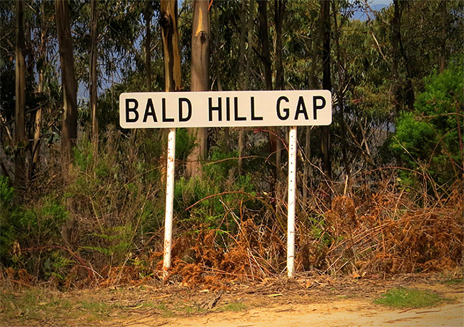
Bald Hill Gap is located in the Mansfield Shire and is a small gap in the range where the Eildon-Jamieson Road passes from one side to the other. A sign marked "Bald Hill Gap" marks the location. It is 49 km from Eildon and 11 km from Jamieson on the Eildon-Jamieson Road.
History:
Bald Hill Gap marks the start of the Mt Terrible Track, a 4x4 bush track which leads upwards to the south from the Gap to the summit of Mount Terrible. Mount Terrible is 1,325 m above sea level and is roughly 1,000 m above the historic Kevington Pub located on the Jamieson-Woods Point Road. A steel fire lookout tower is located at the Mount Terrible summit and the area is also utilised for communications by a number of organisations. These include the Ambulance service, Victorian State Emergency Service, Telstra, Department of Primary Industries and Environment as well as being used as a repeater for the Upper Goulburn Repeater Association.