Congratulations to imoutnabout, KristinewithaK, and drneal for the FTF!!!
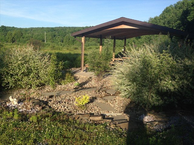
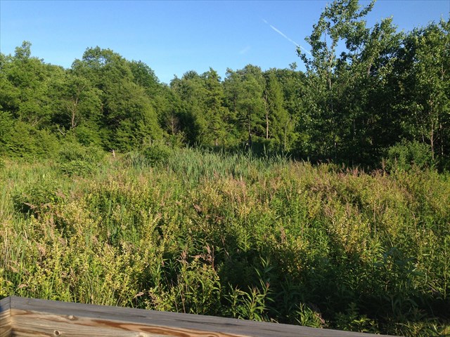
The West Creek Wetlands is a small wetland hidden between a massive powder metal industrial park and a public golf course in the city of St. Marys.
This particular wetland forms the start of West Creek, a St. Marys tributary which continues a path into Emporium, PA and feeds into Sinnemahoning Creek. The West Creek waters continue their winding adventure in an easterly direction, passing through many state towns and cities such as Williamsport, Lewisburg, and even the state capitol of Harrisburg. Ultimately, this water source finishes it's long journey in the upper part of the Chesapeake Bay, just northeast of Baltimore, MD. This watershed can be considered unique because of it's geographic proximity to the Eastern Continental Divide. It sits approximately 30 miles from this major drainage basin.
Within the last several years, the wetland received increasing recognition by local managers and volunteers. After funding, donations, and many, many man hours by dedicated residents, this small geological site has taken on the form of an educational walking trail for the community and for teachers and students of all ages to enjoy.
There are 4 main wetland types; Marsh, Swamp, Bog, and Fen.
One of the best descriptions of a wetland is a water saturated land area, seasonal or permanent, that can sustain aquatic vegetative growth based on hydric soils. Along with naturally occurring wetlands, artificially constructed wetlands can be used as a water management tool.
A Marsh is dominated by herbaceous plants rather than wooded species. The marsh plants will slow down the flow of incoming water and allow nutrient rich minerals to settle in the area. These minerals provide sustainment for the existing and new plant life which increases development of the marsh.
A Swamp is a wetland characterized by the existence of forested area. Most swamps exist alongside rivers where they are extremely dependent on the water level fluctuations. Yet, swamps can occur near lakes and other long standing bodies of water.
Bogs and Fens are sometimes classified as Mires. They are wetlands that accumulate peat. The major difference between a bog and fen is the pH content. Where bogs typically have a more acidic condition and low in nutrients, fens have a more pH neutral or alkaline state.
To claim credit for this Earthcache, provide answers to the following questions.
At cache location:
1. Describe what it means that wetlands are transition areas.
A bit of homework:
2. This watershed sits very close to the Eastern Continental Divide. Which cardinal direction does the ECD run?
3. Some inland bodies of water can be considered endorheic. Explain what this means and state if the West Creek wetlands is endorheic or not.
4. You may take a few photos of the area to post in your log, but it's not required.