Geologic dikes are flat bodies of rock that usually cut in a perpendicular fashion through the host rock, leaving them visible on the surface. Dikes are usually of a different color and texture from the surrounding rock. Dikes can be made up of igneous or sedimentary rock, and are formed after the magma has cooled in the host rock, invading fissures left behind during the cooling process.
A dike swarm is a large scale geologic structure, consisting of parallel, linear, or radially oriented dikes which have intruded on the host rock. Along the Idaho Batholith, this dike swarm covers over 100 miles, and is evident in most rocks you see in the area.
At the posted coordinates, the rock outcrop on the West side of the trail has an amazing number of dikes at various angles.
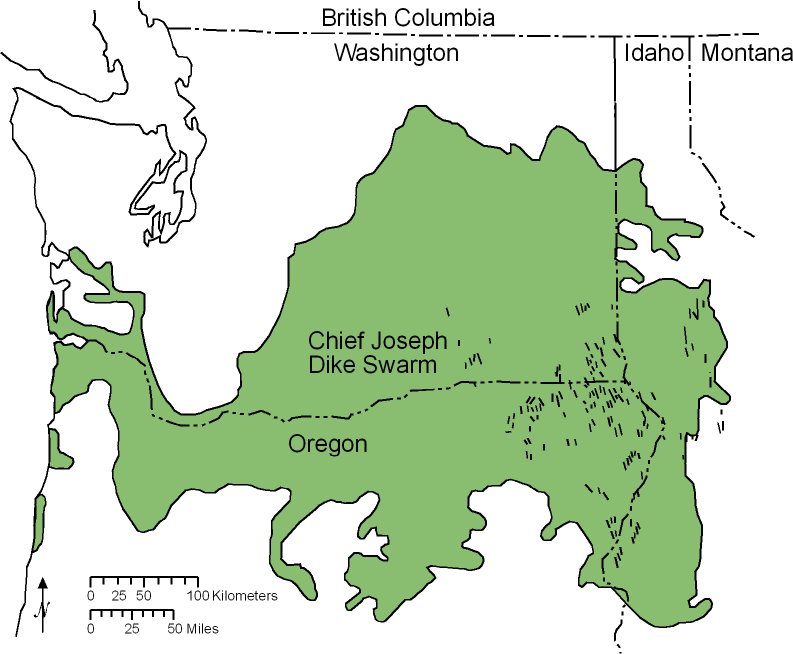
As you can see from the illustration on the left, the dike swarms of the Long Valley area and the Atlanta Lobe, are part of the Chief Joseph Dike Swarm, which extends from the Pacific Ocean, all the way to Central Idaho.
Age dating of the area suggests that the dikes were formed some 50 million years ago, which coincidentally, is the same time as the volcanic rocks in the Challis, Idaho region to the East. It is suspected that the formation of the dikes in the Atlanta Lobe are somehow related to the volcanism in the Challis area, and that perhaps a partial melting of the Idaho Batholith on its Eastern border might help explain the two related features.
Logging Requirements:
- Do the dikes in the feature to the West appear to be linear or at different angles?
- What is suggested about the formation of the dikes at the time of crystallization?
- Do you think the dikes are in their original orientation, or do you think erosion below the feature has led to it's being rotated?
References:
"Salmon River Suture Zone", Matt McKay, University of Alabama Research, 2010
Lund, Karen, 2004, Geology of the Payette National Forest and vicinity, west-central Idaho: U.S. Geological Survey Professional Paper
Digital Atlas of Idaho, Idaho State University, Dr. Paul Link
Explanation of County Geologic Maps (modified from Link, Stanford and Long), Idaho State Geological Survey, Digital Atlas of Idaho