There is a Traditional Geocache at the site, named “Where are the Sardines?”, which was placed in 2002, so make sure you find it too. I do have permission from that cache owner, to place the Earthcache so close.
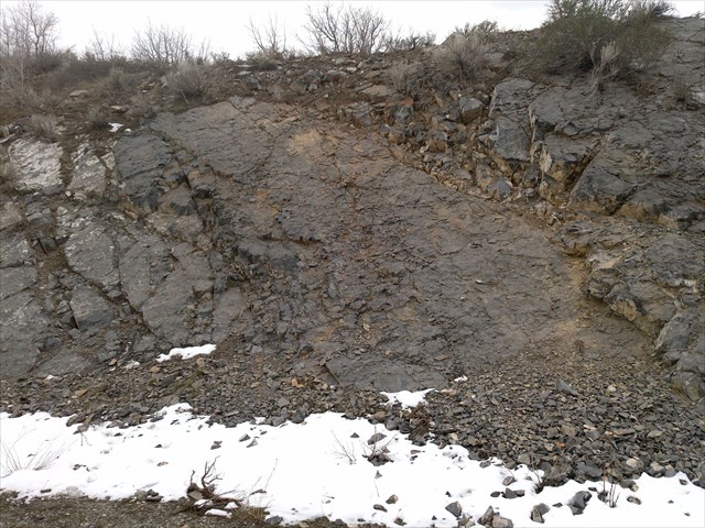
This Earthcache is located at a well known, and popular fossil collecting locality. It is an outcrop of the Upper Mississippian Great Blue Limestone, which has many abundant fossils. This outcrop has been exposed by a roadcut, along Highway 89, in Sardine Canyon. Abundant Calcite and Quartz crystals can also be found here. This land is owned by the State. You are limited to collecting 25 pounds of rock per day, and 250 pounds for a year. While there are fossils on the other side of the highway, it is not recommended to visit there, because you will have to cross four lanes of traffic, and jump two barriers.
This rock is very hard, and it is easiest to collect corals and brachiopods from the smaller broken rocks are the base of the hill at the Earthcache coordinates, or on the other side of the hill, near the traditional cache. It would be extremely difficult to break out fossils from the large flat slabs you will see. Do not attempt to break rocks with a normal carpentry hammer. Make sure you use a rock or masonry hammer.
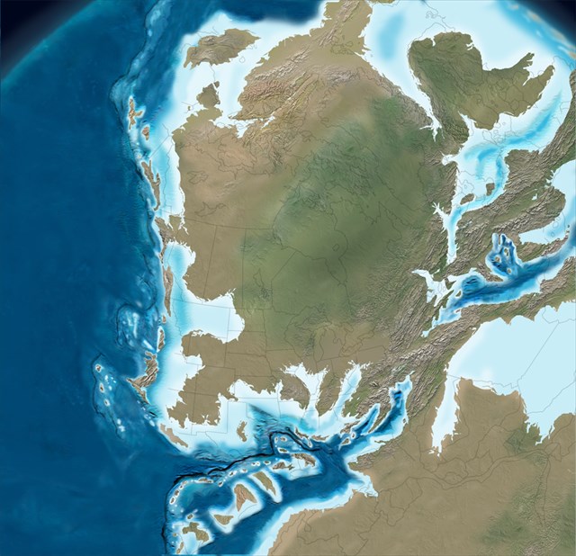
During the Late Mississippian time period (326-318 Million Years Ago), this Earthcache location was at the bottom of a tropical sea, slightly south of the Equator. This area was teaming with life, and was a part of a tropical coral reef. The most abundant life here were Brachiopods, and the now extinct solitary Rugose Corals, Turbophylum, Sp. Their characteristic shape resulted in their common name of “Horn Corals”, because they are shaped like a bull's horn. Other life that lived here at this time, included colonial corals, fish (but not Sardines), sharks, sponges, echinoderms, graptolites, trilobites, bryozoans, squids, nautiloids, and much more.
(This map shows what North America looked Like 325 Million Years Ago. Copyright Ron Blakey. Used with Permission.)
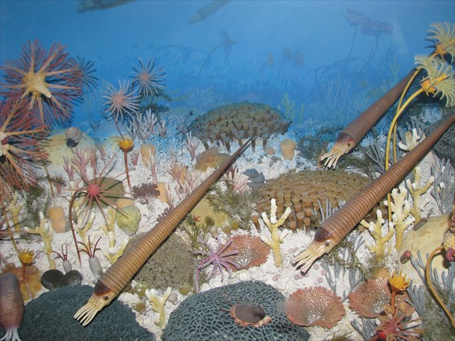
(This reconstruction of a Mississippian Reef is at the North American Museum of Ancient Life, in Lehi UT. Note the clusters of Horn Corals near the center.)
Horn Corals are different from the corals that live today, because there were solitary. Their skeletons did not connect to the other corals around them, building a large colonial structure. Instead, they were “mudstickers”. The point end of their horn-shaped skeletons was stuck in the mud, giving them support, and allowing their tentacles to feed from the ocean currents. Over time, the corals can build up a huge mound, or reef, even though they are not physically connected to one another. The shear numbers, and proximity to one another make the reef. The large flat surfaces you see in the rock here, were the actual sea floor at the time. If you look closely you will see many horn corals in these slabs.
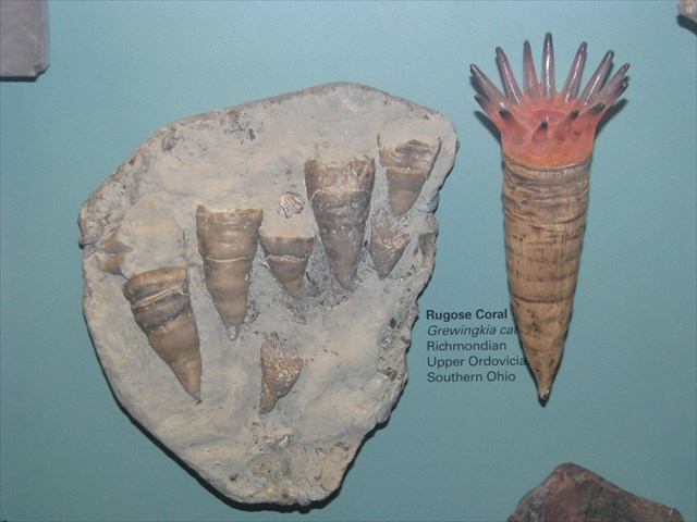
(These are fossil Horn Corals, and a reconstruction of what a Living Horn coral would look like. It is as the North American Museum of Ancient Life in Lehi UT.)
Knowing information about the size distribution of the corals can help us learn about the health of the reef's coral population, and if it was growing, shrinking, or staying the same size. Knowing about the spacial distribution can help us know about how large or continuous the reef might have been. Knowing if there are any prefered orientations of the fossils can help us know if there were any ocean currents when the fossils were deposited. Keep this in mind, when you answer the following questions.
Logging Requirements. Take a close look at the fossils in the flat slabs of rocks, and email me the answers to the following questions:
Are the Horn Corals all/mostly the same size? If not, what size is the most common? How do the numbers of small corals compare to the numbers of large ones?
How large is the largest Horn Coral you have found?
Are the corals evenly distributed across the slabs, or are they found in groups, or clusters?
Do the horn corals seem to line up together, so that a lot of them point in the same compass direction? If so, please tell me the direction, the pointy end of the horn corals tend to point.
If you like, please post pictures of your fossil finds.
References & Additional Information
Blakey, Ron. 2011. North American Paleogeographic Maps. Colorado Plateau Geosystems Inc. http://cpgeosystems.com/nam.html
Gordon Jr., Mackenzie, Edwin W. Tooker, and J. Thomas Dutro, Jr. 2000. “Type Locality for the Great Blue Limestone in the Bingham Nappe, Oquirrh Mountains, Utah.” United States Geological Survey Open-File Report OF 00-012.
Chronic, Halka. 1990. “Roadside Geology of Utah.” Mountain Press Publishing Company, Missoula, MT.
Kappele, Wiliam A. 1996. “Rockhounding Utah” Falcon Publishing Inc. Helena, MT
Morgan, Susan K. 1992. “Geologic Tours of Northern Utah” Utah Geological Survey Miscellaneous Publication 92-1.
Wilson, James R. 1995. “A Collector’s Guide to Rock, Mineral & Fossil Localities of Utah.” Utah Geological Survey Miscellaneous Publication 95-4.