Buckhorn State Park is located on Castle Rock Flowage, a 13,955 acre flowage of the Wisconsin River. Castle Rock Lake is the fourth largest inland lake in Wisconsin. The lake was created between 1949 and 1951 when the Wisconsin River Power Company completed a dam on the Wisconsin River eight miles northeast of Mauston for hydro-electric power production. Flood control and recreational opportunities were also residual benefits the power company envisioned in the dam and flowage development. Prior to the construction of the dam the villages of Werner and Germantown occupied the land that is now Buckhorn State Park and Castle Rock Lake.
The Wisconsin Department of Natural Resources acquired the land for Buckhorn State Park in 1974. Since that time additional land has been purchased and the park continues to grow and develop. In addition to the park there are also recreation opportunities including different hunting seasons and access to the Castle Rock Flowage in the Buckhorn Wildlife Area and the Yellow River Wildlife Area which are next to Buckhorn State Park.
Buckhorn State Park offers hiking trails, camping, picnic areas, swimming beaches, boat launches, fishing, and winter snowshoeing and x-country skiing. The park has family campsites, an outdoor group camp, 50 cart-in campsites and an accessible cabin for people with disabilities. A new 60 unit family campground is under construction off of 19th Ave.
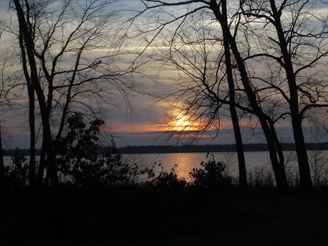
The cache is located off from a hiking trail which goes from the boat launch to the new campground. Enjoy the quiet view of the backwaters of Castle Rock Lake from this location. Parking is available at the boat launch with an easy hike on a trail to the cache. You are looking for a large lock 'n lock container with a log book and swag.

This region is right in the middle of our state, easy to get to from everywhere else. Its biome is sand plains and prairie. The landscape was largely shaped when it sat at the bottom of huge Glacial Lake Wisconsin, which left behind sandy soils and a fairly flat landscape. One still can find eroded sandstone buttes, believed to have been islands during this time period, and certainly striking features as one travels through the region. There are scattered mixed hardwoods and pine plantations, as well as large areas of wetlands and grasslands. Prairie Chickens do their spring dances in this region. The threatened Karner Blue Butterflies live here, as do river otters. Timber Wolves have reached their southern range in this biome.
The Wisconsin Geocaching Association (WGA) is a group of geocachers dedicated to promoting and protecting geocaching within the state of Wisconsin. The WGA organizes geocaching events, works with land owners/managers on geocaching policies, educates the public at large about geocaching, and facilitates communication between WGA members. To learn more about the WGA visit: wi-geocaching.com.
2013 kicks off the beginning of the Wisconsin Geocaching Association State Parks series. It is our goal to place a geocache in every state park in the state of Wisconsin, so watch out for more in this series that encourages geocachers to explore the natural resources in this beautiful state of ours.
WDNR Geocache Notification Form 2500-118 has been submitted to and approved by Heather Wolf, Property Manager at Buckhorn State Park for this cache. Please note that any geocache place on Wisconsin Department of Natural Resources managed lands requires permission by means of this notification form. If you intend to place a cache on WDNR managed lands, please print out a paper copy of the notification form, fill in all required information, then submit it to the respective land manager.