The village name ‘Drayton’ is derived from the Old English for "farm where sledges are used". It is a common place name in England, and refers to places that were perched on the hillside, thus requiring the use of a sledge rather than a cart to pull heavy loads. The suffix 'Beauchamp' refers to the ancient manorial family of the parish. The village is intersected by the Icknield Way a prehistoric, long-distance trackway of significant importance in providing a trading route between East Anglia and the Thames Valley certainly during the Iron Age and maybe earlier. In more recent times it has been bisected by the Roman Road, Akeman Street now the A41 and by both the Aylesbury Arm and Wendover Arm of the Grand Union Canal.
Following the Norman conquest of England William I awarded land which later became known as Drayton Beauchamp to Robert, Earl of Morton who as Magno le Breton had accompanied William at the time of the Norman Invasion in 1066. The Morton family founded a church at Drayton on the site where the present-day church of St Mary the Virgin now stands. The lands were passed from the Beauchamp family to the Cobhams. Sir John Cobham gave the property to King Edward III. The King granted it to his shield-bearer Thomas Cheney (also spelt Cheyne) in 1364. It remained in the Cheyne family until the death of William Cheyne, Lord Viscount Newhaven in 1728.
Drayton Beauchamp was sold by the Cheyne family to John Gumby in 1730 and subsequently the manor house and lands were inherited by Lady Robert Manners. The manor house has since been pulled down. In 1837 it passed to Mrs. Caroline Jenney and remained in that family until the death of Miss Airmyne Harpur-Cruewe in 1999.
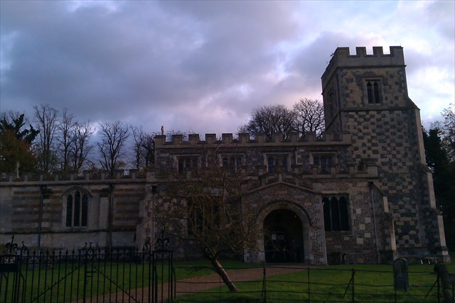
The parish church was extensively rebuilt in 15th century from materials salvaged from an earlier church. Most notable is the Norman font which dates back to the 12th century. The first rector of the new Church was Richard Hooker who took up his incumbency in 1584. The church was again restored in 1867 when the rector was the naturalist, Henry Harpur Crewe.
The cache can be found at N51 47.aab W00 41.cdc where
At the gates find 'In loving memory of Sarah & John Horwood 19ba by their son Bertie Thomas Horwood'
and then find Alice beloved wife of Eben Green of Tring died May b1st 1ada aged cc years.
The order in which you find these items will depend from which direction you approach.
The cache is a short walk away.
Congratulations to IBsearching on FTF
“If anybody would like to expand to this series please do, I would just ask that you could let Sadexploration know first at churchmicro@gmail.com so he can keep track of the Church numbers and names to avoid duplication.
There is also a Church Micro Stats & Information page found via the Bookmark list”