[SLO]
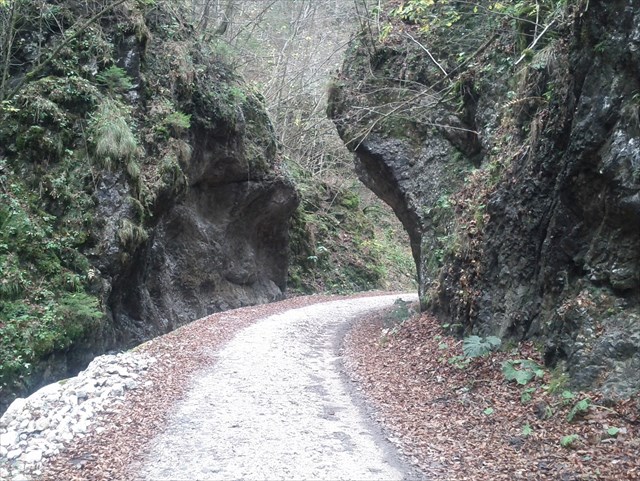
Dolina Korošica se nahaja med Kamniškim Vrhom in Planino Osredek na jugu ter Košutno in Mokrico na severu. Po dolini teče hudourniški potok Korošica. Nekaj sto metrov pred izlivom v Kamniško Bistrico se na kraju, ki mu domačini rečejo Kotel, potok zareže v 20 metrov visoke skale in skoraj naredi naravni predor
Po dolini je speljana dokaj dobra (vendar na trenutke zelo strma) gozdna cesta, ki se na razdalji približno 5 km dvigne na skoraj 1000 mnm in se konča na Markovi Ravni. Ob njej vodi markirana planinska pot, ki nas v nadaljevanju pripelje do Kriške planine in Krvavca ali pa na Planino Koren in naprej na Košutno, Kompotelo, Mokrico ali Vrh Korena.
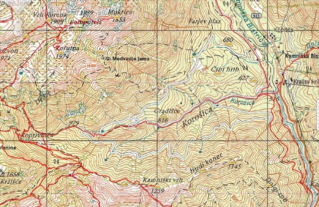
Zakladek je skrit na začetku gozdne ceste v bližini spodnje postaje gondole na Veliko Planino od kjer se lepo vidi sotočje Korošice in Kamniške Bistrice.
[ENG]
Korošica valley is located between Kamniški Vrh (a grassy summit above Kamnik) and Planina Osredek (a mountain top) in the South and between the mountains of Košutna and Mokrica in the North. Korošica stream runs down the valley. In the place the local people call Kotel (i.e. cauldron, as it resembles the sound of water rippling in a cauldron), some hundred metres before outflowing into Kamniška Bistrica (a glacial valley), the stream cuts into a 20-m high rocky slope, almost forming a natural tunnel.
A relatively well maintained forest road, which at times becomes very steep, runs down the valley. In the distance of about 5km it rises to an altitude of 1000 m and ends on the Markova raven plane. The blazed mountain trail guides us up the Kriška planina (Kriška mountain pasture) and Krvavec or the Planina Koren mountain, running further to Košutna, Kompotela, Mokrica or the Vrh Korena mountain peak.
The cache is hidden at the beginning of the forest road, near the lower cable car station, running up to Velika planina from where you can see the confluence of Korošica and Kamniška Bistrica.