El nacimiento de las Islas Canarias / The birth of the Canary Island
The originally volcanic islands –seven major islands, one minor island, and several small islets– were formed by the Canary hotspot. The Canary Islands is the only place in Spain where volcanic eruptions have been recorded during the Modern Era, with some volcanoes still active (El Hierro, 2011).

Una gran cantidad de información geológica disponible en los últimos años ha llevado a la conclusión de que las Islas Canarias, como el archipiélago de Hawai, muestran escenarios submarinos, seguido por el escudo de la capacidad, en declive, erosivas y etapas de rejuvenecimiento. Las etapas mostradas por las Islas Canarias (Figuras 5 y 6):
1. Que contienen los sedimentos submarinos, rocas volcánicas montes submarinos y emergentes (principalmente basaltos alcalinos almohada basálticas y hyaloclastites), enjambres de diques e intrusiones plutónicas máficas y ultramáficas que forman los núcleos de estas islas (Figura 7);
2. escudo de la capacidad, que se caracteriza por basaltos alcalinos subaérea y traquibasaltos flujos de lava (Figura 8);
3. decreciente, que contiene rocas con composiciones traquíticos y fonolítico, y
4. rejuvenecimiento, que contiene nephelinites, basanitas y basaltos flujos de lava.
A wealth of geological data made available in recent years has led to the conclusion that the Canaries, like the Hawaiian archipelago, show submarine stages, followed by shield-building, declining, erosive and rejuvenation stages. The stages shown by the Canary Islands are (Figures 5 & 6):
1. seamount and emergent, containing submarine sediments, volcanic rocks (mainly alkali basaltic pillow basalts and hyaloclastites), dyke swarms and mafic and ultramafic plutonic intrusions which form the cores of these islands (Figure 7);
2. shield-building, characterized by subaerial alkaline basalts and trachybasalts lava flows (Figure 8);
3. declining, containing rocks with trachytic and phonolitic compositions ; and
4. rejuvenation, containing nephelinites, basanites and basalts lava flows.
The Earthcache: Productes generadas en la erupción de un phonlitic / Productes generated in a phonlitic eruption
El Magma que sale al principio tiene un alto contenido en gases disueltos: el chorro eruptivo sale con gran presión, asciende en la atmósfera a alturas de 10-30 km y de ahí es arrastrado por el viento, dejando caer una Iluvia de pómez
Más tarde, el contenido en gases es menor, el chorro se eleva a poca altura y los fragmentos todavía están semifundidos cuando llegan al suelo, de modo que se aplastan y sueldan entre sí (aglutinado) como ocurrió en la cúpula de Montaña Rajada.
Finalemente, el Magma pobre en gas desborda por la boca como líquido pastoso, para dar una colada de Lava (caso de Montaña Rajada), donde se pueden observar Lavas en bloques y Lavas con arcos de empuje.
The first Magma to be emitted contains a graet deal of dissolved gasses: the Eruption exiits under great pressure, Shooting into the atmosphere to heights of 10-30 km an is the blown by the wind, falling as a pumice rain which covers the Terrain in a uniform blanket.
Later the gas Content decreases and the emission barely partially melted when they reach the ground. These fragments flatten and fuse with each other (conglomerate), as occured in the cupola of Montana Rajada.
Finally, Magma containing very Little gas spills over the lip like a thick liquid creating a Lava flow (as occurred in the Montana Rajada) in which Lava blocks and pressure ridges can be observed.
El flujo de Lava / The Lava flow
Requisitos de registro / Logging Requirements
Antes de iniciar sesión, echar un vistazo a la tabla de información en las coordenadas publicado y envíenos un e-mail con las respuestas a las siguientes preguntas:
1. Lo que marcó la "E" en la tabla de información? Por favor envíeme un correo electrónico lo que está escrito exactamente en su lugar en el infoboard.
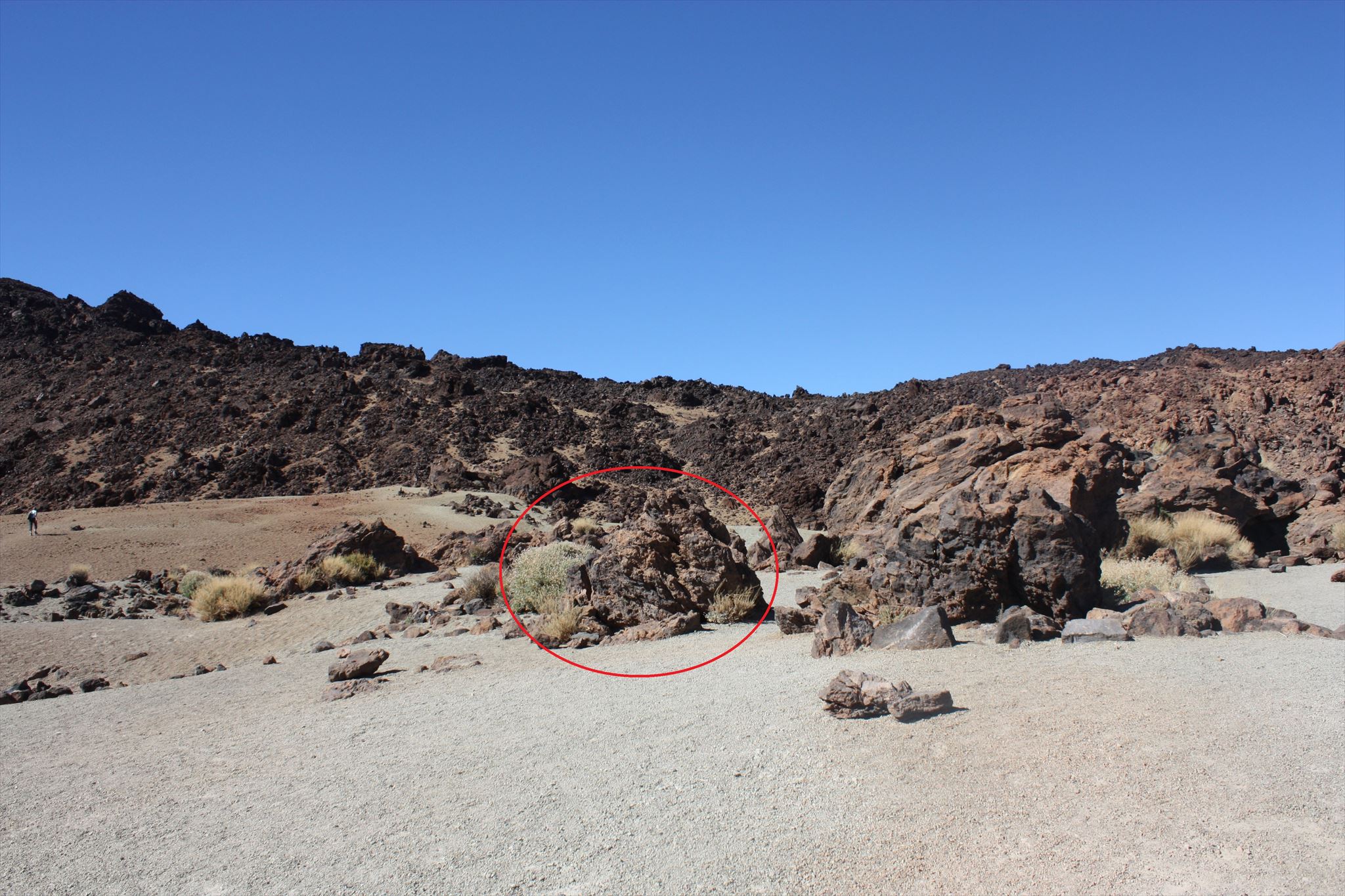
2. En la imagen de abajo hay una roca marcado en rojo. Busque eran él está en cerca de la junta info. Ir a la ock y describir la superficie de la roca.
3. Lo Du crees, que roca típico es (recordar la información bord)
4. En el camino a la roca, se puede caminar sobre otro tip de rock? Lo Du crees, que roca típico es este (recuerde la información bord una vez más)
5. Opcional hacer una foto de usted en las coordenadas
Before logging, take a look at the info board at the posted coordinates and send us an e-mail with the answers to the following questions:
1. What marked the "E" at the Info board? Please E-Mail me what is exactly written at its place on the infoboard.
2. In the Picture down below there is a red marked rock. Look were he is in near of the info board. Go to the rock and describe the surface of the rock.
3. What Du you think, which rock typ is it (remember the info bord)
4. On the way to the rock, you walk over another rock typ? What Du you think, which rock typ is this (remember the info bord once again)
5. Optional make a Photo from you at the coordinates
Puede iniciar inmediatamente. Si hay algún problema, le enviaremos un mensaje / You can log immediately. If there are any problems, we will send you a message.
References:
Wikipedia
Team_Mad_Cats