 This earthcache is located within Deception Pass State Park and is placed with permission. There is no physical container located at the posted coords! The coordinates will take you to the top of Goose Rock where you must answer the questions in order to successfully log this earthcache. I've also included waypoint coords for parking, and the questions to answer.
A rock, like the very best book, holds amazing stories about our ancient past, battles won and lost, and great adventures.
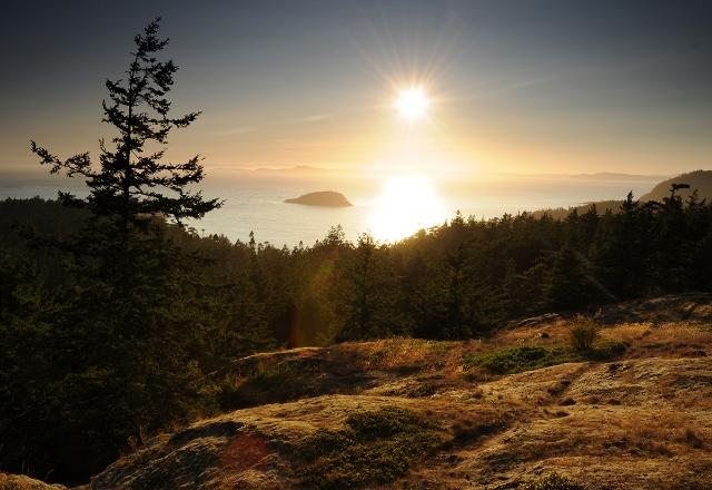
 Welcome to Goose Rock! A short, steep hike (.7 miles) from the North Bridge parking lot will take you to the top of the Rock. At 484 feet it is the highest point on Whidbey Island. Located in Deception Pass State Park, this area is among the most impacted in the park. Please stay on the trail so that visitors can continue to enjoy this unique treasure.
Whidbey Island was born in a deep freeze during the area’s last advance of glaciers. The continental ice shaped the island like a squiggly seahorse and shook out tidelands, prairies and craggy cliffs within the pinch of 50 miles. It left behind alien rocks, scraped topsoil down to bedrock, deposited glacial till and outwash and created kettles and kames topography.
Glaciers are so massive, that the land they dominate is carved and shaped in significant and long lasting ways through glacial erosion. Advancing glaciers carry along with them large amounts of sand and silt. These materials are pressed into the bedrock and they manage to sand it into a smooth surface. But there are cobbles and boulders too. These drag along on the bedrock and with the weight of the moving ice they gouge long straight striations into the rock.

Striae or striations are scratches and grooves cut by debris embedded in the sole of the glacier. Striated surfaces often show many parallel striae. Occasionally, a single surface shows crossing striae, indicating two different phases of ice movement.
Because the movement of glacier ice is studded with rocks it can generate a range of markings. Large blocks embedded in the sole of the glacier create grooves up to four feet wide and many inches deep. Smaller blocks and grit create parallel scratches or striae. Where a large, sharp edged block catches on the bedrock floor, pressure builds up until the rock fails, giving chatter marks or crescentic gouges.
The amount of polish depends on the fineness of the abrading material. Fine- grained uniform rocks make and contain the best surfaces. Limestone is easy to form striations on, but it is also easily weathered. A hard rock like quartzite can preserve striations well, but it is difficult to create the striations on.

To qualify as a "find", email, (do not post online), the answers to the following questions. Please send your answers at the same time you log your find. Failure to due that in a timely manner will result in a log deletion.
At the posted coordinates
1) What two things do you find here that proves the possible existence of glaciers? Hint: The interpretive sign you passed going up may prove to be helpful!
2) Observe the glacial markings here and nearby. Does the bedrock that they are formed in appear to be an easily eroded type of rock or not? What lead you to your conclusion?
3) Which types of markings are located here: Crescentic gouges, chatter marks, glacial grooves and/or striations?
Optional: Post a picture of you or your GPSr with the views from Goose Rock.
We hope you have learned a thing or two about Goose Rock and thanks for visiting Deception Pass State Park.
Sources:
1.http://www.wta.org/go-hiking/hikes/deception-pass-goose-rock
2. http://geography.about.com/od/geographyintern/a/glaciers.htm
3. http://www.registerstar.com/columnists/windows_through_time/article_da023336-33aa-11e4-b812-001a4bcf887a.html
4. http://en.wikipedia.org/wiki/Glacial_striation

- This geocache has an approved Permit to be placed at this location on property managed by the Washington State Parks and Recreation Commission. Visitors are responsible for acquainting themselves with policies and rules pertaining to State Parks areas.
- The following items may not be placed in the geocache: food, illegal substances, medications, personal hygiene products, pornographic materials, hazardous materials, or weapons of any type.
- By searching for the cache, visitors agree that they are responsible for their own actions, and acknowledge that neither the State of Washington nor the cache owner is responsible for any loss or injury that may occur in relation to such search.
- Report any incident, problem, or violation to State Parks staff.
|
 |
Warning: Earthcaches come with a unique set of rules and activities that must be met
before successfully logging. Failure to comply will result in a log deletion.
|
|