New Glarus Woods is a 435-acre state park offering camping, hiking, picnicking and snowshoeing. The park also offers direct access to The Sugar River State Trail, a 24-mile linear trail surfaced with compressed limestone screenings, for bicycling, hiking, snowmobiling and, in some areas, hunting. New Glarus Woods was established as a state park in 1934.
Geology
More than 10,000 years ago, during the ice age, much of North America lay under colossal ice sheets that built up from heavy snows due to global cooling and repeatedly flowed south, then receded. Glaciers -- sheets of ice, more than a mile thick -- pushed down over the land that would become Wisconsin. They scoured the earth as they moved, deposited rock and soil debris, and washed it with meltwater as they retreated. Areas that they traveled over, like central Wisconsin, were made into rolling plains. Lands that the glaciers moved around, as in Southwestern Wisconsin, remained steeply hilly; as rugged as they had been since ancient times.
The glaciers left many interesting landforms on the plains, such as moraines, kames, eskers, drumlins, and gorges. The broad plains allowed fire to regularly seep across them, destroying most woody vegetation. Grasses, which have most of their living tissue underground, survived allowing vast grasslands to form. The French Voyagers, having never seen lands such as this called them "prairie" meaning meadow. These prairies were rich with plant and animal life, and built and enriched the soil beneath them, resulting in the fertile farmland we benefit from today.
The more hilly land formed natural firebreaks, and areas protected from fire grew into dense forests, providing cover and food for animals, and later wood for fuel, lumber, and goods. New Glarus Woods lies on the boundary between these areas. To the north and west, Wisconsin is rugged, with steep hills, ravines, and outcroppings of ancient stone. This is known as the "driftless area."
To the south and east, there are great prairies and savannas, which are grasslands dotted with trees, usually oaks, that evolved to withstand the regular prairie fires.
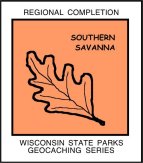
Southern Savannah Biome
This region, the bottom middle of the state, is characterized by remnants of the once predominant oak savanna biome. A savannah will have a low plant density, allowing for grassland development under the open canopy of forest dominated by oak. These landscapes are often described as “park like” due to their open appearance and with development, are disappearing from their original boundaries. Red-Headed Woodpeckers and Wild Turkey are birds that depend on this kind of biome, and of course Whitetail Deer are seen throughout the area, as are raccoons, squirrels and small rodents.
WISCONSIN GEOCACHING ASSOCIATION
The Wisconsin Geocaching Association (WGA) is a group of geocachers dedicated to promoting and protecting geocaching within the state of Wisconsin. The WGA organizes geocaching events, works with land owners/managers on geocaching policies, educates the public at large about geocaching, and facilitates communication between WGA members. To learn more about the WGA visit: www.wi-geocaching.com
2013 kicks off the beginning of the Wisconsin Geocaching Association State Parks series. It is our goal to place a geocache in every state park in the state of Wisconsin so watch out for more in this series that encourages geocachers to explore the natural resources in this beautiful state of ours.
The Geocache Notification Form has been submitted to Brad Bates, Ranger Assistant Manager New Glarus Woods State Park. Geocaches placed on Wisconsin Department of Natural Resource managed lands require permission by means of a notification form. Please print out a paper copy of the notification form, fill in all required information, then submit it to the land manager.
This a WGA STATE PARK SERIES geocache: