Cache is located in Willow River State Park. Park at the coordinates below (just north of the main entrance on Cty. Rd. A), be sure you have a daily or yearly state park sticker, and take the gray trail to the cache which is located on the banks of the Willow River. This is a multi-use trail and well maintained all season.
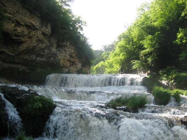
You’ll be going down a good size hill, but the walking is pretty easy and gradual – coming back up will give you a nice workout, but there is a bench part way up to take a break on. If you’re seeking this cache in winter, please do not walk on the ski trail (blue) nearby. The cache is at a very peaceful part of the river – take a few minutes here to enjoy the serenity of this location and keep an eye out for wildlife. Just to the north of this spot is the Willow Falls, so be sure to check it out!
-----------------------------------
About Willow River State Park
With 2,891 acres of prairie, forests, and panoramic river scenery, Willow River State Park offers year-round recreational and scenic attractions in Western Wisconsin. Located 5 miles northeast of Hudson on County Road A, the park has a campground, a boat launch, and a 400-foot beach and picnic area centered on 172-acre Little Falls Lake. The park has 13 miles of hiking trails that vary in difficulty. The most popular hiking trail destination is the Willow Falls area and the scenic overlooks of the river valley. Willow River State Park draws more than 300,000 visitors each year.
The Nature Center, located near the main picnic area, features exhibits on animal and plant life, and park naturalists host many interpretive programs there throughout the year. During the winter months, the Nature Center classroom is opened for use as a warming house from 9 a.m. to 4 p.m. Saturdays and Sundays. See the Wisconsin DNR website for more information.
Mississippi and Chippewa Rivers Biome
The Driftless Region serves as home to these two rivers, and many, many more, and is in a deciduous forest biome. Most of this part of southwestern Wisconsin was not touched by the last glaciers and displays a very rugged landscape dominated by limestone bluffs rising above the two main rivers. Valleys carved by smaller rivers and streams abound, but anything resembling a lake is the result of human intervention. The predominant vegetation is mixed hardwoods such as oak, aspen, and maples. With the abundant spring fed streams in every valley, the trout fishing in this biome is world class. The big river is one of the main flyways for bird migration and plays host to birds using that flyway, including huge concentrations of Tundra Swans in the spring and fall. Timber Rattlesnakes are timid venomous snakes that inhabit those rocky bluffs.
WISCONSIN GEOCACHING ASSOCIATION
The Wisconsin Geocaching Association (WGA) is a group of geocachers dedicated to promoting and protecting geocaching within the state of Wisconsin. The WGA organizes geocaching events, works with land owners/managers on geocaching policies, educates the public at large about geocaching, and facilitates communication between WGA members. To learn more about the WGA visit: www.wi-geocaching.com
2013 kicks off the beginning of the Wisconsin Geocaching Association State Parks series. It is our goal to place a geocache in every state park in the state of Wisconsin so watch out for more in this series that encourages geocachers to explore the natural resources in this beautiful state of ours.
The Geocache Notification Form has been submitted and approved by Aaron L. Mason, Assistant Park Superintendent at Willow River State Park. Geocaches placed on Wisconsin Department of Natural Resources managed lands require permission by means of a notification form. Please print out a paper copy of the notification form, fill in all required information, then submit it to the land manager. The DNR Notification form and land manager information can be obtained at the Wisconsin DNR website.
This a WGA STATE PARK SERIES geocache: