KESZ / CACHE
Kesz to niewielkie pudełko z kilkoma drobiazgami ukryte w miejscu oddalonym o kilkanaście metrów od ujścia Skrody do Nysy Łużyckiej.
Do kesza najlepiej dostać się rowerem przejeżdżając z parkingu (waypoint) przez ścieżkę geoturystyczną "Dawna Kopalnia Babina" i obok słupka z numerem 356 (zdjęcie) jechać dalej prosto (zjeżdżając ze ścieżki geoturystycznej) aż do zielonego szlaku rowerowego lub z drogi na Przewóz (350) skręcając od razu na zielony szlak rowerowy.
The Cache is a small box with a few goodies hidden in a place a few meters away from the mouth Skroda to the Neisse.
The cache best to get a bike ride from the parking lot (waypoint) by a path geotouristic "Old Mine Babina" and the right post with the number of 356 (photo) continue straight (coming down the path geotouristic) until the green bike trail or the road for transportation (350 ) turning right at the green bike trail.
REZERWAT PRZYRODY "NAD MŁYŃSKĄ STRUGĄ" / NATURE RESERVE "ABOVE MILL STRUGA"

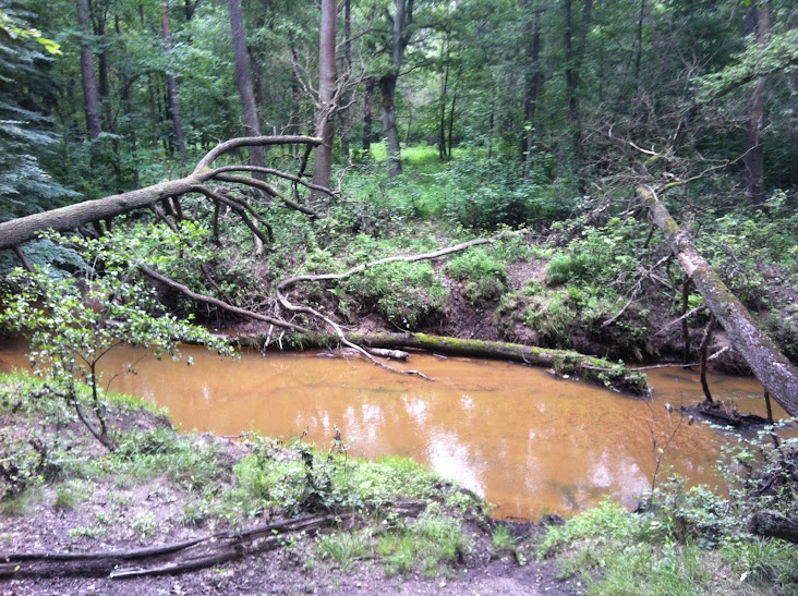
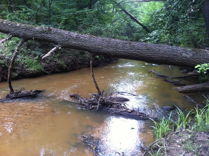
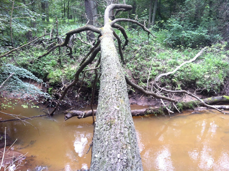
Rezerwat "Nad Młyńską Strugą" – został założony 15 lipca 1970 roku na powierzchni 132,56 ha. Leży nad rzeką Skrodą, którą nazywa się również Młyńską Strugą. Uwagę przyciąga czerwone i pomarańczowe zabarwienie wód rzeki. Jest to rezerwat leśny, który chroni fragmenty nadrzecznych lasów łęgowych położonych w rejonie ujścia do Nysy Łużyckiej meandrującej rzeki Skrody. Występują w nim pojedyncze okazy jodły pospolitej. W rezerwacie przewarzają buki i dęby. Spotkać również można ponad stuletnie lipy, wiązy, modrzewie, jodły, graby, klony, świerki i sosny.
Niezwykle interesujące są ślady jakie pozostawiły wojska II Armii Wojska Polskiego, które forsowały Nysę Łużycką. Na jednym z buków wyryto napis "19 – IV – 45 BAZIUK front nad Nissą". W środkowej części rezerwatu napotkać można rów strzelecki i ślady po ziemiance. Na wielu drzewach widoczne są ślady po pociskach.
Rezerwat można zwiedzać poruszając się ścieżką przyrodniczą, oznakowaną tablicami informacyjnymi.
Rezerwaty Powiatu Żarskiego: http://www.powiatzarski.pl
Nature Reserve "Above Mill Struga" – was founded July 15, 1970 for area 132.56 hectares. It is situated on the river Skroda which is also called Mill Struga. The attention attracted by the red and orange color of the river water. It is a forest reserve, which protects parts of riverine floodplain forests located in the vicinity of the mouth to Neisse of the meandering river Skroda. They are available in single specimens of the fir. The reserve predominate beeches and oaks. You can also find more than century - old linden, elm, larch, fir, hornbeam, maple, spruce and pine.
A very interesting that there are traces left behind armies of the Second Polish Army, which pushed the Nysa. On one of the beeches inscription "19 - IV - 45 BAZIUK front of the NISS." In the central part of the reserve trench encountered by shooting and marks the dugout. On many trees are visible traces of the missiles.
Reserve you can visit moving nature trail, marked with information boards.
Nature Reserves Żary District: http://www.powiatzarski.pl