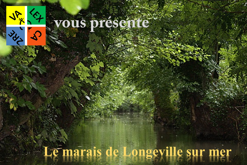

En Vendée, la morphologie de la côte résulte d’une érosion plus ou moins importante selon la nature de la roche. Les roches dures (granites, calcaires, …) forment des caps, tandis que les roches tendres (micaschistes, marnes, …) forment des baies. Le Marais Poitevin reposant sur des marnes tendres, au cours du temps l’action de l’eau a donné naissance à un vaste golfe, ponctué par quelques îlots calcaires (la Dive, St Michel en l’Herm).
Pour bien comprendre la formation du marais, nous devons garder à l’esprit que la côte est en perpétuel mouvement.
Aujourd’hui, nous sommes sur une période commencée il y a environ 18 000 ans. Il y a quelques milliers d’années, la mer bordait Luçon, Fontenay et Niort, le golfe se combla alors progressivement par des dépôts d’alluvions importants. La vase ainsi déposée est appelée « bris » et est composée d’argile fine, de calcaire et de fines particules sableuses. L’envasement continue encore de nos jours en baie de l’Aiguillon.

Le Marais Poitevin étant situé sur 3 départements : la Vendée, les Deux-Sèvres et la Charente Maritime et à cheval sur 2 régions : les Pays de la Loire et le Poitou-Charentes, la gestion et la mise en valeur de celui-ci en est d’autant plus complexe. Après la forte déprise agricole du début du siècle qui eut pour effet l’abandon des cultures traditionnelles au profit du pâturage dans les marais desséchés, le remembrement des années 70 relança les activités agricoles, et transforma radicalement les paysages. La mécanisation, l’amélioration des techniques de drainage permettent aujourd’hui une exploitation intensive des marais.
Depuis cette période, une grande partie des prairies humides ont cédé la place aux cultures céréalières. La gestion de l’eau est aujourd’hui bel et bien au centre de tous les débats entre les différents acteurs du marais poitevin. Le Marais Poitevin accueille une richesse écologique exceptionnelle mais fragile. Dans le cadre de la protection des zones humides, l’enjeu majeur est de préserver ce patrimoine naturel tout en maintenant les activités humaines.

In the Vendée, the evolution of the coast has been caused by the erosion of the rock formation. The hard rocks (granite, limestone, …) form capes, while the softer rocks (mica schist, marl, …) form bays. The Marais Poitevin lying on the softer marl rock formation was gradually eroded by the sea to form a vast gulf, punctuated by a small number of limestone outcrops (La Dive, St Michel en l’Herm). To understand the formation of the marshland, you must remember that the coastline continues to evolve. We are currently in a period which started about 18.000 years ago. Several thousand years ago towns including Luçon, Fontenay, Niort were on the coast but the size of the gulf was gradually reduced with infill from sea deposits. These silt deposits are called “Bris” (literally broken pieces) and are composed of very fine clay, limestone and fine particles of sand. This sitting up process is still going on today in the bay of Aiguillon.

The Marais Poitevin is situated on three departments: the Vendée, Deux-Sèvres and Charente Maritime and straddles two regions: the Pays de la Loire and Poitou-Charentes, management and development of it in is even more complex. After the strong agricultural decline of the early century had the effect the abandonment of traditional crops in favor of grazing in the marshes dried, the consolidation 70s revived agricultural activities, and radically transformed the landscape. Mechanization, improved drainage techniques now allow an intensive use of wetlands.
Since that time, much of the wet meadows gave way to cereal crops. The water management is now well and truly in the center of the debates between the different actors of the Marais Poitevin. The Marais Poitevin has an exceptional but fragile ecological wealth. Under the protection of wetlands, the major challenge is to preserve this natural heritage while keeping human activities.
| La Earth cache FR |
|
Pour pouvoir loguer cette Earth Cache, vous devez aller sur le terrain et étudier les questions suivantes, puis m'envoyer réponses via mon profil.
- Un peu plus loin sur le chemin vous trouverez le pont de la Pépière.
- Quelle est la nature des sols entre l'arrivée des barques et l'arrivée des canoës sous la couche d'herbe ?
- Quelle est la largeur approximative du canal d'arrivée des barques ?
- Revenez sur vos pas afin de trouver les réponses sur les panneaux explicatifs.
- De nos jours l'envasement augmente de combien de centimètres par année ?
- Comment se nomme la période commencée il y a 18 000 ans ?
- Quel rôle joue le Marais Poitevin au niveau écologique, et qu'apporte-t-il au milieu naturel l'entourant ?
Lors de la saisie de votre log:
- Vous pouvez ajouter une photo de vous ou de votre GPS sur le pont de la Pépière en prenant votre photo en direction du Sud, merci !
|
| The Earth cache EN |
|
To log this Earth Cache, you must go into the field and study the following questions and answers send me via my profile.
- A little further on the way you will find the bridge of Pépière.
- Which is the nature of the grounds between the arrival of the boats and the arrival of the canoes under the layer of grass?
- Which is the approximate width of the channel of arrival of the boats?
- Reconsider your steps in order to find the answers on the explanatory panels.
- Nowadays does the silting increase how much centimetres per year?
- How name the started period does 18,000 years ago?
- Which role play the Marsh From Poitou at the ecological level, and which does it does bring to the natural environment surrounding it?
When entering your log :
- You can add a photo of you or your GPS on the bridge Pépière, taking your camera to the south, thank you !
|

