Tai Po River
River is a big word for this stream, but in Hong Kong they don't get much bigger. It is a perennial stream, running all year round. In winter, the dry season, the river is notably smaller than in summer, and after a serious rainstorm it can swell to monstrous proportions.

This stream starts all the way up at Lead Mine Pass, its spring is just below the saddle point, about 400m above sea level. The river runs a steep and almost straight course down, via various villages including Ta Tit Yan and Wun Yiu to finally reach Lam Tsuen River shortly before it drains in the sea. The last part of Tai Po River, from Wan Tau Tong Estate onwards, is tidal.
Lead Mine Pass forms part of a watershed. Water north of it drains towards Tai Po, rainwater falling on the south side of the pass drains into Shing Mun River, which runs around Needle Hill to Sha Tin. This river has been dammed to form the Shing Mun Reservoirs.
Lead Mine Pass
This pass is formed at a major fault line. Faults making the rocks weaker, causing them to erode faster than the surrounding rocks, and where these faults cut through mountain ranges, the rocks erode faster and passes form. The valley of Tai Po River follows this fault down towards Tai Po. On the other side the fault continues forming the valley that now holds Upper Shing Mun Reservoir.
This topology is the reason the spring has formed here. Rain falls on the surrounding mountains, and the water is mostly absorbed by the soil, and then slowly drains down. Due to the bedrock being not far below the surface, the water can not be absorbed deep. The water seeps through the soil, and when it reaches the pass, it meets the water coming from the other mountain, and the soil becomes over saturated. This is where the water comes back to the surface as a spring.
The spring

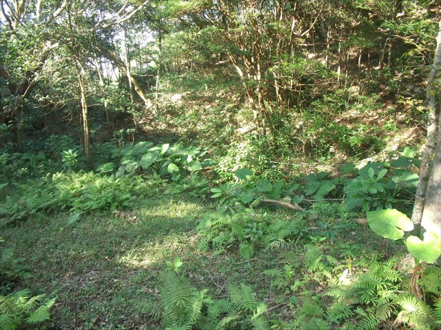
Near listed coordinates (GPS is not very accurate here due to the trees) you can find a few places where the water comes out of the ground, and forms a river. This are very pronounced spots, the exact location of which may change due to erosion of the sandy soil. Around this spring is a swampy area with very wet soil, you can easily see the difference in vegetation of this area compared to the surrounding, drier areas. Towards the south the water runs off into a steep mountain stream bed.
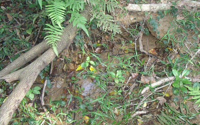
The image to the right is one of these springs. The right top corner is where the water wells up from the ground, and then runs towards the left bottom corner of the image. The current is fast, indicating a good volume of water comes out of the ground here.
Logging tasks
To log this cache, please answer the following questions, and send the answers by e-mail to CO.
- This spring is perennial, also in winter when it may not rain for a month water still comes out of the ground here. How is this possible?
- Look at the soil where the water comes out of the ground. This is a quick draining kind of soil. What kind of soil is this?