CUGA: Cumberland Gap Sand Cave EarthCache
CUGA: Cumberland Gap Sand Cave
-
Difficulty:
-

-
Terrain:
-

Size:  (other)
Please note Use of geocaching.com services is subject to the terms and conditions
in our disclaimer.
The Sand Caves of Cumberland Gap National Park are one of the most amazing sights that we have ever seen. The Sand Cave covers one and a half acres of sand, much of it as fine and dry as moon dust. There are twenty four caves, varying from twenty feet, to over six miles in length.
 For 100 years, the National Park Service has preserved America’s special places “for the enjoyment, education, and inspiration of this and future generations.” Celebrate its second century with the Find Your Park GeoTour that launched April 2016 and explore these geocaches placed for you by National Park Service Rangers and their partners.
geocaching.com/play/geotours/findyourpark

How to get there From Gate City, VA
1. Continue on US 23/58/421 to Duffield, VA.
2. Turn left on US 58/421 in Duffield and continue 11 miles to Stickleyville, VA.
3. Continue on US 58 west where US 421 turns north and through Jonesville, VA.
4. Proceed on US 58 about 25 miles to Ewing, VA although the highway is on a new bypass north of town.
5. Turn right at traffic lights onto VA724.
6. Proceed about a mile to the Thomas Walker Civic Park.
7. Park in grass by pit toilets for day hike. (Park back outside gate if returning after dark.)
8. Trailhead is behind the covered pavilion (which has only a handicapped parking space).
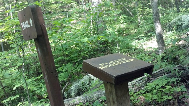
Fees, Permits, etc. Located in Cumberland Gap National Historic Park. No permits or fees required for day hiking. Permit needed from main park visitors center if camping in the backcountry. There is a trail register along the way. Dogs need to be on a leash.
Nothing is to be removed from national park sites. Also, as bears have been active especially in the White Rocks area, please leave no food or food remnants. And if camping in the designated backcountry, all folks are required to obtain a permit and to use the bear proof food storage cable systems available at each backcountry campsite. Click here to visit the park website.
Description: Sand Cave is named after its content. The floor of the cave is covered by beautiful yellow and red sand. This sand is the residual of the cave erosion, and forms piles and dunes inside the huge cavern. Sand Cave is a wind cave, which means it is formed by winds destroying and sculpturing the sandstone. Sandstone is a very common sedimentary rock and perhaps the best known sedimentary rock. It is formed in many environments. The grains of sand are composed of individual crystals of various minerals such as quartz. Iron oxides, manganese oxides and other impurities can cause bright and contrasting colors in sandstones. These colors are what give sandstone its unique character and ornamental desirability. The colors range from bright whites, reds, yellows, oranges and even purples and greens. Colored sandstone is usually intricately banded in multiple colors which enhance its aesthetic appeal. The sandstone deposits of Sand Cave are a beautiful part of the natural environment in the cave.
 Although sand cave is just a rock shelter, there are various features of a true cave. On hot summer days the inner parts stay cool. The location has impressive acoustics, voices echo off the sandstone walls. Decades ago churches used to hold singings at the site. This was in pre-park days, when Sand Cave was accessible by road from the Kentucky side.

Sand Cave is located in the Cumberland Mountain Ridge, north of Ewing, VA. This is one of several mountain ridges running from the east to the west. What makes this ridge special is the fact that it is the border between Kentucky and Virginia, and probably it is a bit higher than the other ridges. The peaks are between 1,000 and 1,100m asl high.
 Route Description Route is a loop hike formed by taking 3.6-mile Ewing Trail up to Ridge Trail, west over to spur to Sand Cave, and then back east to White Rocks overlook. Finally, return along Ridge Trail to 0.5-mile shortcut down on White Rocks Trail to finish with Ewing Trail. Walk through picnic area past covered pavilion to trail leading into the woods. First section is narrow hiking path until it reaches the wider horse trail. Continue up and up through series of switchbacks. Once up on top, the trail will descend some on other side until Ridge Trail is reached. Take right until you see several horse hitching posts. Across the way is the spur trail to Sand Cave (in Kentucky), which drops down some big steps. Just before the cave the trail breaks into several options. Far left on the steps may require some creek hopping during wet weather, while the right is a narrow ledge to cross. Enjoy lunch at Sand Cave. Backtrack up to Ridge Trail. Take left to follow Ridge Trail (passing sign for White Rocks backcountry camping area) until another set of horse hitching posts. The sign here says only "200 ft" to overlook but it involves a climb up a crevice to reach White Rocks. Return back to trail signs to take left on White Rocks Trail down to Ewing Trail. Continue back down to vehicles. Be prepared to allow the better part of the day to make this hike to Sand Cave. It's all of 10 miles, round trip taking the horse trail. Bring food, water, phone, extra batteries and be sure to sign in on the trail guest box.
 Cache has been placed with permission of the Cumberland Gap National Park director. As a bonus, while you are there, stop by and see the waterfall, which is just left of the cave. In addition, when looking in the cave, go to the far right and see if you can find hieroglyphics on the wall. As always, enjoy and happy caching!!

Please feel free to upload your best photos and have fun answering these questions:
1. What creates the opening of the cave?
2. What colors do you see in the rock wall?
3. What is to the right of the cave as you are looking out?
Additional Hints
(No hints available.)