Reynisdrangar EarthCache
-
Difficulty:
-

-
Terrain:
-

Size:  (other)
Please note Use of geocaching.com services is subject to the terms and conditions
in our disclaimer.
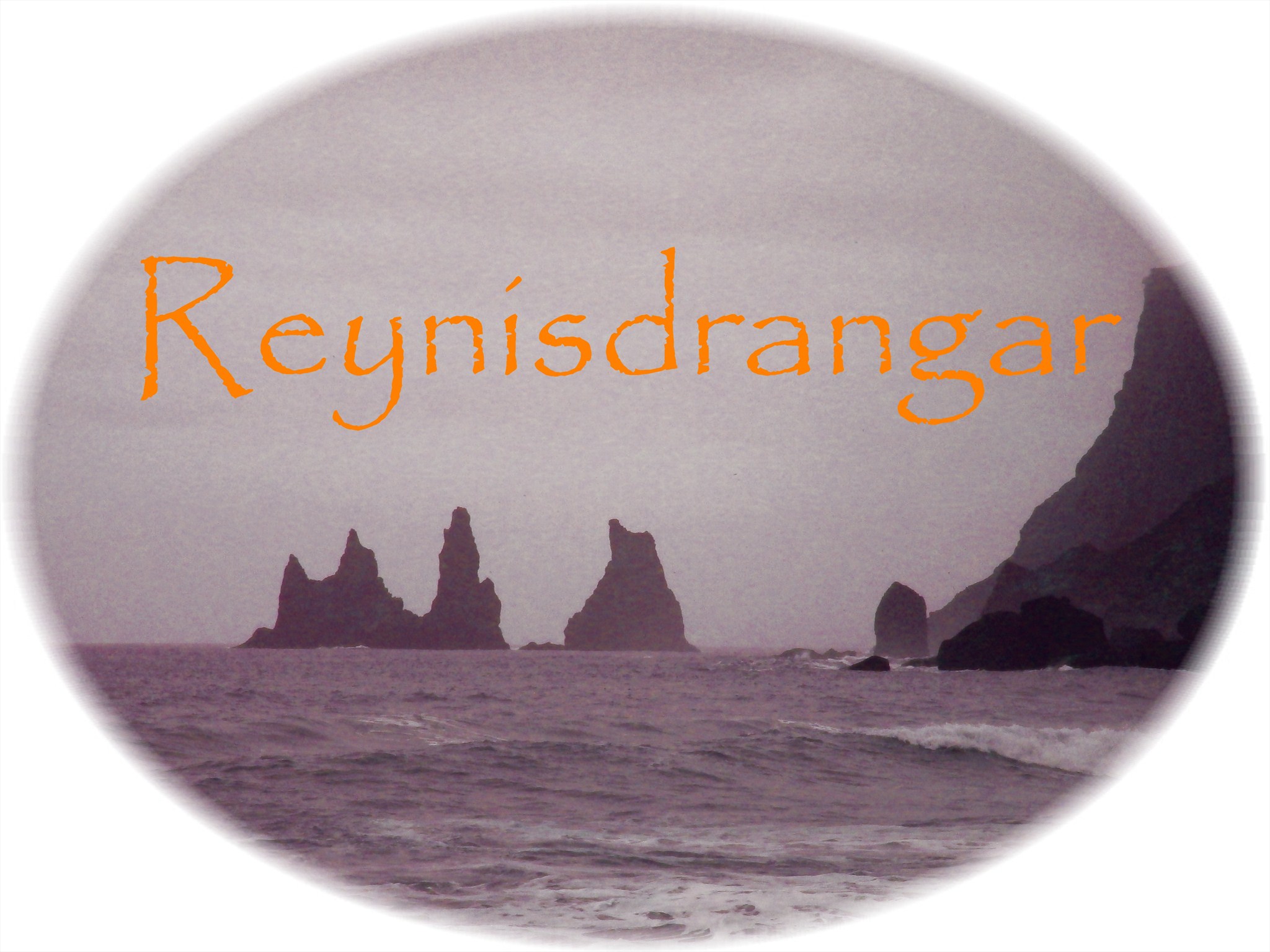
Reynisdrangar
Reynisdrangar is located in south iceland in the small town of vík with a population of around 300 and under the shadow of mýrdalsjökull glacier and one of iceland's dangerous volcano - katla. The area is also the wettest place in iceland.
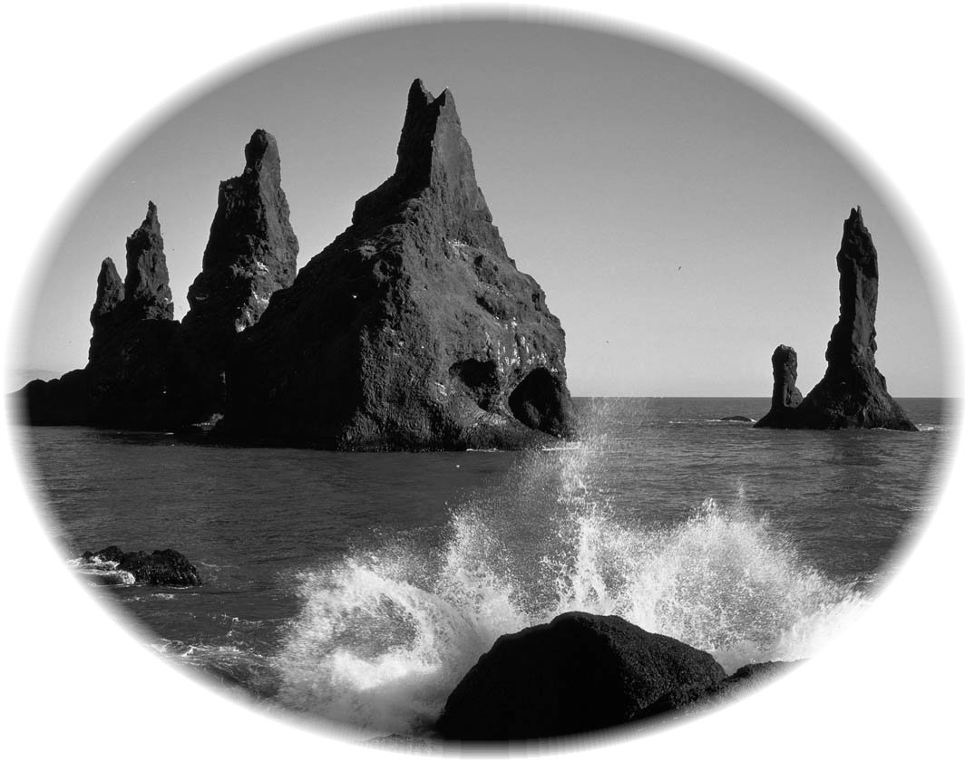
Reynisdrangar is accesible via the ring road. There are many angles and perspectives where you can see the rocks. The coordinates leads you to the black beach of Vik. Here you have a good view to the ca. 60m high Reynisdrangar
The legend and myth of the rocks says that there were three trolls namely: skessudrangur, laddrangur and langhamar who were pulling a three masted ship into the shore, but they were caught at dawn by sunlight and turned into rocks.
Sea stacks
A stack is a geological landform consisting of a steep and often vertical column or columns of rock in the sea near a coast, isolated by Erosion. Stacks are formed through processes of coastal geomorphology, which are entirely natural. Time, wind, and water are the only factors involved in the formation of a stack. They are formed when part of a headland is eroded by hydraulic action, which is the force of the sea or water crashing against the rock. The force of the water weakens cracks in the headland, causing them to later collapse, forming free-standing stacks and even a small island. Without the constant presence of water, stacks also form when a natural arch collapses under gravity, due to sub-aerial processes like wind erosion. Stacks can provide important nesting locations for seabirds.
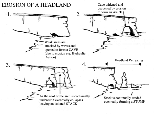
Stacks typically form in horizontally-bedded sedimentary or volcanic rocks, particularly on limestone cliffs. These rock types' medium hardness means medium resistance to abrasive and attritive erosion. A more resistant layer may form a capstone. (Cliffs with weaker rock - such as clay - tend to slump and erode too quickly to form stacks, while harder rocks such as granite erode in different ways.)
The formation process usually begins when the sea attacks small cracks in a headland and opens them. The cracks then gradually get larger and turn into a small cave. When the cave wears through the headland, an arch forms. Further erosion causes the arch to collapse, leaving the pillar of hard rock standing away from the coast - the stack. Eventually, erosion will cause the stack to collapse, leaving a stump. This stump usually forms a small rock island, low enough for a high tide to submerge.
To log this Earthcache:
Send me the answers to the following tasks via my Profile
1. Describe the width and the height of Reynisdrangar. Compare the size with the mountain Reynisfjall on your right side when you look at sea stacks. Do you think, that the rocks from Reynisdrangar belongs to that mountain? Justify your conjecture!
2.In reference to the drawings in the listing: What will happen in the future with Reynisdrangar? And what the reason for your opinion.
3.Take a look at the sand of the beach and compare the shapes of the stones with the rocks of Reynisdrangar. Do they look similar or different. And why?
4.A photo of you in front of Reynisdrangar would be nice but is only optional !!

Sources: Wikipedia, sisgeographywiki.wikispaces.com, travbuddy.com
Sir Tristan berichtet von einem Drachen
der tapfer und Nächstenlieb sei
er habe keinen Feuerrachen
und seine Gedanken sind frei
Bei seinem ersten Abenteuer
da war der nächste dabei
er half den lieben Ungeheuer
zu finden ein Drachenei
C=5
Additional Hints
(No hints available.)