History
Tide Mills is a village that is now derelict, but used to consist of a large tide mill and numerous workers cottages. The mill was built in 1761 and stopped work in around 1900. In addition to the mill there have been a Railway Station, Nurses Homes, Hospital, RNAS Station and later Holiday homes and a Marconi Radio Station on the site.
The area also accommodated large numbers of Canadian soldiers during the Second World War.
For more information on the abandoned village see: Tide Mills
Geology
Shingle structures are mainly limited to areas of extreme latitude, and other regions affected by Pleistocene glaciation. this limited range indicates the role that ice sheets played in the creation of the clastic materials which now form many of the world's shingle structures.
The composition of these structures often reflects local geology, with stones such as granite, quartzite, flint and chert being common to their own geological regions.
Many factors govern the formation of shingle structures; the shape of the coastline, tidal movement, weather patterns and levels of accessible shingle deposits.
There are five recognised shingle structures:
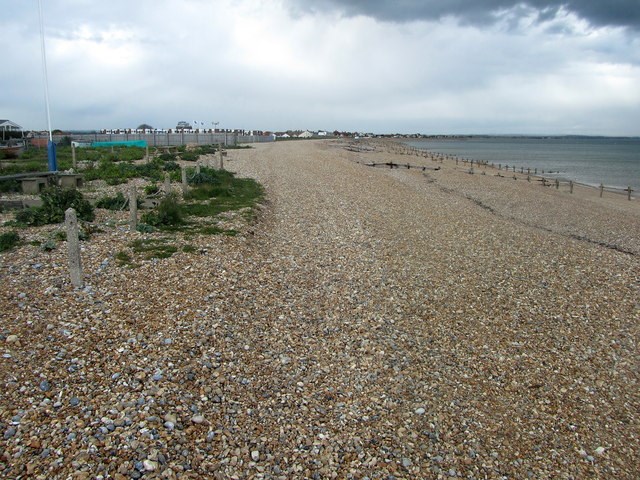
Fringing beach
A fringing beach is a narrow strip of shingle material in contact with and running parallel to the coastline. Often occurring at the base of cliffs and in areas where anthropogenic barriers such as sea walls are dominant. Fringing beaches are generally extremely transient environments which experience large annual fluctuations of material.
An example of a fringing beach can be seen at Pevensey Bay, East Sussex.
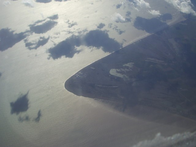
Cuspate Foreland
Cuspate forelands are much larger masses of shingle, forming triangular protrusions which extend seaward. These structures are usually formed in areas where bi-directional wave action pushes shingle to a point where it converges into one structure.
An example of a cuspate foreland can be seen at Dungeness, Kent and East Sussex.
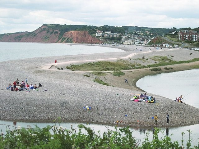
Shingle Spit
A spit is a strip of shingle which develops outwards from the coast, in areas where the coastline changes direction suddenly. Shingle spits can frequently be found in the vicinity of harbours and estuaries.
An example of a shingle spit can be seen at Mouth of the River Otter, Devon.
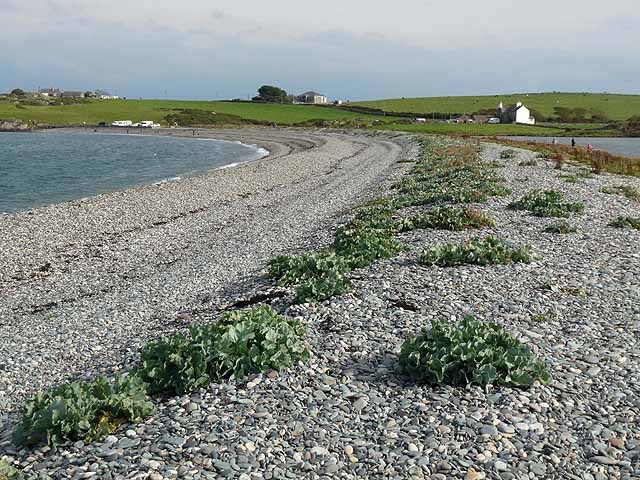
Shingle Bar / Barrier
Bars or barriers are geomorphically similar to shingle spits, with the exception that these structures extend across the length of a bay or estuary.
An example of a Bar / Barrier can be seen at Cemlyn Bay, Anglesey.
Offshore Barrier Island
Offshore barrier islands are formed in areas where a large amount of shingle material is deposited offshore, and may be a precursor to the formation of a sand dune system.
An example of an offshore barrier island can be seen at Scolt Head, Norfolk.
Tasks:
1. Describe the size and shape of the shingle that make the shingle formation here. What type of shingle structure do you think is represented here?
2. What type of stones can be found in the shingle that reflect the local geology and where could these stones come from?
3. From this location the shingle slopes down to the sea in a series of "steps". Describe the differences in the size of the stones found in these structures and how do they differ as you approach the sea? What is the technical term for these steps? Finally how are they formed and what affect do the seasons have on these specific structures?
4. At the published co-ordinates take an elevation reading to determine the height of the shingle structure at this location.
Optional Task:
5. Take a photo of you or your GPS with the ruins of the village in the background.