Container is not only at the city limit, but also on the county line, and also on the state line. A few poker chips, the log and a small pencil included. As of the date of cache placement, the road and park to the northeast is still closed due to flood damage.
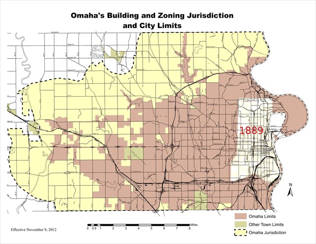
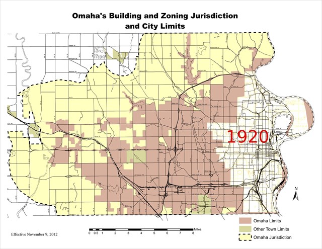
I started with the current map used by the City Planning Commission to indicate Omaha’s city limits. Then I obtained several maps from historic plat atlases from the Omaha Public Library collection. Combining the two gives an impression of Omaha’s growth in the last 120 years or so.
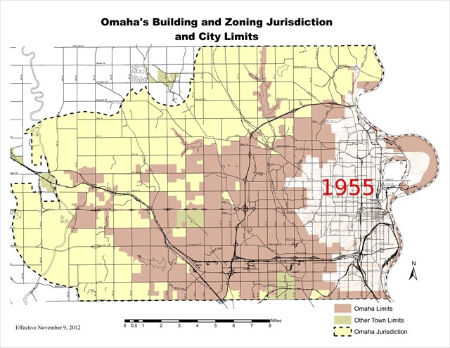
The 1955 city limit map I found was from the 1955 Yellow Pages book, so it's likely not as accurate as the earlier maps which were sourced / signed by the county surveyor.
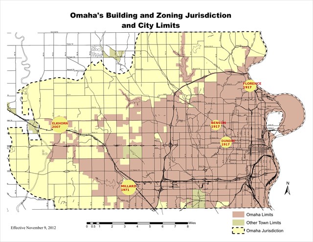
Omaha’s growth was spurred by creating subdivisions and a few annexations. The “shoestring annexation” of Elkhorn from 2005-2007 was controversial and fought out in the courtroom, but the earlier annexations were almost as rancorous.
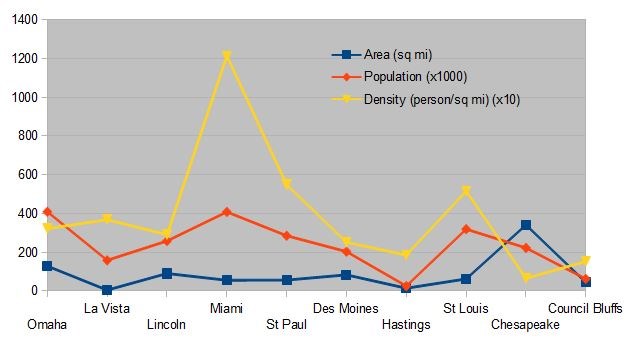
Omaha population, 2010: 408, 958 (National rank, 43)
Land area, square miles: 127.09 (National rank, 78)
Population density (persons per square mile): 3217.9 (Unranked)
Some cities which have a smaller population than Omaha may surprise you: Miami, St. Paul, St. Louis. Of course, this involves the difference between strict city limits and major metro areas comprising contiguous populated areas, all independently incorporated. Here’s a chart illustrating the balance between a city’s population, area and population density. The Nebraska city with the highest population density? La Vista.
I've uploaded the maps I used to make the overlays, and you're encouraged to check them out. (Higher resolutions and zoomable pdfs are available at the Omaha Public Library online site - "Early Omaha History.") Some fun findings when examining the historic maps:
- The maps up through 1900 call Carter Lake “Cut Off Lake.”
- On the early maps, West Omaha was between 30th St and the Little Papio.
- Who knew Chicago was between Millard and Waterloo?
- 1889 map highlights: the “Wagon and Motor Bridge” to Council Bluffs; the “Poor Farm” just south of County Hospital; Holy Sepulchre Cemetery, west of West Omaha; the State Mute Institute; the Omaha Driving Park.
- The “Trans-Continental Road” evolves into the “Lincoln Highway” on these maps.
Sources: Omaha Public Library, Omaha Planning Commission, Douglas County Historical Society, Wikipedia, US Census Bureau.
The maps and charts used are either with publishing dates before 1922, public government maps, or data charts of my own design.
For the truly map-obsessed, there's information about the map sources (and tools used to create the new maps) at the WBs geocaching blog. Use the "Related Web Page" link above.