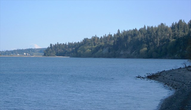
Fort Townsend State Park is a 367-acre marine camping park featuring 3,960 feet of saltwater shoreline on Port Townsend Bay.
Fort Townsend was established by the U.S Army in 1856 to protect settlers in the area. It was used off and on until 1895 when it was abandoned after a fire destroyed major buildings. Few signs of buildings from this era remain. Fort Townsend saw service during World War II as a munitions defusing station. Washington State Parks took custody of the area in 1953. If you'd like to learn more about the early history of Fort Townsend, check out the short interpretive trail that starts southeast of the parking waypoint (just beyond and to the left of the large signboard). The park also hosts a yearly living history encampment that recreates life during the early days of the fort.
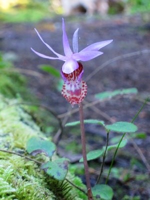
Fort Townsend State Park is one of the best examples in the Puget Sound region of a mature Pacific Northwest forest. It's dominated by Douglas fir, western redcedar, and western hemlock, with many trees being more than 150 years old. There are 6.5 miles of trails wandering through this natural forest area. The large signboard to the south of the parking waypoint features a mural by local artist Larry Eifert. It provides a good overview of the rich natural diversity in the park.
Fort Townsend State Park is located on the Olympic Peninsula a few miles south of Port Townsend. The park is open year round for day use from 8 AM to dusk. A Discover Pass is required for parking. The park is open for camping from late spring through early fall (see the park page for details). Leashed dogs are fine on all trails. A few trails allow biking.
Finding this cache will take you on a half mile (round trip) walk down a forested trail in the park. Nature Trail starts across the road from the parking waypoint.
After finding the cache you can head downhill to a landing overlooking the beach with views of Port Townsend, Mt. Baker, and on a good day Mt. Rainier. You can also access the beach at this point. Heading uphill along the bluff will take you to the rest of Fort Townsend's trail system.

|
- This geocache has an approved Permit to be placed at this location on property managed by the Washington State Parks and Recreation Commission. Visitors are responsible for acquainting themselves with policies and rules pertaining to State Parks areas.
- The following items may not be placed in the geocache: food, illegal substances, medications, personal hygiene products, pornographic materials, hazardous materials, or weapons of any type.
- By searching for the cache, visitors agree that they are responsible for their own actions, and acknowledge that neither the State of Washington nor the cache owner is responsible for any loss or injury that may occur in relation to such search.
- Report any incident, problem, or violation to State Parks staff.
|