Situation
The site of this earthcache is high up on the northern slopes of Craignaw, a remote peak 2000 foot peak, which is a tough 2 - 3 hour walk from the nearest road. There are no escape routes and at least one river crossing might be dangerous if the rivers are in spate. A walking pole is always a help at river crossings but you will also need to make sure your other clothing and equipment is up to the weather you might encounter. Navigation should not be a problem....... you will have your gps with you!!
Geology
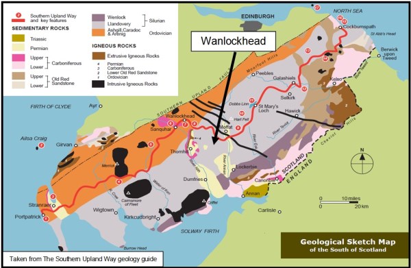
South of the lowland areas known as the ‘Central Belt’ which lies between the Firths of Clyde and Forth, the home to most of the population of Scotland, lie the Southern Uplands. A major fault line runs diagonally across the country from near Ballantrae in Ayrshire to Dunbar on the east coast and the rocks south of this Southern Uplands Fault form a range of hills almost 200 km (120 miles) long, interspersed with broad valleys.
The geological foundations of these hills largely comprise Silurian and Ordovician deposits laid down some 400-500 million years ago, with the oldest rocks forming the furthest north outcrops.
During the Silurian period (443–416 Ma) the continent of Laurentia slowly collided with the continent of Baltica, joining Scotland to the area that would become England and Europe. Sea levels rose as the Ordovician ice sheets melted, and tectonic movements of the plates in the earth’s crust created major faults. These faults are:-
the Highland Boundary Fault, separating the Lowlands from the Highlands,
the Great Glen Fault that divides the North-west Highlands from the Grampians,
the Southern Uplands Fault mentioned previously
and the Iapetus Suture, which runs from the Solway Firth to Lindisfarne, which marks the closing of the Iapetus Ocean and the joining of northern and southern Britain.
The sedimentary deposits of the these periods were pushed up from the sea bed into an accretionary wedge by the collision of these ancient continents. The majority of the rocks are sandstones and coarse greywackes, some of which are weakly metamorphosed by temperature and pressure.
However, Volcanic activity occurred across Scotland as a result of the collision of the tectonic plates, with volcanoes in southern Scotland, and magma chambers in the north so there are some isolated pockets of intrusive igneous rocks such as granite and, particularly south east of Kelso, small areas of extrusive igneous ones such as basalt.
During the Devonian period the Scottish landmass formed part of the Old Red Sandstone Continent and lay some 25 degrees south of the equator, moving slowly north during this period to 10 degrees south. The accumulations of Devonian Old Red Sandstone laid down from 408 to 370 million years ago were created from the erosion of the earlier Silurian rocks, which had been uplifted by the formation of Pangaea supercontinent, the sediments from which were deposited into a body of fresh water, probably a series of large river deltas.
During the Pleistocene ice ages the whole of Scotland was covered by ice sheets and the landscape was much affected by glaciation, and to a lesser extent by subsequent sea level changes. Earth tremors are infrequent and usually slight but the Great Glen is the most seismically active area of Britain.
There are rocks of Carboniferous age south of Ayr and near the border with England with Permian deposits around Dumfries, Thornhill and Lockerbie. The youngest rocks are Triassic age 200-250 millions years old east of Annan.
Landform
The earthcache site is at the north end of a deserted hanging valley which is home to some of the largest and loneliest upland lochs in Britain.
Loch Enoch drains northwards but the waters of Loch Neldricken flow south into Loch Valley and onwards into Glen Trool by the Gairland Burn which you will see tumbling past moraine heaps on your right as you ascend from Bruce’s Stone.
It is a tough walk to GZ over hummocky grass which is often very waterlogged and boggy underfoot. As mentioned earlier, crossing the stream at Loch Neldricken can be tricky but you can still reach the “bowling green” by taking a longer route around the west and north sides of the loch.
The majority of the rocks in the area are probably lying where they were dropped by the retreating glaciers 10,000 years ago so please leave them where they are and resist the temptation to move them around or, heaven forbid, play a game of bowls with them  !
!
To log the earthcache you need to send me an e mail the answers to the following questions along with your email address and (optionally) post a photograph of yourself at the site.
You can log your visit as a "find" for your  straight away and I will contact you asap to let you know any errors if any there are.
a) Look carefully at the rock that makes up the relatively flat "bowling green" and in particularly the crystals in it. Say whether they are fine or coarse and describe the colour of two of them. From these observations & the rock types mentioned in the listing identify what type of rock this is.
b) Consider the "bowls". Are the majority a different or similar type of rock to the "green"? How do you think they arrived to be on "bowling green"?
c) Bearing in mind the name of the feature, have an intelligent guess at the number of "bowls" that seem most likely to be present on the "bowling green".
d) Most of the structures you will see at the site are rounded but not at N55 07.392 W004 25.249. Describe what linear feature you can see at this point and what does it seem to be made of?
e) Although the bowling green is flat (relatively) it is not level. Use your gps or compass to tell me in which direction it slopes.
f) For a bonus - whatever that is! - can you tell me the name of the lichen that gives colour to the "green" and the deciduous grass that clothes the boggy ground all around.