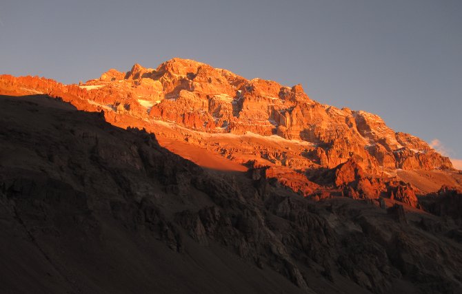
The mountain: Cerro Aconcagua (6962 m, 22 837 ft) is the highest mountain of South America, the highest mountain outside Asia, and one of the Seven Summits. It is located in the Andes mountain range. The name probably comes from Quechuan "Anco Cahuac", meaning "White Sentinel", although this is still the subject of discussions.
Source: Wikipedia
History: The first successful expedition to Aconcagua was led by Edward FitzGerald and consisted of Stuart Vines, de Trafford, Philip Gosse, mountain guide Mattias Zurbriggen along with porters Joseph and Louis Pollinger, Lochmatter, Nicola Lanti and Fritz Weibel. They made their base camp nearby the old Plaza de Mulas, two days before the Christmas of 1896. Their first ascend attempt was marked by their lack of experience with Andes conditions. They decided to push onwards on the same day, but made it only to an altitude of about 16 000 ft (almost to today's camp Canada) before sunset and exhaustion forced them to stay for the night. Underestimating the night cold, they decided not to pitch any tents, and simply crawled into their sleeping bags. In their own words the night was "miserable and cold, our attempts to sleep having been in most cases a failure". Next their "cooking aparatus" failed to work because of the thin air, which sentenced them to eating half-frozen food until they discovered a more suitable way of cooking much later. Their next ascend led them through a gravel slope, which gave them a lot of difficulty because there was no well trodden path ("every step we took we slipped back, sometimes half, sometimes more than the whole distance we had originally climbed"). Despite obvious signs of altitude sickness they managed to make camp somewhere above today's Nido de Condores. The description of the conditions there was quite colorful: "I have seen the men actually sit down and cry like children, so discouraged were they by this intense cold." The reason for this they were able to explain later on: "The rarefied atmosphere lowers all the vital organs to such an extent, that 20°F of frost feels more like 60°F, and one does not have the usual power to fight against the temperature. Almost all the time we had a cold biting wind, which, no matter how thickly we clothed ourselves, seemed to penetrate to our very marrow." Also they observed that "It is difficult to sleep for more than a quarter of an hour or twenty minutes at a time without being awakened by a fit of choking." Before retreating to the base camp, Zurbriggen was able to find the highest point reached by the previous expedition, marked by a small stone man and a tin box with a card.
For the second attempt they tried to make use of their previous experience, and gathered wood for cooking instead of relying on cooking contraptions. The idea proved to be good one later on, but that particular kind of wood was almost impossible to burn, which left them on frozen diet once again. At one point they had to resort to thawing water in their mouth (which is a severely bad idea because of the threat of hypothermia). Also for the ascend to the high camp they chose a different path, which was harder to climb but with more firm footing. The next day after reaching camp they set off before sunrise, which proved unfortunate for Zurbriggen. Because of the lack of modern gear, the severe cold stopped the circulation in his feet and he only narrowly escaped amputation by retreating to the camp. Two days later they made another peak attempt, but had to turn back from strong wind and exhaustion. After that depression resulting from malnourishment and altitude sickness forced them to retreat all the way to Puente del Inca. During the trip they decided to cross the stream that flows from melting snow late in the afternoon when the flow is strong. This proved nearly fatal for Zurbriggen when his mule rolled over and pinned him underwater on a boulder. To make things worse, later during that trip his mule fell off a rock precipice. These two incidents left him with a severely injured shoulder, that caused him some pain during later attempts.
For the third attempt they were able to find light pine wood that could start a proper fire in short time. They also brought some light food that was easier on the stomach. After reaching high camp they decided to take a day off, to try to acclimatize. This they late recognized to be a mistake: "Every day spent at this height makes one the weaker. [...] Resting here did not seem at all a success." After two unsuccessful peak attempts the luck turned to their favor on the 14th of January 1897. Because of the previous experience, they waited for the sun to get sufficiently high and didn't start before seven o'clock. "We walked as slowly as possible, carefully picking our way, never taking a long step where two short ones would do, and by every means trying to save ourselves needless exertion and fatigue." Despite good prospects the expedition leader FitzGerald got altitude sickness after midday break somewhere before Canaletta. He let Zurbriggen go ahead and after realizing that he wouldn't be able to reach peak before sunset, he turned back. Zurbriggen had "succeeded in gaining the summit, and had planted an ice-axe there; but he was so weak and tired that he could scarcely talk, and lay almost stupefied by fatigue. Though naturally and justifiably elated by his triumph, at that moment he did not seem to care what happened to him." They returned to Puente del Inca the next day.
During this expedition there was another successful ascend by Stuart Vines and Nicola Lanti. Edward FitzGerald couldn't get past his altitude sickness.
Source: Edward FitzGerald: The Highest Andes
The path there: These are the GPS tracks made during my ascend. There are no acclimatization trips included, so you shouldn't try to follow it step by step.
The cache is hidden on the Aconcagua plateau. You're looking for a small lock&lock box containing only a logbook and a pencil. First you should look for what I guessed to be a weather station (see photo). From there you should find a large rock, about waist-high, with a shelf-like opening under it. The cache is in there, covered with some stones.