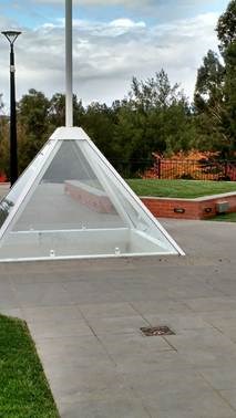
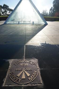
The cache is NOT at the listed coordinates ...
and neither is the CHIRP...
*** Note also that the CHIRP returns the published coordinates, NOT the coords for GZ.
The only thing the CHIRP gives you is the clue required to open the cache.***
The Flag Staff and Plaque(s) at this site are an important place to start your quest. In addition to starting at the site of the first gazetted Survey point in inland Australia, this is the first CHIRP cache to be placed West of the Blue Mountains in NSW.
You can find this cache with a CHIRP-enabled device (once you locate GZ) , but I've also placed the chirp-delivered information in the logbook of another local cache GC4507K in case you're not so chirpy.
This cache has been placed to recognise recent efforts to relocate the original location of the 1815 Bathurst Flag Staff in preparation for the Bathurst bicentenary celebrations on 07 May 2015.
You can read all about how the actual location was re-determined in this paper if you have the spare time.
This cache can be done day or night, but GZ can be a busy place at certain times of day.
Consider timing your find for early or late in the day.
Summary
To find this cache you’ll have to discover the following information, on location, or in the description below:
ABC = Distance to the nearest 100 metres between listed coordinates and the obelisk unveiled in 1930.
DE = Distance to the nearest metre describing how far Bathurst has moved due to tectonic motion over the last 200 years.
F = Distance to the nearest metre between the new Flag Staff and the NSW Permanent Mark PM18152015 (shown above).
FINAL Latitude = Listed latitude plus 0.(ABC-F) minutes
FINAL Longitude = Listed longitude plus 0.0DE minutes
The CHIRP, located near GZ, will give you the additional information you will need to complete this cache.
(I'm eager to hear how this chirp works for you. All feedback is welcome!)
The History
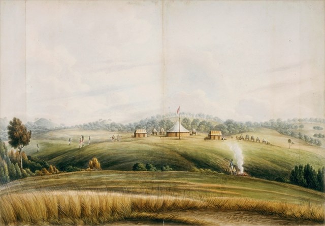
We often take for granted these days that we know 'exactly' where we are, but things haven’t always been that simple (and in fact, still aren’t as simple as you might suspect!) In May 1815, just two years after the first crossings of the Blue Mountains by Lawson, Blaxland, Wentworth and Deputy Surveyor George Evans, Governor Lachlan Macquarie made an official visit and established camp at the terminus of the newly constructed Cox’s Road, on the banks of the Macquarie River. Here he ordered a Flag Staff to be erected, and on Sunday May 7, he assembled the whole of the People (75 in number), hoisted the Union Jack, and christened the future town on that site, ‘Bathurst’. 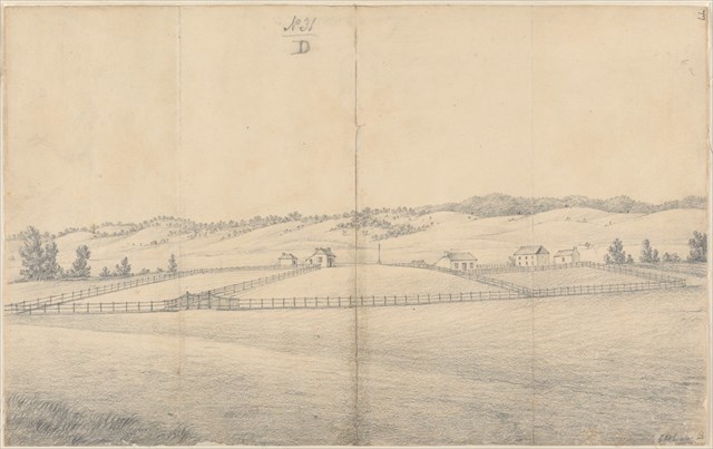
This event marked the beginning of the first inland European settlement and the earliest gateway to inland NSW. The Flag Staff served as the first gazetted survey point in inland Australia (predating the Macquarie Obelisk in Sydney), both for the proposed town of Bathurst and for explorations of regions to the West. It is referred to in the Sydney press of the day, both officially and privately, in reference to land titles and distances from Sydney. It was, in early years, a known visual landmark for travellers, surveyors and explorers.
Unfortunately, the eventual fate of the Flag Staff is unknown. However, in Bicentennial park on the banks of the Macquarie river, you’ll find evidence of few separate attempts to create local monuments to the Flag Staff. This raises the question:
Where exactly was that Flag Staff?? And why would people suggest different locations?

Where the Flag Staff SHOULD be
If you are standing at the plaque at the listed coordinates, which reads “NSW Permanent Mark 18152015” then you are standing at the original location of the 1815 Bathurst Flag Staff. Don’t mind the fact that the plaque under glass claims to be at the "exact location of the Flag Staff... ", after all, it also claims that William Cox planted it there – so don’t believe everything that you read  .
.
It is quite apparent, from records and charts available from that time that the Flag Staff was indeed located half way between the two main streets William and George, and on the reserve for Stanley street, where this PM18152015 plaque is located. (Actually, the Flag Staff came first, and the town was designed around it!)
In the end, the new Bathurst Flag Staff is where it is for architectural reasons... and I’m fine with that. It is still midway between William and George, and looks great where it is.
Convenience
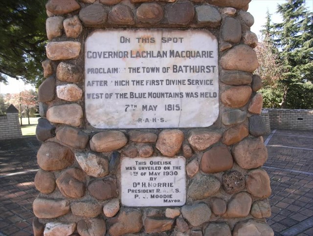
However, notice also the large Obelisk at the end of William Street (to the South East), which was unveiled in 1930 and which claims that "On this spot Governor Lachlan Macquarie proclaimed the the town of Bathurst... " Was it convenience or misunderstanding that led to the placement of the obelisk at this location? This location IS at the end of Cox’s original road after all.
Take note of the distance between these two monuments (round to the nearest 100 meters) and record this information as numbers ’ABC’.
Clock Problems
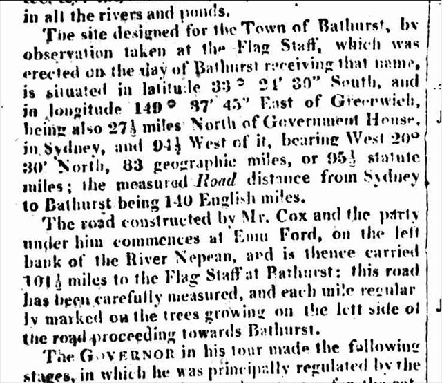
But hang on a minute, surely the records of the day, when the Flag Staff was still standing, would be the most accurate. The journey by Macquarie was esteemed so importantly at the time that it covered a page and a half of the Sydney Gazette of 10 June 1815: "The Governor desires to communicate, for the information of the Public, the Result of his late Tour over the Western or Blue Mountains..." (The whole article can be found here, if you're interested!) Therein, it indicates that "the site designed for the Town of Bathurst, by observations taken at the Flag Staff ... is situated in latitude 33° 24’ 30" South, and in longitude 149° 37’ 45" East of Greenwich."
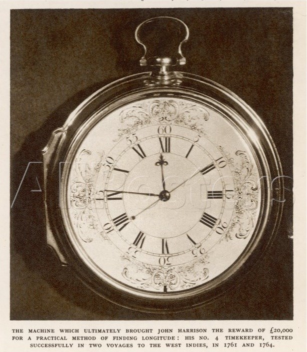 Hmmm. That’ s even worse! Why? Of course, the early surveyors had to rely on astronomical observations and/or a chronometer in an uncharted land (uncharted in the Western sense, at least). For every second their clocks were wrong, this was equal to 15 seconds of arc (the earth rotates 360 degrees in 24 hours). A good chronometer was enormously expensive, and difficult to keep in good nick. Surveyor Evans’ clock was only wrong by about 10 seconds, but that put him over 4 kilometres out of position! And why was his clock wrong? Someone forgot to keep it wound up on the trip over from England!

Coordinate Systems and Mapping
Ok, surely things have improved since then? Yes, our clocks are certainly better, we have GPS (and the two are inter-related, but that’s a story for another day). We’ve moved from an ‘Australian-centric’ coordinate system (AGD66) to a ‘geo-centric’ coordinate system (GDA94) to accommodate GPS and other global navigation satellite systems. (Are you old enough to remember when ALL of our maps shifted by 200 metres in about 1998?)
We’re making more and more accurate maps, but of course, things still go wrong. Some people still map in the old Australian-centric system, and other times people just don’t line things up properly. On this Google map, the roads are in the ‘right’ place, but the images aren’t. Of course, the ‘time-stamp’ of a map is just as important for accuracy as the position of things... does anyone see anything suspiciously out of date in the Google map attached (screen shot from 2013)?
Tectonic Motion
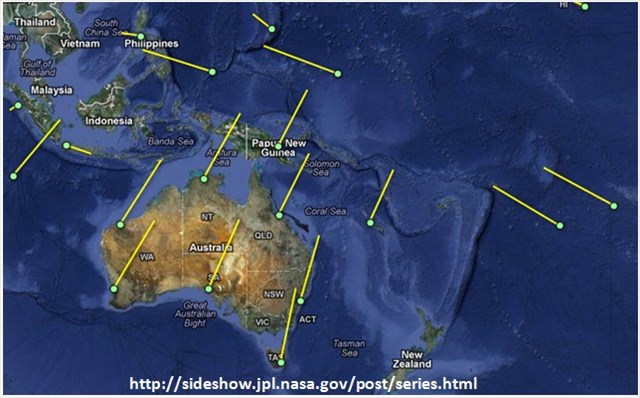
We should also consider how the Australian tectonic plate moves. I find it incredible that only since about the 1950’s we’ve accepted the fact that the Earth’s crust is rather dynamic. Thanks to astronomical and satellite techniques, we can confirm that Australia is moving to the NNE at about 20 degrees from True North. We’re moving about as fast as your fingernails grow: Bathurst is moving at 58 mm every year!
Calculate the how far, in meters, Macquarie’s Flag Staff (and all of Australia!) has moved from where he originally planted it in 1815, and record this as 'DE'. 

What else could possibly go wrong?
So, I hope you’re getting the picture that the task of giving the coordinates for something on the ground is more complex than you might have realised. In the mean-while, thank your lucky (artificial) stars that you have GPS (and GLONASS and BEIDOU and GALILEO and ...) to keep you re-assured about your place in this world. But wait, did you realise these (GPS) satellies are more than 20 MILLION metres away and moving at 4000 metres PER SECOND. They send their positioning signals at the speed of light so each
 milli / micro / nano second of error in your clock costs you 30 cm.
What could possibly go wrong? ;-)
So get out there and happy caching!
...And no more claims that a cloudy day made your GPS go wonky... that’s just an excuse not to go caching in the rain  (GPS is NOT affected by clouds
  )
)
I hope that you’ve enjoyed this first CHIRP cache
West of the Bluies!
FTF prize is another CHIRP!
Congratulations to Code1, who managed to demonstrate great patience, and still manage a FTF! 
(and also thanks for some early troubleshooting!)
I wonder where the next chirp will pop up?
Since this is a puzzle cache, though not a terribly difficult one, I'll provide a coordinate checker just to avoid any disappointment 


(This will only confirm that you're within a few metres though)
