WaStatePks100: Larrabee ... Mountains to Sea Traditional Geocache
WaStatePks100: Larrabee ... Mountains to Sea
-
Difficulty:
-

-
Terrain:
-

Size:  (regular)
Related Web Page
Please note Use of geocaching.com services is subject to the terms and conditions
in our disclaimer.
This cache was originally placed in 2013 as part of the Washington State Parks Centennial GeoTour - "100 caches in 100 parks to celebrate 100 years" - cosponsored by Washington State Geocaching Association (WSGA).
Established in 1915 and located along historic, scenic Chuckanut Drive, Larrabee State Park is Washington's first state park and the third largest.
History
In 1913, Governor Ernest Lister suggested establishing a state park along a part of Chuckanut Drive (then known as Waterfront Road which was still under construction), to Charles Larrabee, one of Bellingham's most influential and wealthiest citizens. Larrabee readily agreed to deed his waterfront property (20 acres) along the drive near the Skagit-Whatcom County line. Charles died in 1914, before the deed was prepared; but his wife, Frances ensured the deal was completed. On October 23, 1915, Lister formally accepted the park, originally named Chuckanut State Park, which became the first in the state. In February 1923 the name was changed to Larrabee State Park by the State Parks Committee.
Features
Larrabee State Park covers 2,683 acres stretching from the Whatcom-Skagit county line north almost to the Bellingham city limits.
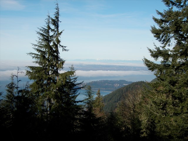
The park is known for its hikes and scenic views from higher elevations, and various water sports activities along its beaches. It includes coves and tidelands, Fragrance Lake and Lost Lake (both freshwater lakes), and much of the Chuckanut Mountains. The terrain within the park varies from sea level to over 1,900 feet in elevation.
Larrabee State Park and its surrounding area are unique to Washington State; it is the only place in Washington where the Cascades (of which the Chuckanut Mountains are a part of) come down west to reach the sea.
Camping facilities consist of 53 standard sites, eight walk-in sites, 26 trailer hookup sites; three emergency campsites; and a reservable group camp area (40 persons maximum). The park is on the Campsite Reservation System.
The park offers 67 picnic sites, two reservable kitchen shelters with capacities of 50 and 100; two other shelters; a band shell; three comfort stations; and three vault toilets.
PARK HOURS - Summer: 6:30 AM to dusk / Winter: 8 AM to dusk
About the Cache
Drive 3+ miles slowly to the very end of unimproved, gravel Cleator Road to enjoy a view overlooking the San Juan Islands, then take a short stroll to the cache along a peaceful trail on top of the Chuckanut Mountains.
Click for map of Chuckanut Trail System
NOTE: Dense tree cover and rock outcroppings in some areas may affect GPS accuracy. Use the hint and your geosenses to find the cache.

|
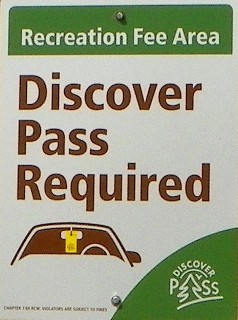
- This geocache has an approved Permit to be placed at this location on property managed by the Washington State Parks and Recreation Commission. Visitors are responsible for acquainting themselves with policies and rules pertaining to State Parks areas.
- The following items may not be placed in the geocache: food, illegal substances, medications, personal hygiene products, pornographic materials, hazardous materials, or weapons of any type.
- By searching for the cache, visitors agree that they are responsible for their own actions, and acknowledge that neither the State of Washington nor the cache owner is responsible for any loss or injury that may occur in relation to such search.
- Report any incident, problem, or violation to State Parks staff.
|
Additional Hints
(Decrypt)
Ng gur Ebpx Genvy fvta va gur cnexvat ybg, GNXR GUR GENVY GB GUR YRSG. Pnpur vf ng onfr bs fznyy Urzybpx; orgjrra fghzc naq qbjarq ebggra ybt. FJ fvqr bs genvy.