This is another cache in the Explorer Challenge series, originally conceived by PetersfieldPoodlePosse, and based upon British Ordnance Survey grid squares as depicted on Explorer maps.
For more information on this series and the rules for placing others in the series there is a dedicated website
To complete this challenge all you have to do is find a total of 232 different caches; how difficult can that be?
The cache is at the published location which is close to the centre of the Explorer 232 map.
What is the Explorer 232 Challenge?
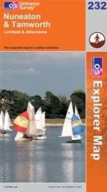 The cache is called the Explorer 232 Challenge because each of the 232 different caches you need to have found to qualify must be in a different British Ordnance Survey grid square as depicted on the Explorer 232 Nuneaton & Tamworth map.
The caches can be of any type, previous finds qualify (including those finds now archived and events attended (even if you were the host)), in fact just about any cache other than those you have placed yourself (more on that later) can be counted.
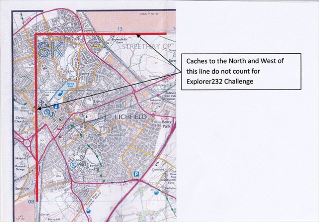
The grids on the map "start" in the north west corner near Lichfield at SK 11500 11000. For the purposes of this challenge cache the ‘extra' area in the NW corner of the map does not count so any caches found in the area North and West of the red line will not count.
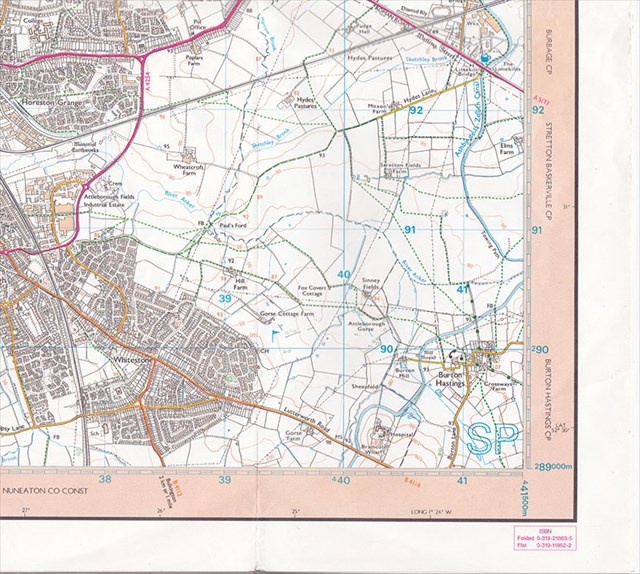 The grids on the map "finish" to the south east of Nuneaton at SP 41500 89000, so giving a possible twenty two (89 to (1)10) northing squares and twenty four (17 to 41) easting squares. Plus an extra 72 squares in the NE inset. That's 600 squares in total in which you can find a cache. To qualify you only need to find one in 232 different squares, which in turn equates to 38% of the possible squares available.
It can be time consuming trying to determine which of 600 squares of an OS map a cache qualifies for, although of course the British Grid reference is given at the top of each cache page just below the main co-ordinates shown in bold, as circled in red below.
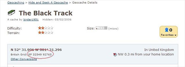
For the purposes of this challenge the published co-ordinates of all caches, including Unknown/Mystery and Multi caches are those that are to be used when determining which square a cache counts towards
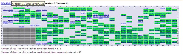
To help those of you that want to plan your finds a GSAK Macro has been written which produces a web page of your finds, example output shown below.
When you have found the 232 caches you need to provide proof of that fact to be eligible to claim a find on the cache; this can be via one of any number of different methods you may have available:
List the 232 cache codes and names and corresponding grid references in your found log
Create a public bookmark list
Create a Spreadsheet grid of your finds and attach an image of it to your log
Attach the generated GSAK Macro image to your log
Any finds without proof of qualification will of course be deleted! Have fun!
There are small certificates for First and Second to find
First to Find :- Baddesley Bodgers
Second to find :- Legochugglers
Many thanks to PetersfieldPoodlePosse for allowing me to use the Explorer Challenge concept and writing the GSAK macro.