
 [DEUTSCH]
Wanderung durch das Langental zu den Cirspitzen
Alpine Rundwanderung über das Hochland von Crespeina im Naturpark Puez-Geisler.
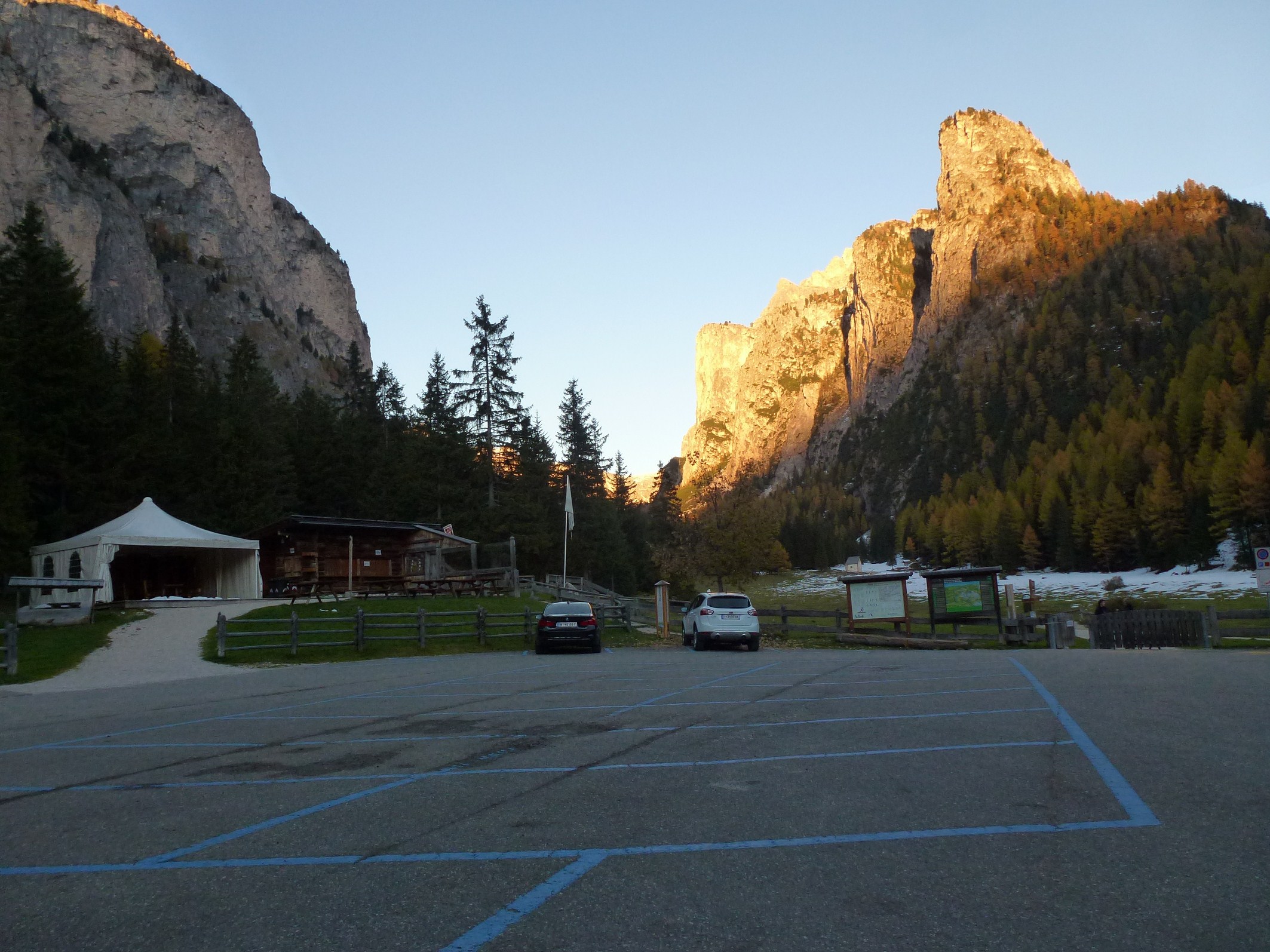
Der Parkplatz (gebührenpflichtig) am Eingang des Langentals bei Wolkenstein ist Augangspunkt dieser Alpintour. Der erste Abschnitt verläuft durch das wunderschöne Langental auf einem angenehmen Spazier- und Wanderweg mit Ausblick auf die Stevia und die Wände des Puezmassivs zur linken sowie auf die Chedul-Berge und den Col Turond auf der rechten Talseite. Am Talschluss beginnt dann der beschwerliche Aufstieg auf einem schmalen Pfad, der sich über Serpentinen hinauf auf die 600 m höher gelegene Ciampatsch-Scharte schlängelt.
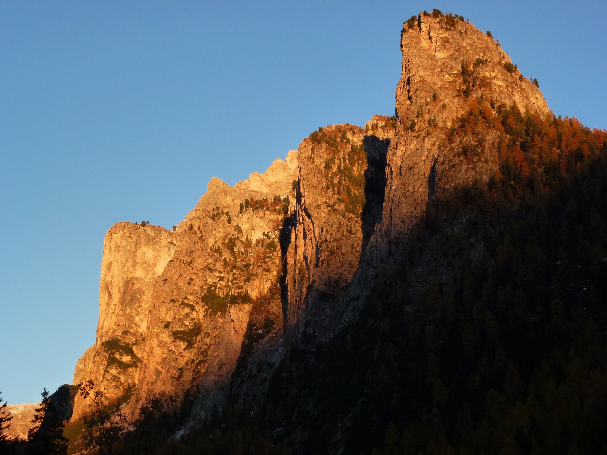
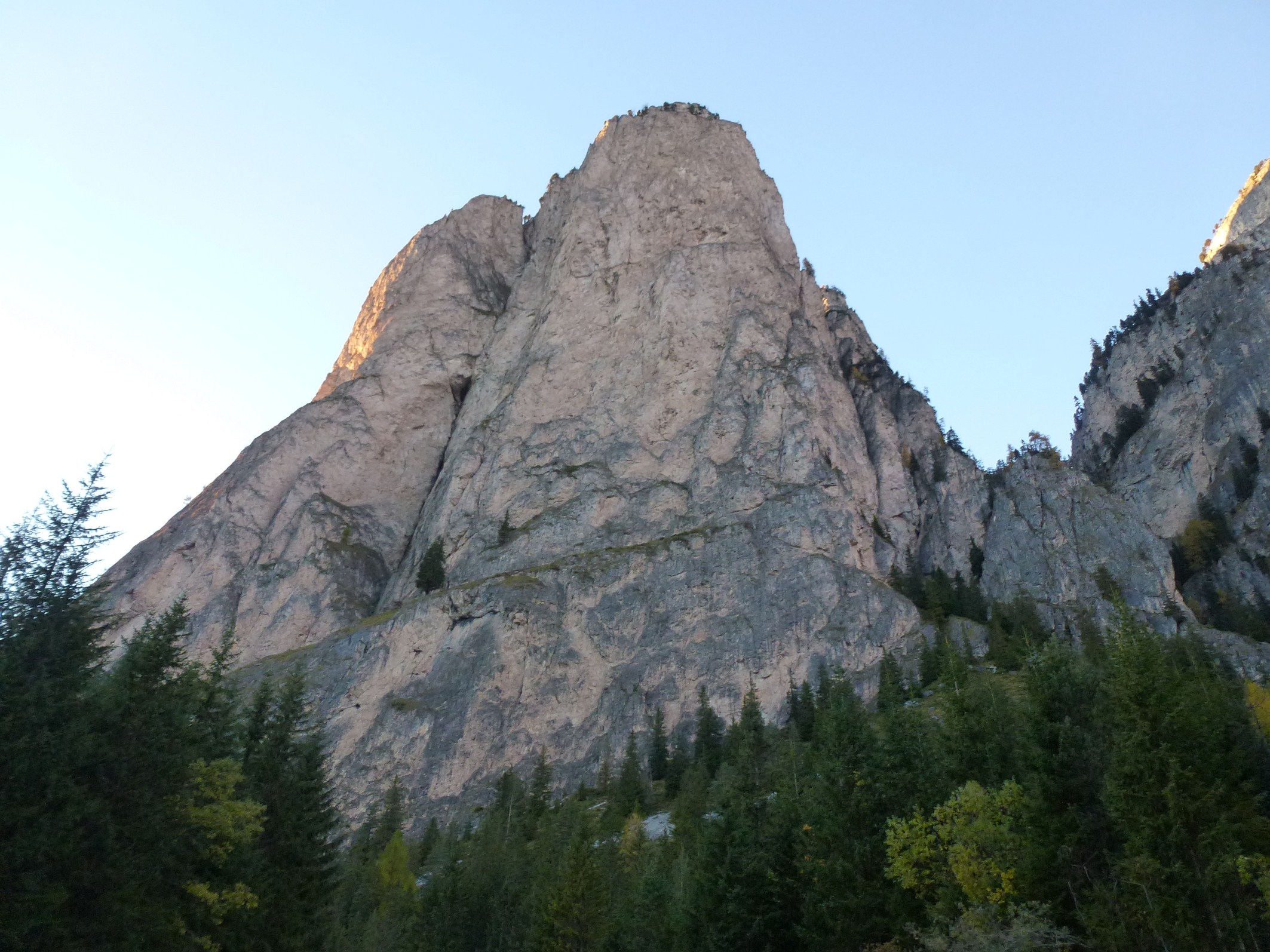
Oben angekommen, haben wir den härtesten Teil der Tour hinter uns und bereits mehr als die Hälfte des Weges zurückgelegt. Jetzt geht es über das Hochland von Crespeina in Richtung Crespeinajoch (Weg Nr. 2). Dabei kommen wir am wunderschönen Crespeinasee vorbei, dann geht es nochmals ein bisschen aufwärts bis zum Kreuz am Joch. Von dort oben genießen wir den Blick auf die Cierspitzen und auf den Mont de Seura, dazwischen im kargen Gestein hält sich das hell begrünte Chedultal. Ein majestätischer Anblick. Wir gehen den Pfad unterhalb des Cir weiter zum Cirsattel, von dort aus erblicken wir die Cirspitzen - Türme aus Dolomitgestein, die wie Fabelwesen in die Höhe ragen. Durch diese märchenhafte Landschaft wandern wir zum Grödner Joch hinunter, genauer zur Jimmyhütte, und von dort ein Stück hinauf zur Berstation der Dantercepies-Kabinenbahn. Mit dieser geht es nach Wolkenstein hinunter, die letzten Meter bis zum Parkplatz am Eingang des Langentals legen wir zu Fuß zurück.
Die besonderen Eindrücke der hochalpinen Gebirgslandschaft der Puez-Geisler-Gruppe haben uns überwältigt und der doch anstrengende Weg hat uns auch ein bisschen müde, aber zufrieden gemacht. Für alle, die diese Tour gehen wollen: Auf dem hier beschriebenen Weg gibt es bis am Ende des Weges keine Einkehrmöglichkeiten, daher ist die Mitnahme von Proviant und Getränken im Rucksack wärmstens empfohlen!
 [ITALIANO]
Escursione attraverso la Vallunga al gruppo del Cir
Escursione alpine per l’altipiano di Crespeina nel Parco Naturale Puez-Odle.
Il parcheggio (a pagamento) all’ingresso nella Vallunga nei pressi di Selva Gardena è il punto di partenza per questa escursione alpina. Il primo tratto si sviluppa lungo la stupenda Vallelunga, su una passeggiata piacevole con vista panoramica sui gruppi montuosi Stevia e le ripidi pareti del massiccio del Puez a sinistra, mentre a destra s’innalzano il Col Turond e le montagne della Val de Chedul. Verso il fondovalle inizia infine la faticosa salita per un piccolo sentiero che si sviluppa in serpentine fino al giogo Ciampac (dislivello 600 metri).
Arrivati in cima abbiamo già il tratto più difficile dietro di noi come anche giá oltre la metà del nostro cammino. Ora il sentiero prosegue per l’altipiano di Crespeina (sentiero n° 2). Passiamo per lo stupendo lago di Crespeina fino alla croce sul Passo Crespeina. Da qui, davanti a noi si apre una magnifica vista panoramica sul gruppo del Cir, sul Mont de Seura e sulla Val de Chedul. Un panorama veramente da mozzafiato. Seguiamo poi il sentiero ora il sentiero fino al Passo Cir, da dove possiamo ammirare le imponenti cime del gruppo del Cir. Attraverso questo fiabesco paesaggio ci avviciniamo infine al Passo Gardena, ovvero al Rif. Jimmy. Proseguiamo per un piccolo sentiero fino ad arrivare alla stazione a monte della cabinovia Danterecepies, con la quale scendiamo a valle. Giunti a Selva ci avviamo infine per gli ultimi metri fino al parcheggio dove abbiamo lasciato la nostra macchina.
Le favolose impressioni che ci hanno accompagnato in questa escursione alpina attraverso il Parco Naturale Puez-Odle ci hanno sopraffatti ed il sentiero in parte difficile ci ha esausti. Per tutti coloro che vogliono intraprendere questa escursione: lungo il sentiero qui descritto non ci sono possibilità di ristoro. Consigliamo quindi di portare con se provviste.
 [ENGLISH]
Hiking across the Vallunga to the Cir mountains
Alpine walk across the Crespeina high-plateau in the Puez-Odle nature park.
The parking space (subject to charge) at the entrance of the Vallunga in Selva Gardena is starting point for our alpine tour. The first section takes us across the fantastic Vallunga, on a pleasant hiking trail with a great view on the Stevia rock face and the Puez mountains on the left as well as the Chedul mountains the Col Turon on the right side of the valley. At the head of the valley, a narrow and exhausting trail takes us up to the Forcella de Ciampac, located 600 m higher than we are now.
Once reached this ridge we have overcome the hardest part of the tour and more than half of the way. Now we continue across the highland of Crespeina and walk towards the Forcella Crespeina on the trail n°2. We walk by the fantastic Crespeina lake, then again the way up to the cross at the highest point. Here we enjoy an overwhelming view on the Cir pinnacles and the Mont de Seura, in the middle the light green Chedul valley stretches. A breathtaking scenery. On the trail underneath the Cir saddle we continue our walk, from here we can see the Cir mountains, which are pinnacles of Dolomite stone rising into the sky like fabulous creatures. Across this legendary landscape we walk towards the Passo Gardena, strictly speaking to the Rif. Jimmy. From this mountain hut we walk up to the Dantercepies funicular, which takes us down to Selva Gardena. From the lower terminus, we walk the last metres to the entrance of the Vallunga, our starting point.
The impressions in the high-alpine mountain landscape of the Puez-Odle mountain range were amazing in this tour, even if it is quite exhausting. For all those who would like to do this tour: on the above mentioned course, there are no mountain huts or possibilities to stop until, so we highly recommend you to take beverages and food with you in your rucksack.