Great Almscliff Crag EarthCache
-
Difficulty:
-

-
Terrain:
-

Size:  (other)
Please note Use of geocaching.com services is subject to the terms and conditions
in our disclaimer.
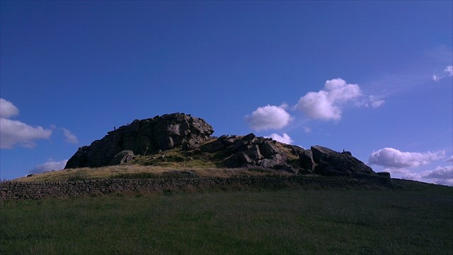
Great Almscliff Crag is one of the largest Gritstone Tors in the Pennines and is a site of national importance for geomorphological studies of tor formation, rock weathering and landscape development. Aside from being important for science, it is a place of great natural beauty that can be seen from miles around and affords superb 360 degree panoramic views of the surrounding countryside. It's also great fun to visit and clamber on the rocks!
The view of the Tor as you approach from the footpath below
A Site of National Importance
The resilient sandstones of the Kinderscout Grit Group to the South of the Wharfe Valley can be seen in many locations, of which one of the most famous is the Cow and Calf formation near Ilkley where you can find another EarthCache. The Northern ridge, which is formed of Almscliff Grit, has very few natural exposures, other than here at Great Almscliff Crag.
It is believed that this particular tor is so prominent and exposed is that the sandstone here is especially thick. Elsewhere the layer is approximately 65 metres deep but here it is nearly 50% thicker at 100 metres deep.
The second reason this tor is of national importance is because it would have been located within the limit of the ice sheet during the last ice age (Devensian) up to 10,000 years ago. Because of this, it will have been modified by the ice sheet unlike many other gritstone tors.
To log this cache, please send me the answers to the following questions:
1) According to the noticeboard located at the co-ordinates for this cache, there are two theories for how Great Almscliff Crag formed. Please describe them in your answer.
2) Go to the cache co-ordinates at N 53 56.179 W 01 35.581 and look to the South West. You can see across the Wharfe river valley floor to a ridge which is Pool Bank and Otley Chevin. Can you explain why landscape looks like it does by referring to the underlying geology.
3) Although not compulsory, we would love to see a picture of you/your GPS at this location with the view behind you.
Panoramic views from the crag

Safety
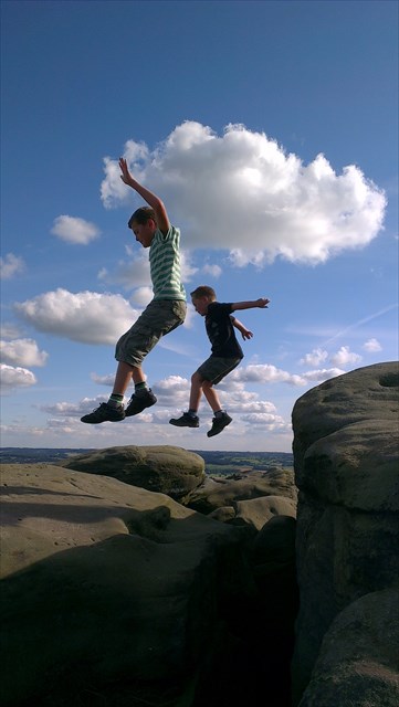
This is a great place to take the mini cachers: my youngest (8 years old at the time) and his friend had a fantastic time here. But there are very big cliffs to fall from and plenty of fissures to fall into so please take care and supervise carefully. Needless to say, you are solely responsible for your own safety and that of the members of your party.
Site of Special Scientific Interest
This location is a site of Special Scientific Interest (SSSI) and is protected by legislation. It is against the law to damage the rocks at this site. There is a major problem with graffiti here: please don't add to it. Many thanks to Natural England for granting consent to locate this Earthcache here under Section 28 of the Wildlife and Countryside Act 1981.
Access
The current landowner appears to permit access to the crag but please note that there is no public right of access away from the public footpath. Should permission to access the crag be removed, and for those who don't like heights, it is possible to answer the questions by keeping to the public footpath that runs beside the crag.
Have fun but take care!
Additional Hints
(No hints available.)