Earthcaches DO NOT have containers. In order to log this cache, you must answer the questions on this page correctly by visiting GZ. DO NOT post the answers in your log (send them in a email).
In order to claim this EarthCache, I will need a few questions answered. The questions must be answered and messaged to me. A photo is optional based on EarthCache Guidelines.
I have Described 10 different rocks that are up on Campbells Ledge. #1 Describe 3 of the ten Rocks that are on top of Campbell's ledge. #2 In what order are the layers of rock that make Campbell's Ledge from top to bottom. If you find a fossil that is a bonus,they are everywhere.
When Conrad Weiser, a celebrated Indian interpreter, visited Wyoming in 1754, he found an Indian village called "Asserughney," on the banks of the Susquehanna between the mouth of the Lackawanna river and Campbell's ledge, near the site of the depot of the Lehigh Valley railroad. It was a small village, hunting and fishing being the main sources of support. The summit of Campbell's ledge, towering above, afforded an uninterrupted lookout over the valley below, and was used by the Indians not only in watching over their wigwams, nestled along the river, but as a place to kindle their beacon or signal fires. This castle or encampment was the upper one of the Delawares in the Wyoming valley. It was a point of importance because of its favorable location for trading purposes. The great war path from the inland lakes of New York to Wyoming and the south, and the trail down the Lackawanna from the Minisink homes on the Delaware, passed through it.
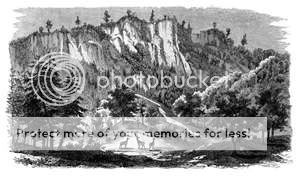
The far-famed Campbell's ledge is situated on the west border of the township, where the Susquehanna seems to have broken through the mountain barrier, forming a wide gorge. The ledge was formerly called Dial rock, from the fact of its presenting a nearly perpendicular face of considerable length, lying directly north and south, and being first illuminated when the sun reaches the meridian. The Indians and the white people of the upper end of the valley thus had a timepiece more serviceable than many town clocks. It is a historic spot in the way of a natural curiosity. The mountain here is 2,800 feet high and from it is one of the finest views of the valley and its towns and boroughs. The ledge is only 2,000 feet high. It also features a multipurpose antenna for emergency services. If looked closely at (especially in winter) you could see the face of the cliff makes a '2'.
There are a couple of abandoned mine shafts. They are since filled in partially and fenced in for safety reasons. There is a small lake at the top called the Campbell's Ledge Reservoir which has a very high Largemouth Bass, Perch and Bluegill population. Currently, it is not permitted to fish the reservoir. The wooded area surrounding Campbell's ledge consists of many ATV and hiking trails. Traveling along these trails, many beautiful natural structures can be found, including waterfalls, quartz caves, and streams. The area surrounding Campbell's ledge is teeming with wildlife. Inhabiting the area are white tailed deer, foxes, coyote, turkey, bear, ducks, geese, cranes, rabbits, hawks and a few species of snakes, among others This name was adopted for the ledge in compliment to Campbell's "Gertrude of Wyoming." Of course, like every other perpendicular ledge in America, that is finished off with a curdling legend of the "maiden's leap," or the "lover's leap," or something of that kind, always where the villain still pursued her." This, too, has been applied to the poet Campbell's namesake, and into its legend the story teller had a man named Campbell hemmed in by the legion of savages, and when fairly at bay on the edge of the precipice and the savages were upon him, jumped over, horse and all, rather than be slowly roasted by the painted cannibals.
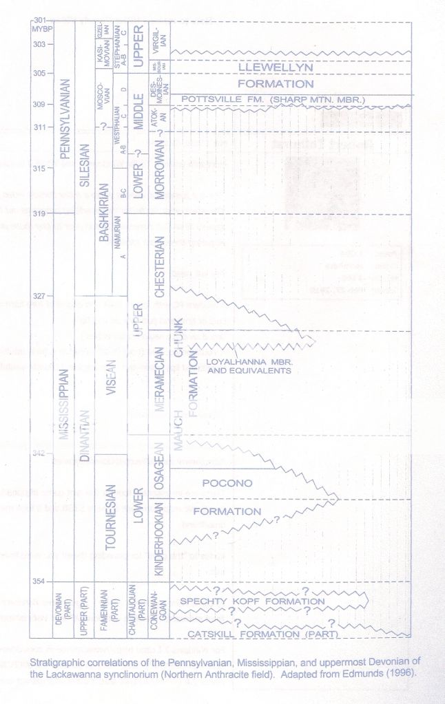
Ok,so much for the History Lesson.Lets talk about the Geology at Campbell's Ledge.Below is a Stratigraphical relations of the layers of rock ,and also of Mauch Chuck and Pocono Rocks at that Locality.
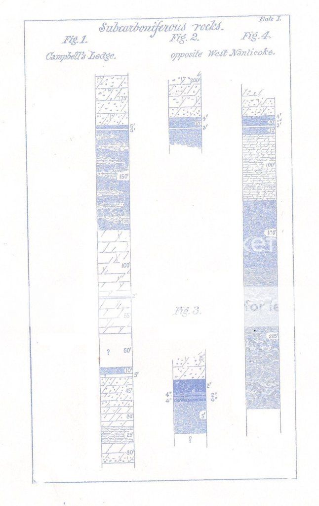
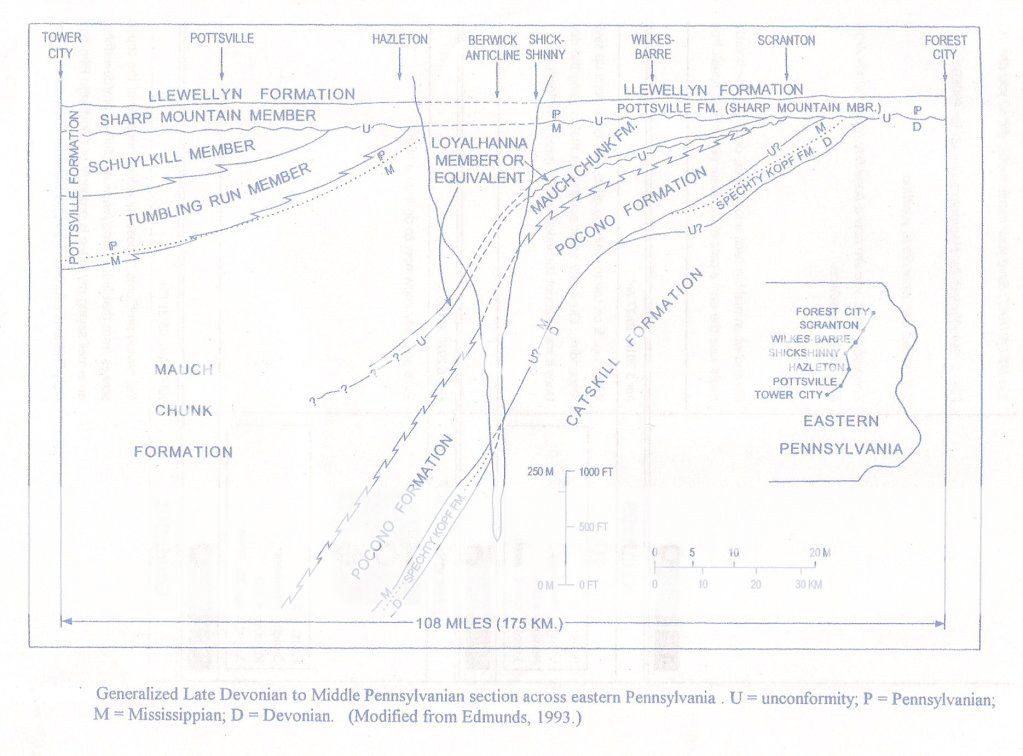
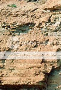
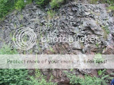
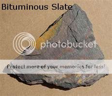
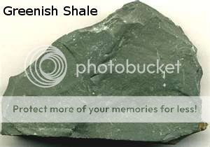
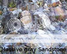
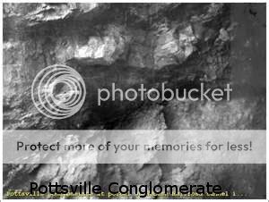
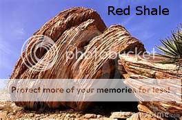
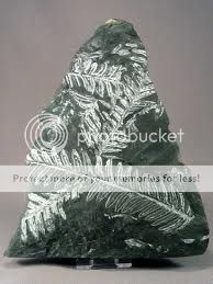
There are a total of 10 Different rocks at campbell's Ledge,But only a few stand out on top of the ledge. #1 Massive sandstone,gray,with large quartz pebbles #2 Sandstone Shaly #3 Gray sandstone,Few pebbles #4 Massive,Coarse,Greyish-white conglomerate #5 Red Shale,sandy,Visible #6 Greenish Shale #7 Massive ,Very Pebbly,Basal member of pottsville Conglomerate #8 Bituminous Slate,Fossiliferous (Plants and Insects) #9 Sandstone,Gray,Very Hard #10 Mauch Chunk Shale-Flaggy sandstone,and greenish sandy shales in which not a trace of RED could be Found.All of the rocks that are listed make the Layers of campbell's Ledge,from the top to the bottom and underground.

Campbell's Ledge Has yielded a large number of Organic Remains,principally plants.The Species Mentioned were Collected from a single locality where seemingly not more then two or three cubic yards of the Black Slate have been excaveated.The Identifications on a few are Alethopteris Serlii,Pecopteris longifolia,Ledidophyllum Campbellianum, Ledidophyllum lanceolatum, Ledidophyllum Gracile, Lepidocystis Fraxiniformis.There is a total of 63 Species of Plant Remains and 6 Species of Fossil Insects in the same bed,belonging to the genera Miamia,haplophlebium,Euphemerites are described from this bed.
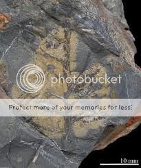
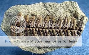
The Insects were found in the upper portion of the plant layers,the extreme upper and lower portions of the bed being quite barren;the former,coarse,sandy;the latter,fine,soft,clayey.The dividing line between Carboniferous and sub-carconiferous,a very hard grayish-white sandstone,containing no pebbles,but totally different in its lithological character from anything else in the mauch chuck beds at this locality.The following Succession observed on the south side of the river,opposite west nanticoke in luzerne county,would seem to bear the same Signification.
Now There is parking Coord's to park your car/truck if you wanted to hike up, or if the gate is locked.Also if you plan on driving up well the road is very rocky and its not that bad in the begining but as you get closer you will need 4 wheel drive or something with good clearance to get over the rocks.so you dont damage the bottom of your vehicle.
I like to Thank the Pa Department of Conservation Natural resources Bureau of Topographic and Geological Survey for helping me gather Information.