You will be required to wear sturdy solid hiking boots.
Wear gloves for protection and to grip and grab as you ascend and for 4wd traction as you descend
Bring water and snacks; round trip time with looking around will be about 2 hours or more
You will not have cell coverage
You must be physically fit to make this
You will at times be near some areas that if you fall, you will get hurt. That said, common sense should prevent this.
Do not bring young kids.
Study my other cache before going.
http://www.geocaching.com/seek/cache_details.aspx?guid=27b0298c-3b1f-4ce8-ac2e-fbc12d2610d2
This is the route start which will you take. This is the lower tram station and is where the mine ore was unloaded.
Take a look at the relics, then glance across the stream from the old diesel engine. Notice the trail going up the short hill across the stream?
Take it by hopping across the stream rocks. Get ready for some moderate cardio as you climb the hill in lieu of the massive log bridge sligtly upstream - one which has long since rotted and fallen. Continue up the puncheon road (rough split timbers) that are arranged horizontally across the wide trail.

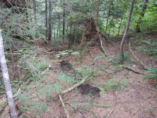
Moderate hike up a modest grade. Notice the 1" fallen tram cable that alternates on either side of the trail, as well as the 107 yr old wood stave water pipe (made from pieces of wood banded together to form a pipe) Below:
You will soon come to the mid tram station off to the right; it appears as a mound of mineralized dirt / mine waste rock out of which grows some 30 yr old trees. Notice the wood support with the Y bracket near the trail right beside this mound The construction of this entire mechanism is very similar to a ski lift. This is the middle of the tram line, and was used for support and has long since collapsed. Take a rest here because the hike gets much more physical from here on!
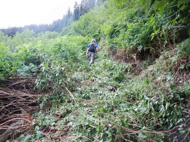
Now you will follow the trail once more...slightly to the right. Easy to follow, not easy to climb. It immediately changes & gets brushy and much more varied as to the terrain. You will automatically be heading steeply up & parallel to / on the right side of the huge valley of which the main mine and upper tram station is high up on the right side of the valley.
You will encounter freshly hacked brush with rocks underfoot (cleared thanks to the mine claim owner! If this was all brushy the going would be extremely tough).
Below:
Soon you will run into just a few challenges such as steps up, etc. This section is your toughest area, by far. Be very careful and take your time. No pictures of this area as I was concentrating on the task at hand.
Soon you will emerge to the left at an area of collapsed timbers and buildings! This was the upper tram station.
Below:
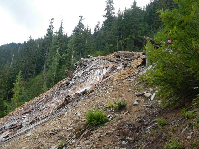
Walk through the debris, notice the old tram wheel and cabling, the oil drum, all the items that nature has slowly destroyed by 8 ft of snow each year.
Continue up to the landing where buildings once stood and continue past a large selection of ancient rusty tools laid out by responsible mine explorers.
Below:
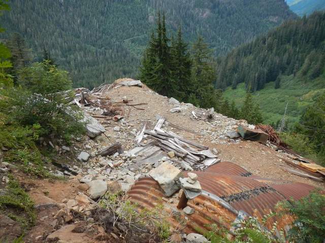
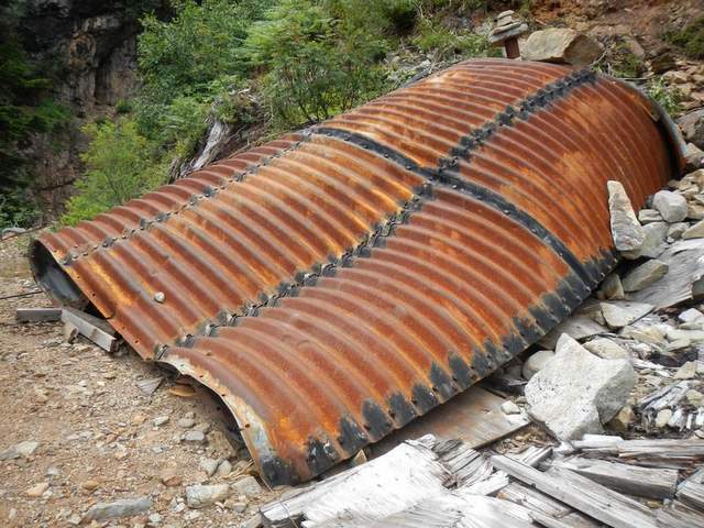
PLEASE DO NOT MOVE THESE ITEMS ! Not many make it up this way, and those that do never leave garbage, graffitti or any trace they have been there. Please do the same. Continue on the path that takes you past a monstrous large culvert. Inside there is a wood shelving unit, a bed frame, a packrat nest and a stove made from a barrel. This is not a mine shaft.
Below:
Continue on and you will see wha tthe miners were after...a huge steep valley appears and the dropoff is treacherous but the walk is easy. Be careful, and do not take this area lightly after your tough climb. Notice the identical crushed culvert. The is a mine tunnel, a right angled snub tunnel circa 1980 that was an aborted attempt to intersect a nice vein that has since collapsed and is under logs and rock across the outfall from the waterfall above. THIS IS WHERE THE GEOCACHE IS. Look up to the right of the upper portion of the culvert. You are looking ofr a large ammo can. Misc trinkets and log book/pencil
**FIRST TO FIND - a 1 ounce silver coin**
Enter the tunnel for a relatively safe feeling of what it is like to be a miner. It is only 35 ft long and the mners quit before reaching to collapsed tunnel. You are now standing under the waterfall ! Cross the waterfall and notice the huge dropoff. Look up above and see what can come down and what has landed on the 1/4" thick colvert and what has the crushing force to destroy. It is amazing the power of nature!
Enjoy! Going down I crabbed some portions (hence the use of gloves) Be careful.......and have fun!