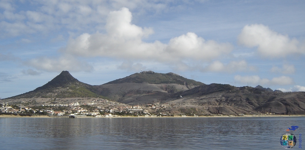
O topo do Pico do Facho é o ponto mais alto do Porto Santo, a 516 metros de altitude. Segundo a história, quando eram avistados piratas acendiam-se fogueiras para avisar a população e se a visibilidade permitisse, eram visíveis na ilha da Madeira, que recebia a informação com algumas horas de antecedência para se preparar.
Em redor dos afloramentos rochosos do topo existe uma floresta plantada com espécies exóticas, entre os anos 55 e 70 do século passado. As espécies dominantes são do género pinus e cupressus.
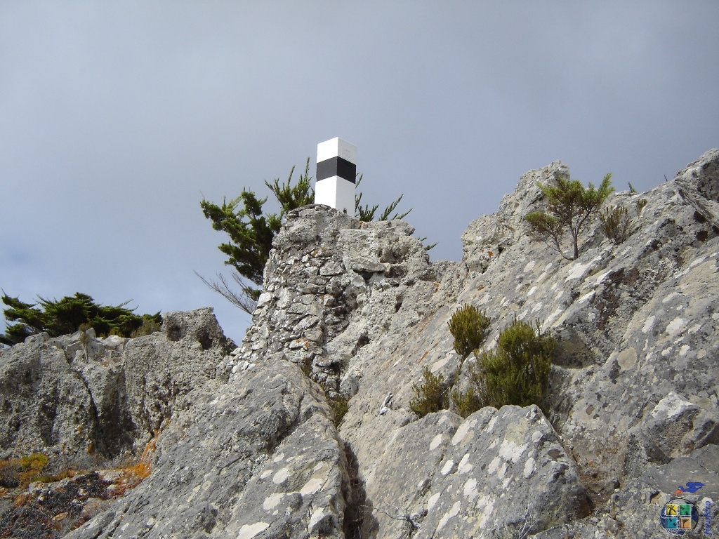
Nesta elevação com forma alongada, e próximo do topo, está implantada uma estação de radar de auxílio à navegação aérea, na aproximação das aeronaves à Madeira e Porto Santo.
A cache: Estacione, siga pelo caminho de terra ou montanha a cima até encontrar o início da vereda de acesso à cache (Reference point 2). Antes de qualquer escalada, deixe o GPS estabilizar e procure no início das rochas o container. Se pretender ir perto do topo, o melhor acesso é seguir a partir da cache, subindo em pequenos patamares na rocha natural – terreno 5! Avalie o desafio e as suas capacidades para subir e voltar. Tenha em conta as condições climatéricas e leve companhia quando for para a montanha!
Atenção: mesmo que o seu GPS indique para outro local, esta cache está num local seguro e acessível – Observe o spoiler.
Por favor não publique imagens da cache nem do local onde está escondida. Seja um geocacher prevenido, leve algo para escrever!
The top of the peak of the Torch is the highest point of Porto Santo, at 516 meters altitude. According to history, when pirates were sighted, bonfires were lit to warn the population and when visibility allowed, were visible on the island of Madeira, who received the information with few hours in advance to prepare.
Around the rocky outcrops of the top there is a forest planted between 55 and 70 years of the last century, with exotic species, especially pine and cupressus.
At this elevation with elongated shape, and near the top is installed a radar station, to aid the air navigation, aircraft on approach Madeira and Porto Santo.
The cache: Park, take the unpaved road or go up by the mountain to find the beginning of the path cache access (Reference point 2). Before any climbing, let the GPS stabilize and look at the beginning of the rocks the container. If you want to go near the top, the best access is to follow from the cache, climbing the natural rock in small levels - Terrain 5! Evaluate the challenge and your skills to climb and return. Keep in mind the weather, and bring company when you go to the mountain!
Attention: even if your GPS to indicate another location, this cache is in a safe and accessible place - Observe the spoiler.
Please do not post pictures of the cache, or the place where it is hidden! Be forewarned geocacher, take something to write!
 FTF...
 STF ...
 TTF ...