 [DEUTSCH]
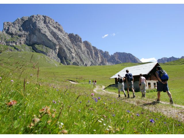
Leichte und gefahrlose Almwanderung auf Steigen und Wirtschaftswegen am Fuße der Geislerspitzen und der Seceda; auch für Kinder und Senioren geeignet. Die Blumenpracht dieser Alm ist Sprichwörtlich.
Wegverlauf
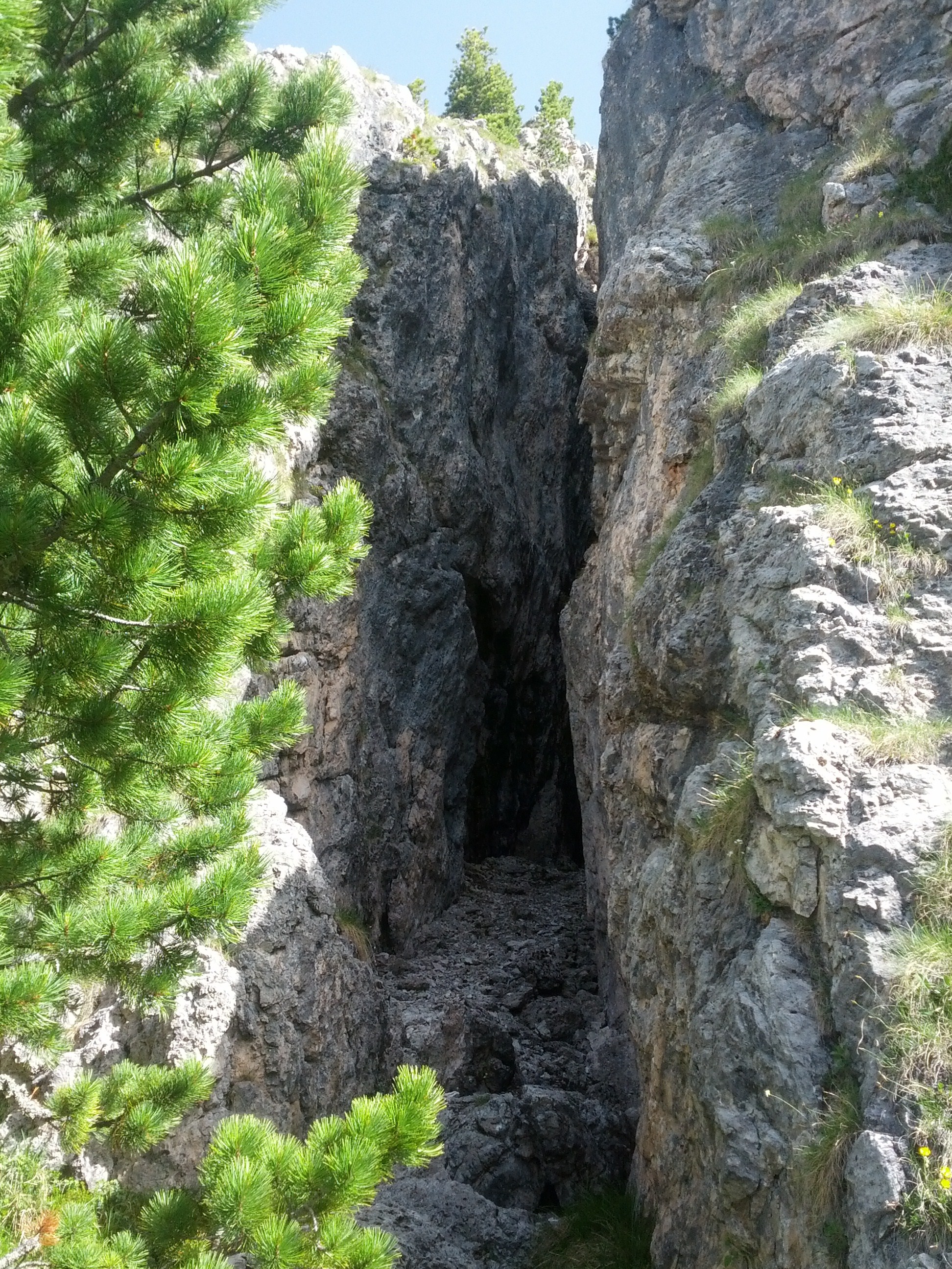
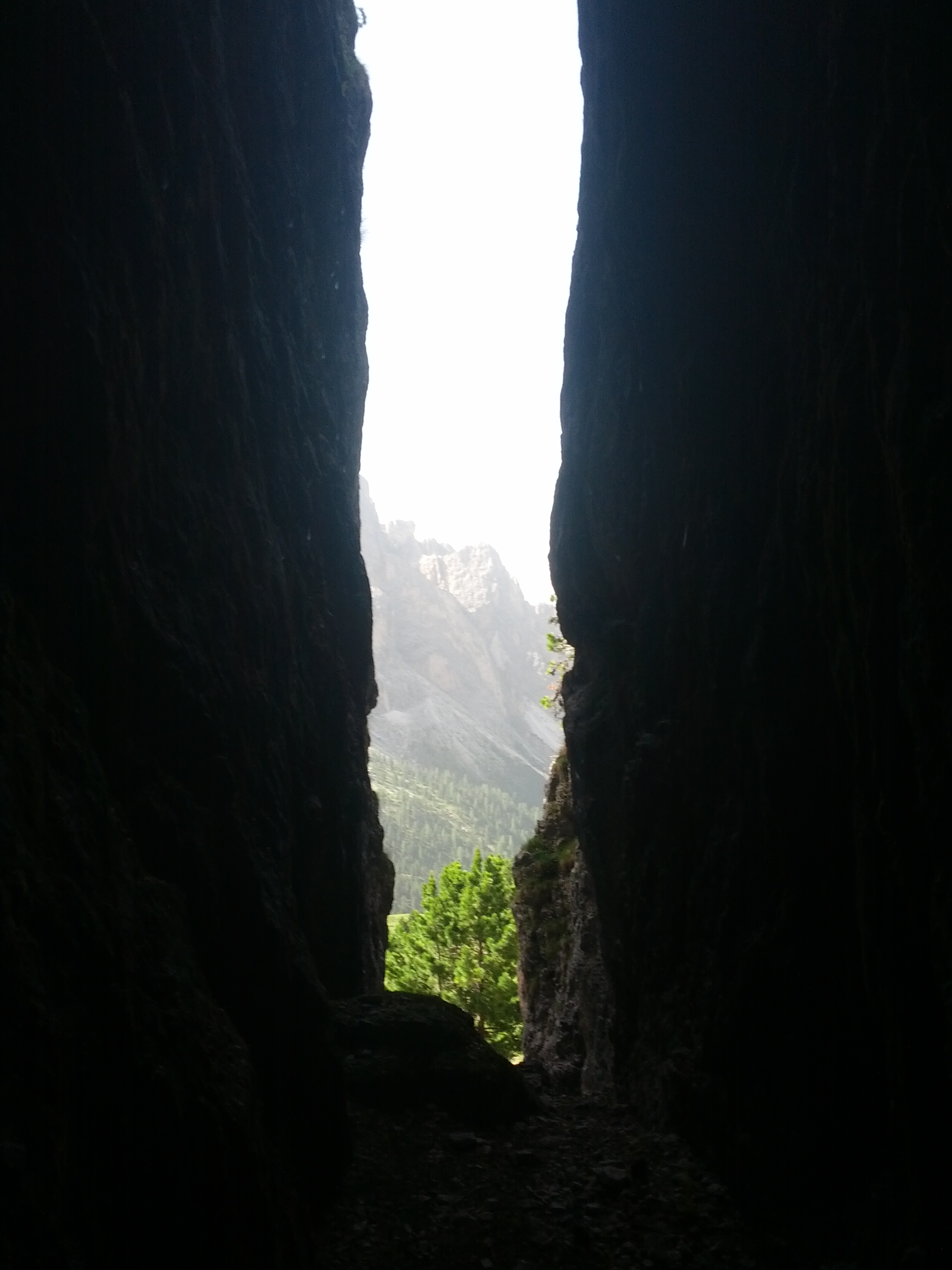
Von der Bergstation führt ein idyllisches „Steiglein“ in 20 Minuten zur nordöstlich gelegenen, nach wenigen Minuten sichtbaren, Regensburger Hütte (2037m). Dort geht es, das Nebengebäude mit Sonnenuhr zur Rechten, auf den Steig 13 am Brunnen vorbei, hoch. Über die prächtige Landschaft am Fuße der Geislerspitzen aufsteigend, erreicht man, direkt am Sockel des Sass Rigais, den Weideabsatz Plan Ciautier. Dieser Weideboden ist eine echte Wanderweg-Drehscheibe, davon zeugen die zahlreichen Wegschilder, die dort aufgestellt sind. Zu lesen: Anstiegswege auf den Sass Rigais, die Furchetta, zur Wasserscharte etc. Vom unteren Wegweiser nun schräg links aufwärts zum zweiten. Dort dem Steig 2B nach und über das buckelige, von einigen harmlosen Felsvorsprüngen gezeichnete Gelände am Fuße des As da Mesdi Turmes westlich weiter bis zur Abzweigung unter dem Großen Fermedaturm. Dort verlässt man den Steig 2B nach links und nimmt jenen zum Col Raiser auf. Er führt nun weiter in Richtung auf den charakteristischen, frei aufragenden und stark überhängenden Felszacken der Piera Longia zu, der sich am Ende der Eiszeit von den Geislerspitzen gelöst hat und herabgestürzt ist. An seinem Fuße stoßen wir auf einen abfallenden Almweg, der prächtigste Bergblumenhänge quert. Weiter hinab gelangt man wenig später zu einer wichtigen Steigkreuzung mit Wegweiser. Man geht indes vom Kreuzungspunkt weg in nordwestlicher Richtung auf dem Weg mit Mark 1 bis zur Einkehrstätte Troier Alm (1/4 Std). Aufwärts wandernd kommt man an einem lieblichen Almteich vorbei, der ein hübsches Fotomotiv abgibt. Von der Troier Alm weg verfolgt man nun einen Wirtschaftsweg, der südwestlich durch eine Wiesenmulde zu der einige Minuten tiefer liegenden Hütte Daniel abfällt. Um die Fermedahütte, das nächste Ziel zu erreichen, steigt man auf dem Wirtschaftsweg 10 Minuten ab. Man erblickt sie erst spät, da sie in einer Mulde rechts des Weges liegt. Von dort auf schönem, fast ebenem Weg zum Col Raiser Lift zurück (3/4 Std).
| Startpunkt |
St.Christina - Bergstation Col Raiser |
| Dauer |
3:45 h |
| Höchstgelegener Punkt |
2300 m |
| Höhenunterschied |
200 m |
| Karte/Literatur |
Kompass - Wanderführer - Dolomiten-Gröden |
| Schwierigkeitsgrad |
leicht |
 [ITALIANO]
Escursione nel parco naturale, un giardino fra le rocce.
Dalla stazione a monte un idillico sentierino (segnavia n. 4) conduce in 20 min. al Rifugio Firenze in Cisles, 2037 m, che appare a nord-ovest dopo pochi minuti. Da lì, lasciando sulla destra l'edificio con la meridiana, si sale lungo il sentiero con segnavia n. 13 (tabella Sass Rigais/Rif. Genova ) passando accanto all'abbeveratoio. Percorrendo in salita lo splendido paesaggio alle pendici delle Odle, raggiungiamo l'erboso terrazzo del Plan Ciautier, 2263 m, proprio alla base del Sass Rigais, 45 min. (punto di svolta orientale). Questo verde terrazzo segnato da frane di disgregazione, è un punto per le escursioni, come si vede dalle numerose tabelle qui colorate: sentieri per la scalata al Sass Rigais, Furchetta, Forcella dall`Ega, Rif. Puez ecc. Dalla tabella segnavia 2B (stazione a monte della funivia dell Seceda) lungo le ondulazioni del terreno segnato da qualche innocuo spuntone di roccia ai piedi della torre del Sas da Mesdì, proseguendo verso ovest fino al bivio sotto la torre della Grande Fermeda (tabella segnavia).
Lì si abbandona il sentiero 2B prendendo a sinistra quello per il Col Raiser. Questo conduce ora verso la Piera longia, caratteristico spuntone di roccia staccatosi dalle Odle e precipitato qui alla fine dell'era glaciale, che svetta isolata formando un forte strapiombo. Giunti alle sue pendici ci imbattiamo in un sentiero d'alpeggio che scende tagliando a mezza costa splendidi declivi fioriti. Più in basso, dopo poco giungiamo ad un importante crocevia di sentieri con tabelle segnavia. Qui c'è la possibilità di terminare il giro prima del previsto: a) lungo il sentiero con segnavia n.1, oltrepassando il dorso dell’Alpe a sud –est fino al Rif. Firenze, non visibile da qui, 30 min.; b) lungo il sentiero 2B in discesa fino alla cabinovia del Col Raiser, già visibile, 25 min.
Per chi invece desiderasse prolungare il giro, dal crocevia si prosegue in direzione nord-ovest sul sentiero con segnavia n. 1 fino al posto di ristoro Malga Troier, 2271 m; 15 min. Procedendo in salita si arriva ad un ameno specchio d’acqua (Lech da Iman), da cui si può trarre un bel motivo fotografico. Dalla Malga Troier percorriamo una carrareccia di servizio in direzione sud-ovest che, attraverso una conca prativa, dopo alcuni minuti ci conduce in discesa alla Baita Daniel. Per raggiungere il Rif. Fermeda, la nostra prossima meta, scendiamo per 10 min. lungo la carrareccia. Il rifugio si scorge solo tardi, poiché sorge in una conca a destra del sentiero. Da lì so torna alla cabinovia del Col Raiser su un bel sentiero quasi in piano (45 min.).
| Punto di partenza |
Col Raiser - Stazione a monte |
| Tempo impiegato |
3:45 h |
| Altezza massima |
2300 m |
| Dislivello |
200 m |
| Cartina/guida |
Kompass - Dolomiti Val Gardena (nr989) |
| Grado di difficoltà |
facile |
 [ENGLISH]
Easy and safe alpine walk along steep tracks and rural roads at the foot of the Gruppo delle Odle/Geislerspitzen and the Seceda; also suitable for children and senior citizens. These meadows are famous for their rich profusion of flowers.
Route
From the mountain station, an idyllic steep climb leads to the rifugio Firenze/Regensburger hut (2037m) 20 minutes to the northeast, which you’ll see after just a few minutes. With the annex with the sundial on your right, take trail no. 13 up past the fountain. Ascending through the magnificent landscape at the foot of the Gruppo delle Odle, you’ll come to the foot of Sass Rigais, the Plan Ciautier pasture. This pasture is the point where many paths meet, as demonstrated by the numerous signposts pointing to paths to the Sass Rigais, the Furchetta, to the Furcia Mont da l’Ega/Wasserscharte, etc.
From the lower signpost, now head diagonally left up to the second. There, take trail no. 2B across the hilly terrain featuring rocky outcrops at the foot of the As da Mesdi tower, continuing westwards to the fork in the path below the large Fermeda tower. From there, turn left off trail no. 2B and follow the path to Col Raiser. This continues in the direction of the tall and overhanging crags of the Piera Longia, which broke away from the Gruppo delle Odle during the Ice Age and plunged to the ground. At the foot of the Piera Longia, join a sloping alpine path that crosses through splendid hillsides simply covered in beautiful flowers. Further down, you reach an important crossing with a signpost.
From here, head in a north-westerly direction along the trail marked no. 1 to the Troier Alm hut (1/4 hour). Walking along an incline, you will get to an attractive alpine pond, which presents a pretty photo opportunity. From the Troier Alm, follow a rural path that leads south-westward through a meadow situated in a hollow to the Daniel hut just a few minutes away. Continuing along the rural trail, it takes 10 minutes to get to the next destination, the Fermeda hut. You only see it at the last minute as it is situated in a hollow to the right of the path. From there, an attractive, almost even path leads back to the Col Raiser lift (3/4 hours).
| Starting point |
S. Cristina - Col Raiser mountain station |
| Duration |
3:45 h |
| Highest point |
2300 m |
| Difference in elevation |
200 m |
| Map/guide |
Compass - walking guide - Dolomiten-Gröden |
| Difficulty rating |
easy |