CJS - Janes Island State Park #2 Daugherty Creek Traditional Geocache
CJS - Janes Island State Park #2 Daugherty Creek
-
Difficulty:
-

-
Terrain:
-

Size:  (micro)
Please note Use of geocaching.com services is subject to the terms and conditions
in our disclaimer.


Come on a journey to remember and commemorate the history and travels of Captain John Smith! Over four hundred years ago, Englishman John Smith and a small crew set out in an open boat to explore the Chesapeake Bay. Between 1607 and 1609 Smith mapped and documented nearly 3,000 miles of the Bay and its rivers. Along the way he visited many thriving American Indians communities and gathered information about this “fruitful and delightsome land.” In December 2006 the U.S. Congress designated the routes of Smith’s explorations of the Chesapeake as a national historic trail—the first national water trail.
Are you ready to follow in the wake of Captain John Smith? Visit sites along the National Historic Trail and learn about the native cultures and the natural environment of the 17th-century Chesapeake through the Captain John Smith Chesapeake Geotrail. The Trail provides opportunities for you to experience the Bay through the routes and places associated with Smith’s explorations. Caches will be located in museums, refuges, parks, and towns in Virginia, Maryland and Delaware along the rivers and creeks that Smith and his crew explored four centuries ago.
The Captain John Smith (CJS) Geotrail launched June 4, 2011 with over 40 caches within Maryland, Virginia and Delaware. A trackable geo coin will be awarded to the first 400 geocachers, while supplies last, for locating at least 15 CJS caches. To be eligible for the coin, geocachers must download a passport from either the CJS Geotrail or Maryland Geocaching Society website. Geocachers must find and log at least 15 finds, record the code word from each cache on their passport and post a picture of themselve at each cache location. After discovering the 15 required caches, geocachers may have thier passports validated in person or via mail at the National Park Service, Chesapeake Bay Office located at 410 Severn Ave, Suite 314, Annapolis, MD 21403. Please refer to the passport for complete validation instructions.
Participating in the CJS geotrail is fun and we hope that many people join in. However, it is not a requirement for logging your find on this cache once you find the container.
You are seeking a traditional hide. YOU WILL NEED TO BRING YOUR OWN PEN. This cache was placed with approval from the Maryland Park Service. Please respect all park rules and no night caching!

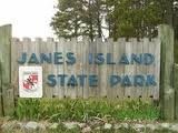
Janes Island State Park encompasses 2,900 acres of salt marsh, 30 miles of water trails, and miles of pristine beaches in close proximity to Crisfield in the Lower Shore region of Maryland as well as the Tangier Sound. Janes Island State Park sits on a long canal, opposite a large island cut by multiple tidal creeks. The park features many amenities, including campgrounds, rental cabins, a conference center, picnic areas and pavilions, and a boat ramp and marina. To reach Janes Island, one must rent a boat, canoe, or kayak from the park or nearby boat rental facility. The island is virtually wild and evokes a similar experience to one Captain John Smith might have encountered as he explored the Chesapeake Bay and its tributaries.
The original inhabitants of Janes Island State Park were Native Americans of the Accohannock or Annemessex Nation. In 1659, the Maryland Accohannocks' name was changed to Annemessex, the name of the river where they lived at Crisfield. The Annemessex tribe was a peaceful one. The tribe managed to build a strong relationship with Captain John Smith and early colonists. The settlers took most of the land from the tribe on the Western Shore rather than the Eastern Shore. This is why the Annemessex had such a good rapport with the settlers. After Chief Powhatan died, his brother, Opechancanough, took over his chiefdom. He did not like the white man and decided to rid his land of the intruders. He developed a plan to poison their food and wells to kill them. The Annemessex Tribe was encouraged to participate in the plan, but refused. The Annemessex people actually warned the colonists of Opechancanough's plan, so the plan failed. Some of the Tribe left the land but a remnant remains even today. According to oral tradition, the Clan Mothers prayed for peace and survival and received a vision to follow Pocahontas and to marry their daughters to the white colonists in order to hide in plain sight until the tribe could be reborn. Clan names survive today and many of the tribe's people live in the same areas as those who originally inhabited Maryland. 
Thanks to Run & Hike for helping with this hide and to the Maryland Geocaching Society for assisting with this project!
Additional Hints
(Decrypt)
Abg ba gur tebhaq.