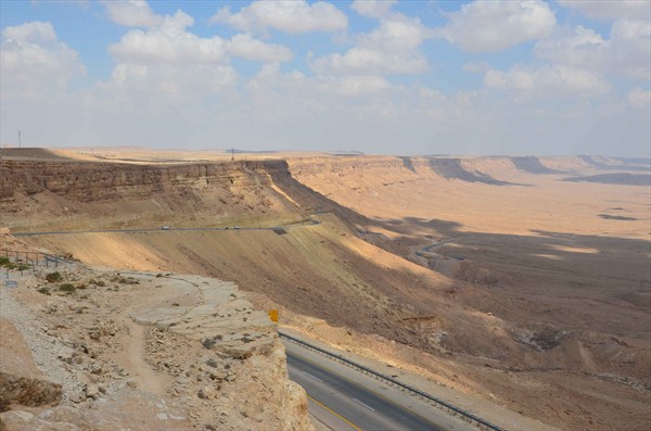
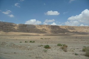
A makhtesh (plural: makhteshim) is a geological landform
considered unique to the Negev desert of Israel and the Sinai
Peninsula. Although commonly known as "craters" (a literal reading
of the Hebrew, and due to the visual similarity), these formations
are more accurately described as erosion cirques (steephead valleys
or box canyons). A makhtesh has steep walls of resistant rock
surrounding a deep closed valley which is usually drained by a
single wadi. The valleys have limited vegetation and soil,
containing a variety of different colored rocks and a diverse fauna
and flora which has been protected and preserved over millions of
years.
The name Ramon comes from the Arabic "Ruman" meaning Romans.
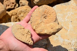
Makhtesh Ramon is a geologists’ paradise with fossils, rock
formations and volcanic and magmatic phenomenon dating back as much
as 220 million years. The Ramon crater began forming when the ocean
that covered the desert began to move north. Water and other
climatic forces slowly began to flatten the curve on top. Much
later, the Arava rift valley was formed and the rivers began to
change their flow. As this occurred, it carved out the crater. Some
rocks at the bottom of the crater can be dated back 220 million
years. Also, vertical dikes of magma which squeezed upward through
fissures can be seen at various spots through the makhtesh. The
lowest spot in the crater, Ein Saharonim, contains its only natural
water source. From the visitor’s center it is possible to get
a spectacular panoramic view of the crater.
authorities: wikipedia.org,
jewishvirtuallibrary.org
1. Go to the coordinates, there you
will find an information board. Behind it in the distance you can
see a hill in the makhtesh. What colour is it? Why?
2. Which other colours of stones you
can see here too?
3. Please take a photo of yourself or
your GPS in this area (voluntary).
In order to log this Earth
Cache, simply send us the answers. You do not have to wait until we
reply. Simply log. In case the answers are wrong, we will contact
you. If we do not, log permission is granted!

Free counters