Over the last few years beavers have begun to populate the
Belgian Ardens again. This cache will take you through an
interesting walk of about 5 kilometers. It will lead you past a
beaver hotspot.
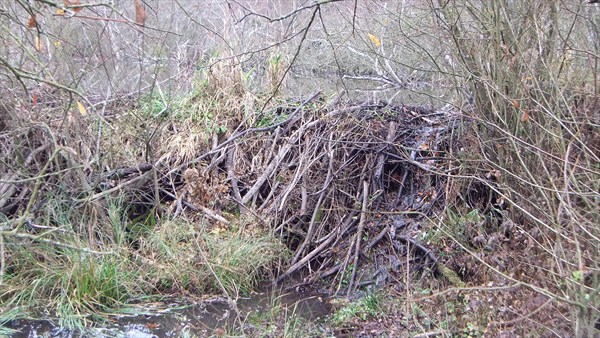
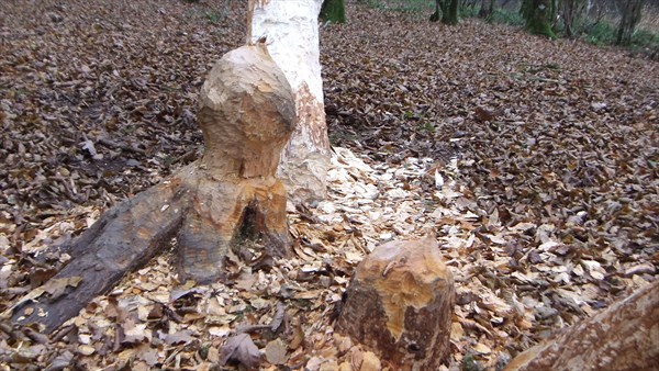
Early in the trip you will encounter an impressive hide-out of
the beavers consisting of a beaver dam and a beaver lodge. As these
guys will have noticed you from miles away, chances are small you
will encounter them. Nevertheless you will be stunned by their
remarkable constructions.
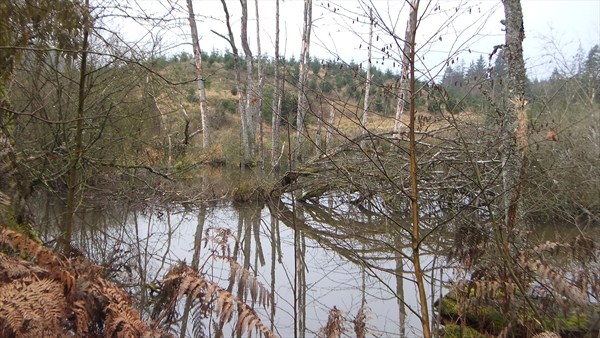
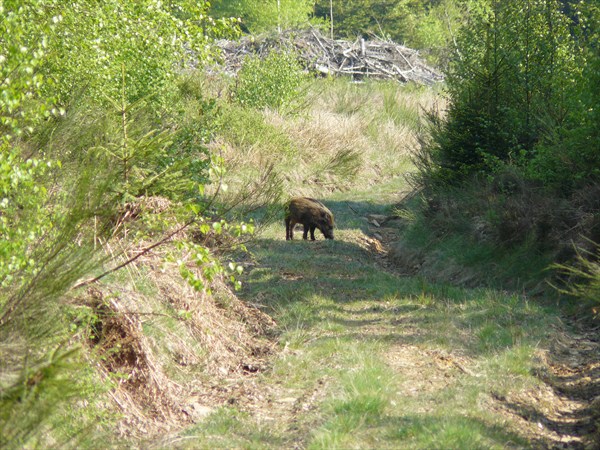
From here the walk will take you through an area rich of
wildlife. It is not unlikely that you will meet dear or wild
boar.
Along the way you will notice a lot of signs indicating private
property, but we stay out of these. We do pass a sign that
indicates only for "forestiers" but as the road is not barred and
as we are on foot (we hope you are) we are allowed to enter.
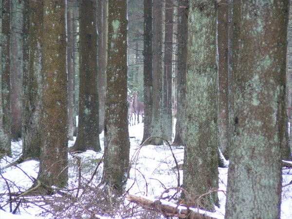
Who says animals can't read? The more of these signs, the less
people who enter the forest and the more wildlife you will
encounter. One rule however, be quiet and you might just run into
one of these...
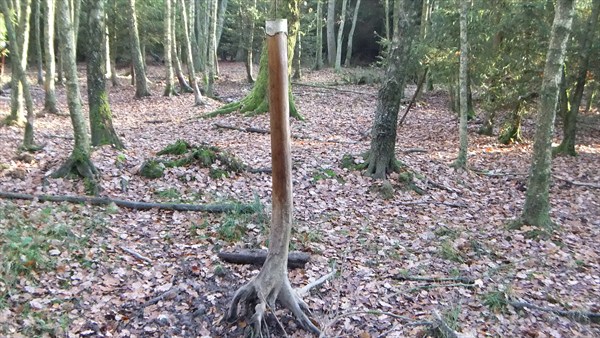
We stay on well marked tracks, though at the end we cut through
a firebreak. Along the way you might notice these strange
landmarks. No idea what they are about, but they indicate you are
on track.
And now for something completely different....the cache
It consists of 9 waypoints and a final. As we like you to enjoy
the walk as well and not spend too much time on locating the
caches, we made sure they are not too hard to find for the
experienced cacher. Each intermediate waypoint will reveal the
location of the next waypoints and will also provide information
for finding the final. Please make sure you keep track of the
hints.
There is plenty of parking space near the coordinates of this
cache. The walk starts at waypoint 1.
Waypoint 1
N 50° 10.399
E 005° 47.494
Now head for waypoint 2.
Waypoint 2
N 50° 10.33A
E 005° 47.A21
From here we go to the first beaver settlement. It is located at
waypoint 3.
Waypoint 3
N 50° 10.3(B+2)1
E 005° 4A.1B0
The hint you'll find here will guide you to a remarkable spot on
the walk. Originally the next cache was hidden under a pile of
stones. During the test-run we found the stones spread around its
original location and the cache 2 meters further, half eaten by a
boar. The stones are still there but the cache is now way out of
the reach of the boars (we think). You'll find it at waypoint
4.
Waypoint 4
N 50° 10.B1C
E 005° 48.B(C-2)3
Now we go for the crossroads where we enter the real wildlife
region. There is no cache at this location. It only serves as a
reference point.
Waypoint Ref
N 50° 10.(C+D)14
E 005° 48.(C+D)69
Way into the wild now! From here we recommend you to be really
quiet and avoid this region in the hunting season. The next cache
is very close. Originally it was also hidden close to the surface
but regarding our weird experience with the previous one, this one
is now also hidden out of the reach of wildlife...though a dear
might find this one interesting.
Waypoint 5
N 50° 10.6(B-D)0
E 005° 4A.6B3
At the next waypoint the cache is hidden at a very obvious
location. Pick & Go, but at least look over your shoulder as
this is a location that is very much favored by dear. You never
know.
Waypoint 6
N 50° 10.6(E-6)7
E 005° 48.(E-5)1D
The hint at this cache will help you to find the next waypoint.
Right before this waypoint you will have to wade a small river.
Normally no problem, though after a lot of rain it might be a bit
hard to keep your feet dry.
Waypoint 7
N 50° 10.7(F+1)
E 005° 48.0BA
Now head for waypoint 8.
Waypoint 8
N 50° 10.A65
E 005° 4G.E66
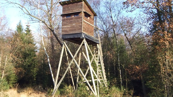
From here on the road gets a bit tricky. Though if you walk in
an almost straight line to the next waypoint, you should not have a
problem finding the firebreak that starts near a hunting tower (see
picture).
The last waypoint of the walk is located near the end of this
firebreak.
Waypoint 9
N 50° 10.(E-H)55
E 005° 47.B1(C+H)
Now you should have all hints to get to the final. It is located
near the end of the walk. Please leave the cache in place. You
should be able to retrieve its content without moving it.
Waypoint (final)
N 50° (H-D)(F-A-D).BC(H+I)
E 005° CG.DE(A-H)