Nature reserve 'De Westhoek'
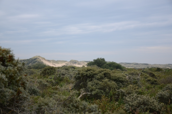
With a surface of 340 ha, the Belgian nature reserve De Westhoek is part of the largest closed range of dunes along the Belgian coast. Together with the neighbouring Krakeelduinen, the Calmeynbos, the Oosthoekduinen and the Franch Dunes of Le Perroquet , DeWesthoek forms a unique wildlife area. The dunes along the North Sea coast is one of our most distinctive landscapes. This landscape is built up by the wind.
The young dunes were formed between the 12th and 16th century. Why precisely in this period dune formation occurred is not entirely clear. Possibly it had something to do with deforestation, which the wind was free. Other possible causes for the formation of the young dunes are fluctuations in sea level, or the fact that when there were more storms.
In fact on a windy day on the beach, you can feel the constant injections of sand blowing in your face. The wind can blow sand and put it away again elsewhere. In the shelter, for example, a tree loses its strength winds, which dragged along the sand particles fall back on the ground. That is the very beginning of dune formation. If the tree-clad hill behind the hits, there can always be more sand and grows increasingly dune. As long as there is enough sand and parts of the dune for example, not by the sea swept away, will continue the dune formation. Until an equilibrium is reached between the speed at which the dune is built up and demolished. A dune may take up to ten meters high.
Since the seventies, however, the area suffered from drought as a result of the extraction of drinking-water in the nearby dunes. Nature management is therefore especially focused on preserving the grasslands and the wet dune slacks. To cope with the loss of this biodiversity, large areas of the reserve are now mown or grazed by half wild cattle.
The landscape of the nature reserve ‘De Westhoek’ has been protected as early as 1935 and was designated as an official state nature reserve in 1957. Almost any of the different types of vegetation of calcareous dunes areas are found here and, as such.
You can freely walk trough the nature reserve on signposted routes which give you access to the of the adjacent dunes of the Calmeynbos and the French dunes of Le Perroquet.
To log this earth cache, read the information panel at the given coordinates and answer me the following questions:
1. The huge mass of sand is being transported by the wind, predominantly eastward. At a rate of how many metres a year?
2. How many different types of dunes are existing here?
3. Tell me 3 kinds of birds living here.
4. Optionally: Ad to your log a picture of you and/or your GPS in front of the dunes.
Please mail the answers to me. After checking the right answers i will mail you a log permission.
Please answer and log in English, Français, Deutsch or Lëtzebuergesch. Thanks - Merci - Danke - Merci.
Enjoy the place.