IMPORTANT: PLEASE READ THE TRACK CONDITIONS AT THE BOTTOM OF THE PAGE!
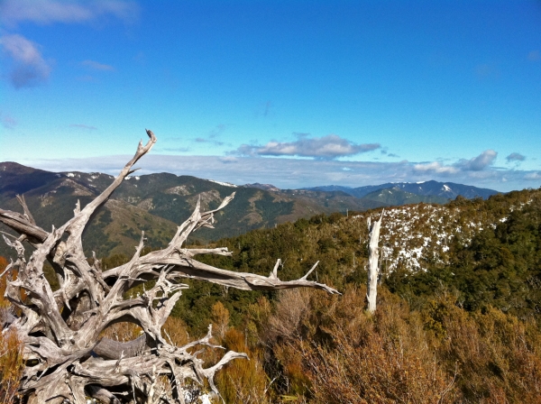 |
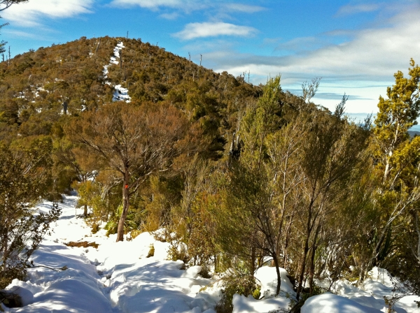
| Views from highpoint 656. Petrified Stump in foreground. |
Details & Description
Wow, that didn’t take long! 10 minutes ago you were at the Marchant Ridge Junction and now you’re standing on High Point 656. Represented by nothing more than a number next to a single dot on the Topo50 maps, many highpoints are renowned for their views and relative prominence. HP656 is no exception, from a distance, at “Marchant Ridge Junction”, it’s a plateau of petrified trees, rocks and dracophyllum.
Believe it or not, HP656 is roughly 656 metres high, and is a short stroll from the previous cache, a simple fall and rise. It features some of the best scenery and views on the entire Dobson Loop, views extending in nearly all directions.
Along the ridge, especially in the more open sections, you will be presented with views spanning out towards the Wairarapa – extending as far as the eastern hills, back across towards Mt. Climie and the Rimutakas, and even as distant as the snow-capped Kaikoura’s in the South Island.
We were exceptionally lucky, when we visited, the snow from the recent polar blast was leg thick, but it was warm, sunny, and there was only a slight drift of wind. This made for some spectacular photos and scenery. The Marchant Ridge section of the Dobson Loop isn’t too badly damaged, and there are no trees down on this section.
The photo opportunities were too good to pass up on this section. The snow covered path was white amongst a field of orange-green. Really great stuff.
We had been meaning to walk this track and use it for cache placements for a while now, and today’s weather presented the perfect opportunity for us. If arriving by car, drive up the unsealed track to the parking area – which we have listed here. This will save you a solid 10 minutes of walking. The unsealed track is definitely drivable with both 4WD and 2WD, but may not be suitable for caravans.
This cache is quite a walk from the carpark, and as you are in the mountains, please bring appropriate gear and be sure of the weather before you leave. Boots are a must – as you will be walking on potentially slippery clay, which absorbs no water which runs off creating hazards, and a walking stick would be preferable (we forgot ours…).
The cache, which is a 800mL translucent Sistema, when placed contained a logbook and geocaching notice, along with a TB. There is a double prize for the FTF. If finders could please post information on the track conditions as they visit, it would be most welcome. Have fun, and enjoy the (short-lived) snow!
 |
| Track up to HP656 from "the dip"... |
Dobson Loop Track
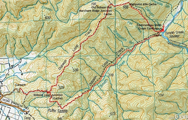
Clocking in at over 13.7km, the Dobson Loop Track is a medium length day walk for those wishing to enjoy the Tararuas without getting into serious high altitude multiday trips – the DOC posted sign says 5-6 hours for the loop, we took over 6 hour 30 minutes, which includes walking, lunch, cache placements, photos and navigating around deadfall (which significantly slowed progress). We decided to tackle the walk in a clockwise fashion, and we recommend all potential seekers do the same.
Here is the tracklog:
And here is the elevation profile:
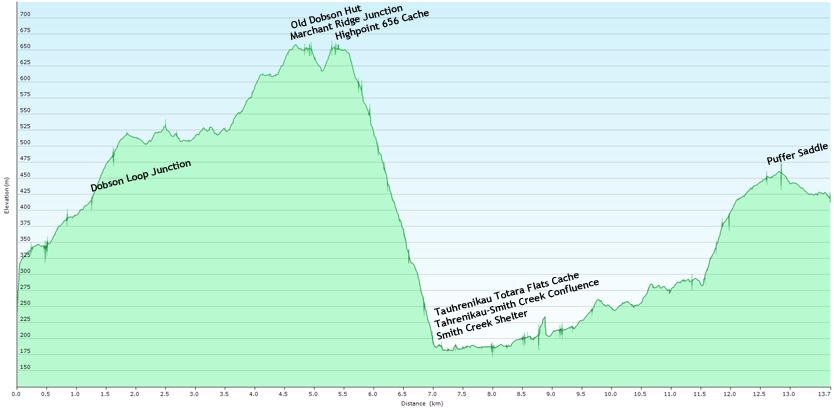
The track starts at the carpark, at an altitude of 310m, and sidles up the hillside on a wide clay path until you reach the Dobson Loop Junction at 427m (this should only take 20 minutes). The posted sign shows the directions, “Alpha Ridge” to the west (left), and “Smiths Creek” to the east (right).
The track between Dobson Loop Junction and Marchant Ridge Junction (the site of the old Dobson Hut), along Marchant Ridge (signposted as “Alpha Ridge” at Dobson Loop Junction) is roughly the same condition, although it is steeper in parts, and goes through a variety of forest, beech forest, shrub, and dracophyllum (closer to the end of that leg). This section takes you from 427m to 643m, and took us 1 hour 30 minutes (walking only).
From Marchant Ridge to Highpoint 656 – there is a short drop and then a short rise back to equivalent altitude - this took us 10 minutes (walking only). There are good views in this section, which is mostly alpine vegetation and dracophyllum.
From Highpoint 656 down to Smiths Creek Shelter, the track is very steep, dropping from 656 metres to ~185 metres through forest and shrub. 45 minutes (walking only).
Smiths Creek Shelter to Puffer Saddle along Puffer Track is a slight uphill gradient, becoming more inclined near the end, with a Puffer Saddle resting at a comfortable ~460m.
After a few more minutes of walking from Puffer Saddle, you will be back at Dobson Loop Junction!
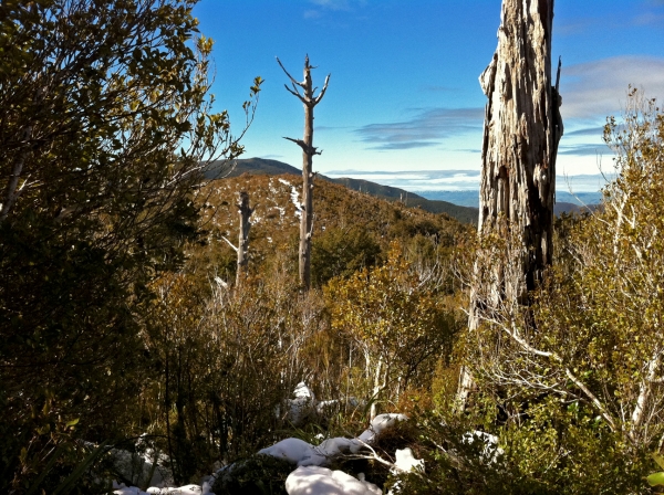 |
| HP656 from closer to Marchant Ridge Junction. |
Track Conditions as of Mid September 2011:
Track between carpark and Dobson Loop Junction has occasional shrubs down.
Track between Dobson Loop Junction and Marchant Ridge Junction has no major obstructions to slow progress.
Puffer Track between Smiths Creek Shelter + Confluence and Puffer Saddle is severely damaged by treefall, dozens of trees down which need climbing over, inhibiting progress significantly.
 |
| Another View... |