I added this cache as a bonus to make your
trip out here more rewarding. There is some bushwacking
required.
Broder Island is located south east of Morrisburg Ontario in the
St. Lawrence River. It is almost directly across from the Nash
Creek. For kayaks/canoes I suggest launching from the Morrisburg
beach located off of Lakeshore Drive, near the Morrisburg Golf
Club. Parking for the beach is available, also washroom
facilities.
About a third of Morrisburg, including Main Street and the
original business district, was lost during the flooding of the
Seaway construction. The Lost Villages Historical society has an
extensive collection covering the demolition of old Morrisburg. You
can go to www.lostvillages.ca/en/html/morrisburg.html
for more information on the flooding and on how the old city of
Morrisburg used to look.
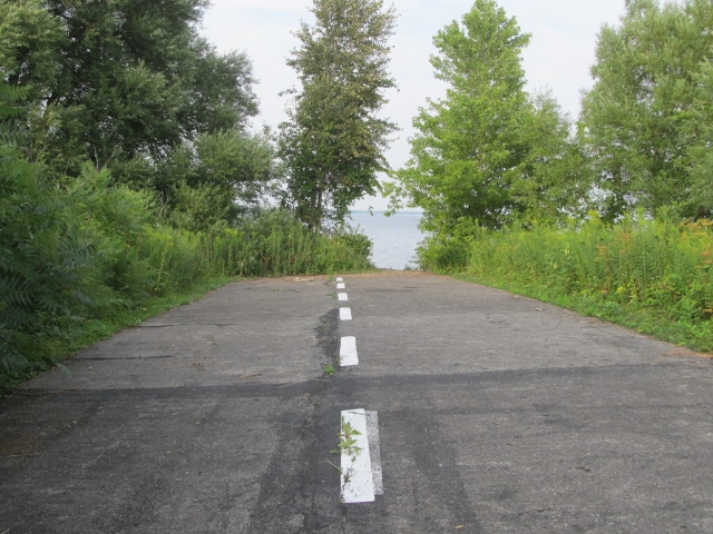
As a result of the flooding Broder Island was created and you
can still see the old highway #2 raising out of the St. Lawrence
River, where is crosses over the Island before retreating back into
the river. Someone faithfully refreshes the painted white passing
lines along this section of highway. It is a sight to see.
This parcel of land was originally part of the Operating
Engineers Training Institute of Ontario (OETIO) and they have
graciously allowed the Chesterville Kayak Club to adopt this
island. Go to www.chestervillekayakclub.com
for more information about the kayak club.
In return the Chesterville Kayak Club has committed to maintain
the islands' cleanliness for visitors. This has been a bigger chore
than originally thought, as "people" are using it as a camp site
and they are leaving all their garbage behind. There is way too
much for us to carry back in our kayaks. It has been impossible to
keep up.
With that in mind, I have left cache
in/trash out bag containers for those of you who wish to assistance
with this job.