The River Avon is navigable for 44 miles from the River Severn at Tewkesbury to Stratford upon Avon. On the journey boats have to climb some 80 feet by means of 17 locks.
The River Avon was made navigable from as early as 1636 by William Sandys of Fladbury. But from the 1850s it suffered a slow decline and by 1945 was abandoned and in terminal decline.
CD Barnwell, encouraged by the Inlands Waterways Association formed a trust to reopen the navigation in 1962.
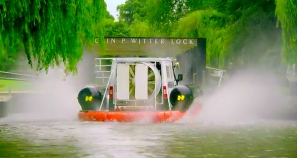
Colin P Witter Lock, previously called Stratford Lock, because of its unusual depth and the unstable nature of the ground (silt pit) was the most difficult to build. The girder supports were put in as the lock was originally going to be deeper, thus dispensing with the next lock down stream (Weir Brake).
The work was done by men from Gloucester Gaol and other volunteers and the lock was opened to traffic in 1974.
You are looking for a magnetic preform container. Trees and nearby metalwork may interfere with GPS accuracy, the clue may help.
Top Gear Hovervan approaching the lock on 27/06/13