All the photos below are taken at significant historic buildings
in Bierton. All you have to do is find them and the answer to the
associated question to build up the co-ordinates to find the final
cache. There are no locations published or any further clues as to
where and what the buildings are – you will have to use a
keen eye, local knowledge or a combination of both to find
them!
All I will say is that they are all visible from the main road
through Bierton (A418 Aylesbury Road) along a stretch of about 0.42
miles between N51o 49.777 W000o
47.330 and N51o 50.023 W000o
46.895. Some are more discretely tucked away than others
so keep your eyes peeled!
If you’re thinking of using modern internet facilities to
complete the ground work, bear in mind that as well as being an
incredibly tedious hour or so of your life that you won’t
ever get back, the cache has been deliberately designed to make
this a particularly difficult (and impossible in many cases) way of
gathering the information, so you are encouraged to do the cache as
it is intended – on foot.
Now a boring, but important health and safety point. Please
remember that the road is quite a busy one where the pavement
narrows on some sides in places and although you’ll probably
be preoccupied looking for the buildings, PLEASE MAKE THE
ROAD YOUR PRIORITY and be especially careful caching with
children and dogs.
The co-ordinates above are for the top of Parsons Lane, down
which there should be plenty of parking. Please avoid school
drop-off or pick-up times though as it gets very busy at these
times.
Find the following buildings and answer the associated question
based on some information close to each one. They are listed in
random order and could appear at any point during your journey from
the recommended start point of N51o 49.777
W000o 47.330.
The cache is located at N51o AB.CDE
W000o FG.HIJ. The GPS signal isn’t
wonderful and the co-ords are based on averaging a few different
visits, but I would suggest getting to within 30 feet or so,
ignoring the direction needle and looking at possible hiding places
from there. The cache is located adjacent to a public footpath and
you do not need to cross any fences or enter private land to
retrieve it. The encrypted hint is intended to be a spoiler if you
need it. There is the traditional scratch card for the FTF.
Have fun, enjoy the walk and stay safe!
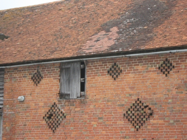
PICTURE A
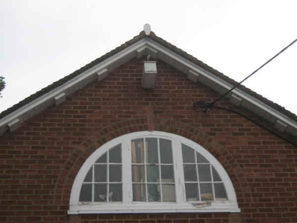
A = Last digit of year that two significant stones were laid in
this building?
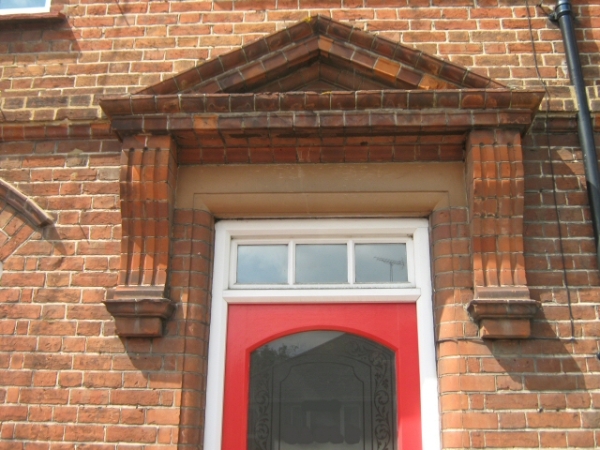
PICTURE B
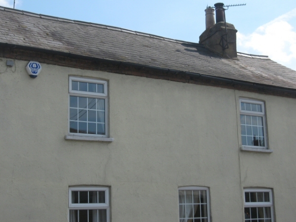
B = Sum of all digits in this house property number (ignore any
leading digit in the resultant value)?
PICTURE C (NB: Picture modified – detail
removed!)
C = First of the two digits on the white discs on telegraph pole to
left of property?
PICTURE D (NB: Picture modified – detail
removed!)

D = Second digit of either of the two sets of numbers on green
metal box to right of property?
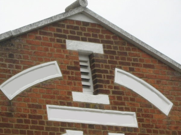
PICTURE E
E = Number of letters in second word of street name in sign below
this photo?
PICTURE F

F = Phone number on the red object opposite – 08F57
7F07F0?
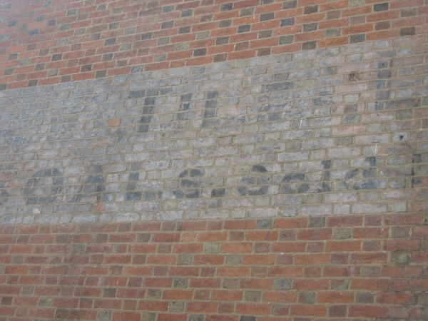
PICTURE G
G = Number of letters in name of home town of maker of drain
kerbstone?
PICTURE H

H = Last digit of the upper number on either of the two concrete SV
posts on ground?
PICTURE I

I = Number of letters at the very top of this building?
PICTURE J (NB: Picture modified – detail
removed!)
J = Number of letters of the name on the front door (Ignore the
word ‘The’ ?)