Neco o Vysokém hrbetu
Vrchol je ve výšce 1078 mnm. Jedná se o protáhlý suk 6 km
západne od Hartmanic. Asymetrický hrbet na okraji Šumavy,
severovýchodní svah je až 300 m vysoký. Ojedinele rozptýlená
sut. Zalesneno smrkovou monokulturou. Na vrcholu je srub a
geodetický bod.
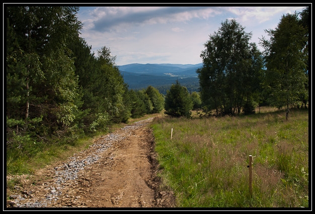
Vyhlídka je v nadmorské výšce „pouhých“ 975 mnm
a lze se k ní dostat z parkovište prímo pod kopcem.
Další prístupná a pohodlná cesta je z Roviny, kde se lze
rádne nadlábnout a vyrazit po zelené znacce po hrbetu Vysokého
hrbetu.
Jak na kešku
Vlastní keš se nachází prímo u výhledu a je dostupná mimo
zimní zasnežené období.
Something about Vysoky hrbet
 The peak is at an altitude of 1078 meters
above sea level. It is an elongated knot 6 km west of Hartmanice.
Asymmetric spine at the edge of the Bohemian Forest, northeastern
slope is 300 m high. Occasionally dissipated rubble. Forested
spruce monoculture. On top of the cottage and geodetic point.
The peak is at an altitude of 1078 meters
above sea level. It is an elongated knot 6 km west of Hartmanice.
Asymmetric spine at the edge of the Bohemian Forest, northeastern
slope is 300 m high. Occasionally dissipated rubble. Forested
spruce monoculture. On top of the cottage and geodetic point.
The view is at an altitude of "only" 975 meters and can reach her
from the parking lot directly below the hill. More accessible and
comfortable road is from the Rovina, where you can fine eat and
going by green trail on the Vysoky hrbet.
How to the cache
The actual cache is located near view and is available outside
the snowy winter season.