Neco o Kremelné
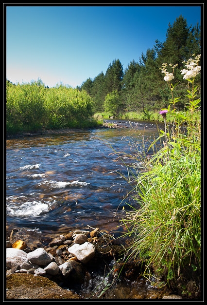 Kremelná je šumavská reka v okrese Klatovy v
Plzenském kraji v Ceské republice. Má délku 30,3 km, plochu povodí
171,6 km²
Kremelná je šumavská reka v okrese Klatovy v
Plzenském kraji v Ceské republice. Má délku 30,3 km, plochu povodí
171,6 km²
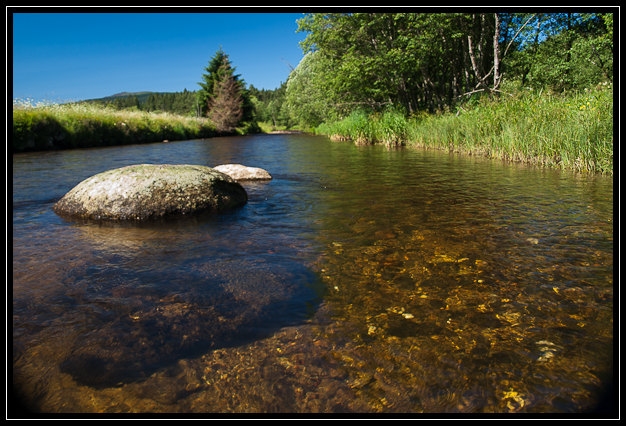
Pramení v Železnorudské hornatine, na severním svahu hory
Pancír (1214 m) v nadmorské výšce 1090 m. Stéká z
Pancírského hrbetu a protéká Kochánovskými plánemi. Na nich vytvárí
prevážne otevrené údolí s cetnými slatemi (I. zóna NP U
Cettlovy hurky) a meandry. V záveru svého toku, pod Stodulkami se
reka hluboce zarezává do Svojšské hornatiny. Údolí prechází
v kanon, v koryte reky jsou obrí hrnce a pereje. Tento charakter si
reka zachovává až k soutoku s Vydrou, jímž vzniká reka
Otava.
Kremelná protéká prevážne hornatou krajinou a je zrejme
jedinou rekou v Cesku, na jejímž brehu nestojí žádný
dum.
Zdroj: wikipedie
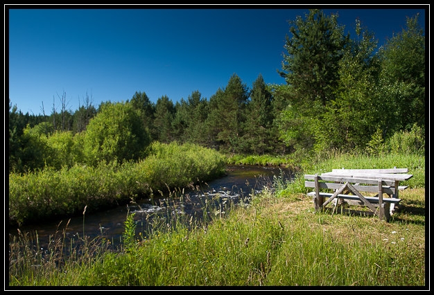
Jak na keš?
Na Stage N 49° 08.473 E 013° 23.656 na
informacní ceduli zjistete pocet obyvatel obce v roce 1890, získáte
písmeno K. Je zde ideální místo s výhledem na
reku, zároven si zde mužete odpocinout a posvacit.
Finálka je pak na souradnicích
N 49°8.(K+165) E 13°23.(K+342)
Eng:
This is the very simple and short Multicache. According default
cache coordinates is recommended parking from 6:00 to 9:00 pm.
About Kremelná
 Kremelná is a river in the district of Klatovy in the
Region in the Czech Republic. It has a length of 30.3 km, a
catchment area of 171.6 km ²
Kremelná is a river in the district of Klatovy in the
Region in the Czech Republic. It has a length of 30.3 km, a
catchment area of 171.6 km ²
Springs in Železná Highlands, on the northern slope of Mount
Armour (1214 m) in altitude 1090 m. The ridge runs from Pancírského
Kochánovskými plains and flows. The one produces predominantly open
valley with numerous bogs (NP zone I. For Cettlovy hurka) and
meanders. At the end of its flow under the river Stodulky deeply
cutting into Svojšské Highlands. The valley passes in the
canyon, the river bed is a giant pot and rapids. This preserves the
character of the river to the confluence with the otter, which
arises Otava River.
Kremelná flows mostly mountainous countryside and is probably the
only river in the Czech Republic does not stand on the bank of any
house.
How to the cache?
At Stage N 49° 08.473 E 013° 23.656 on the
information sign, note the number of inhabitants in 1890, you get
the letter K.
Final cache is located at
N 49° 8.(K+165)E 013°23.(K+342)
DE
 Die Kremelná (deutsch Kieslingbach, Kiesleitenbach)
ist ein 30,3 km langer Fluss im Böhmerwald, Tschechien. Das
Einzugsgebiet umfasst 171,6 km², der Durchfluss beträgt an der
Mündung 4,43 m³/s.
Die Kremelná (deutsch Kieslingbach, Kiesleitenbach)
ist ein 30,3 km langer Fluss im Böhmerwald, Tschechien. Das
Einzugsgebiet umfasst 171,6 km², der Durchfluss beträgt an der
Mündung 4,43 m³/s.
Die Kremelná entspringt etwa 6 km nördlich von Železná Ruda am
Fuße der Berge Pancír (1214 m) und Mustek (Brückelberg, 1234 m) in
1090 m Höhe in dem ausgedehnten Quellmoor Šmauzy (Schmausen,
Naturschutzgebiet). Von dort fließt der Bach, einer tektonischen
Senke folgend, parallel zum Böhmerwaldhauptkamm südostwärts. Als
Zhurský potok (Haidlerbach) wird der Oberlauf bis zum Zusammenfluss
mit dem Prášilský potok (Stubenbach) bezeichnet. Im
Unterlauf nimmt die Kremelná den Charakter eines Wildbachs mit
vielen Stromschnellen, Felsblöcken und unregelmäßigen Schwellen im
Flussbett an. Sie umfließt das Bergmassiv des Kremelná (Kiesleiten,
1125 m) südlich in einem engen Durchbruchstal und nimmt dabei von
rechts den Chinitz-Tettauer Schwemmkanal auf. Unterhalb der Cenkova
pila (Vinzenzsäge), 4 km südlich von Rejštejn, vereinigt
sich die Kremelná mit der Vydra zur Otava.
Ressource: wikipedie
Wie Cache?
Etappe an den Koordinaten N 49° 08.473 E 013°
23.656 Das Hinweisschild beachten, die Zahl der Einwohner
im Jahr 1 890, erhalten Sieden Buchstaben K.
Cache ist bei den Koordinaten befinden:
N 49° 8.(K+165)E 013° 23.(K+342)