Please take care on muddy paths.
Springs are sometimes indicated on Ordnance Survey maps as
'Issues' in reference to the occurrence of water 'issuing' from the
ground to the ground surface.
Springs occur in two ways. They may issue from an opening in the
ground where water may flow outwards. This could be from joints or
fractures within the rock or in karstic (limestone)
terrain from a channel created by the flowing water itself. These
tyes of springs are known as 'Fracture', 'Fault' & 'Solution'
springs.
The second way is much more common in the UK and the Midlands in
which groundwater intersects with the ground surface. Typically
this intersection occurs in streams and rivers where it is not
visible but in some locations, such as here at Whitley it can be
identified. This type of spring is known as a 'Contact' spring.
A contact spring occurs where permeable rocks overlie
impermeable rocks. Permeability refers to a rocks ability to allow
the transmission of water through the pore spaces between the
grains or crystals with which it is comprised. No rocks can be
termed completely impermeable but can have permeability rates so
low as to be effectively considered impermeable.
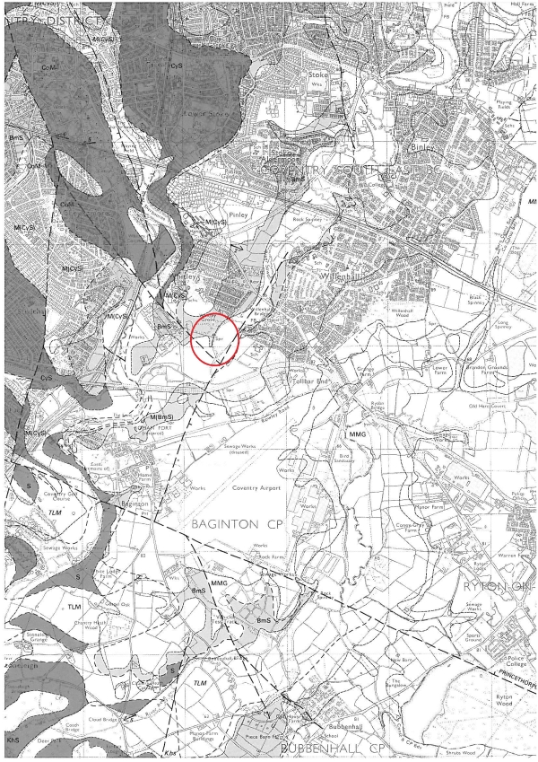
Reference to the geological map indicates the spring at this
location can be seen to coincide with the contact between the
Bromsgrove Sandstone Formation (BmS) and the Mercia Mudstone Group
(MMG). The boundary lies approximately north to south at this
location. As the names of these formations implies this is the
contact between a sandstone a mudstone. The permeability of the
sandstone is greater than the mudstone as the pore spaces between
the sand grains is greater than the pore space between the clay
platelets. When the water contained with the sandstone flows
downhill (via gravity) to the mudstone contact it is effectively
'dammed' and flows outwards depending upon the local
topograpghy.
In order to claim this Earthcache you will need to visit
the given coordinates and answer the following questions:
1. What is the approximate diameter of the
pool which has formed at the spring?
2. Given this is the boundary between the
Bromsgrove Sandstone Formation and the Mercia Mudstone Group, is
there any evidence to suggest which rocks lie to the east and which
lie to the west? and if so please state your conclusion.
3. Springs often occur in 'Spring lines'. Is
there any evidence of a spring line at this location?
4. (Optional) Take a photo of yourself or
your GPSr at the given coordinates.
Please email you answers to the questions to me before
posting your log. I will attempt to verify your answers as soon as
possible so you can post your discover. Please do not post your answers on your log.
Many thanks and good luck.