Hlubinné horniny
Hlubinné horniny se vytvorily zpravidla v hlubších
cástech zemské kury, príp. až ve svrchním plášti. Tvorí
prevážne velká telesa nepravidelných tvaru. Pokud jsou
jednodušší, oznacují se jako masivy (napr. brnenský
masiv, dyjský masiv), jsou-li komplikovanejší, tvorí
plutony, napr. stredoceský pluton, krkonošsko-jizerský
pluton. Z morfologického hlediska se v rámci hlubinných
magmatických teles rozlišují tzv. batolity (magmatická
telesa, která se smerem do hloubky rozširují), lopolity
(velmi mocné ploché intruze pánvovitého tvaru), harpolity (ploché
intruze jazykovitého tvaru) a etmolity (telesa, jejichž prurez
se smerem do hloubky zmenšuje). Menší hlubinná telesa
zaokrouhleného až eliptického prurezu o rozloze nekolika
desítek kilometru ctverecných se nazývají pne. Bývají uložena
tesne pod povrchem, nebo mohou úrovne zemského povrchu místy i
dosahovat .
Intrusive rocks
Intrusive rocks are generally formed in deeper parts of the
earth's crust or in the upper mantle. Forms usually the big
formations of irregular shapes. If the formation is simple it is
called massifs (for example Brno Massif, Dyje Massif) if it is more
complicated it is called pluton (Krkonoše-Jizera Pluton).
From the morphological point of view we distinguish the magmatic
forms as follows: the batholiths (igneous forms that extends into
the depth direction), lopoliths (very mighty flat intrusion of
basin shape), harpholiths (flat intrusions of tongue shape) and
etmoliths (forms that decreases into the depth direction). Smaller
intrusive forms of rounded or eliptic cross-section and dimension
of several tens of square kilometers is called pne. They are laid
just below the surface, or they can even reach the earth's surface
in several places .
Žilné horniny
Žilné horniny tvorí menší deskovitá telesa, která se
formují v zemské kure (príp. i ve svrchním plášti) ve stejné
hloubkové úrovni jako plutonity nebo i ponekud blíže zemskému
povrchu. Bývají obvykle príkre orientovaná k zemskému povrchu a
vytvárejí velmi dlouhé pruhy, oznacované jako žíly. Dosahují
velmi ruzné mocnosti (od nekolika cm po desítky metru) a délky (od
desítek metru do desítek km). Žíly probíhající napríc vrstev
nazýváme pravými žilami. Mají nesouhlasné (diskordantní)
uložení ve vztahu k okolním horninám, jimiž
prorážejí. Vnikne-li magma mezi vrstvy starších hornin,
mohou vzniknout žíly ložní. Tyto sledují obvykle vrstevní
plochy nebo plochy bridlicnatosti. Vuci okolním horninám jsou
uloženy souhlasne (konkordantne). Menší plošnou
rozlohu, avšak vetší mocnost než ložní
žíly, mají cockovitá nebo bochníkovitá telesa, zvaná lakolity.
Pri intruzi docházelo v tomto prípade k vyklenutí nadložních
souvrství. Lakolity bývají uloženy rovnež souhlasne
(konkordantne) s okolními vrstvami. Vzhledem k tomu, že
hlubinné a žilné horniny pronikají staršími horninami,
bývají obe tyto skupiny souborne oznacovány jako intruzívní horniny
(intruzíva).
Hypabyssal rock
Hypabyssal rocks are forming smaller tabular forms that are
shaped in the earth's crust in the same depth level like plutonics
or in the upper mantle. They are usually steeply oriented to the
earth's surface and forms a very long strips, called veins. They
reach very different thickness (from several cm to tens of meters)
and length (from several meters to tens of kilometers). Veins
running across layers is called the true veins. They have
discordant layout in relation to surrounding rocks that are going
through. When the magma gets between layers of older rocks, sill
may arise. They usually follow bedding plane or slate plane.
Towards the surrounding rocks are stored concordantly. Smaller area
space but higher thickness than the sill have got lenslike or
loaflike forms called laccoliths. In this case the arch of group of
strata was performed during the intrusion. Laccoliths are also
layed in concordance with the surrounding layers. As the hypabyssal
rocks penetrate older rocks, are both these groups called intrusive
rocks.
Výlevné horniny
Výlevné horniny vznikají z lávy, tj. z magmatu, které dosáhlo
úrovne zemského povrchu. Nejcasteji vytvárejí príkrovy, proudy nebo
kupy . Efuzíva vznikají z magmatu rozlitého na velkých plochách o
rozloze místy i nekolika tisíc kilometru ctverecných. Jejich
horizontální rozmer vždy výrazne prevládá nad rozmerem
vertikálním (lávové proudy a príkrovy). Extruziva vznikají z
magmatu rozlitého na menších areálech. Horizontální rozmer
teles je zde zhruba stejný jako vertikální (lávové kupy).
Volcanic rocks
Volcanic rocks are formed from lava, ie from magma that has
reached the earth surface. They create mostly the nappes, streams
and mounds. Effusive is formed from magma spilled over the large
surface - in several places thousands square kilometers. The
horizontal dimension predominate always the vertical dimension
(lava streams and nappes). Extrusive is formed from magma spilled
on smaller surface. The horizontal dimension is roughly the same as
the vertical one (lava mounds).
Podmínky logu: / Terms of log:
A) Pres profil odpovezte na následující otázky:(odpovedi
získáte po prostudování listingu a na míste z tabulky oznacující
nejvyšší bod Trebounského vrchu) / Send me the
replies to following questions (by using my email in profile)(After
studying listing you get answers and on place from the table which
mark the highest point of Trebounskeho hill)
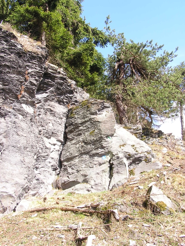
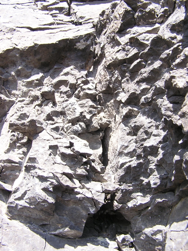
1) Sestavit a na e-mail mi zaslat odbornou popisku skalky z
úvodních souradnic. Vaše popiska musí obsahovat minimálne: /
compose and e-mail me a professional description of the rock at the
initial coords.Your describtion must include at least:
- Do které skupiny hornin z listingu by jste zaradili skalní
útvar. / Which group of the rocks from the listing would you
include the rock formation
- Výšku skalního útvaru od paty po vrchol. / Height of
the rock formation from the heel to the top
- Jakou má hornina prevládající barvu / the dominant colour of
the rock.
- Do jakého období by jste datovali vznik této horniny / In what
period you would date rise of this rock formation
2) Prevážne z jaké horniny je tvoren Trebounský vrch? /
From which rock is mostly composed the hill Trebounsky?
B) Dobrovolné: / Optional:
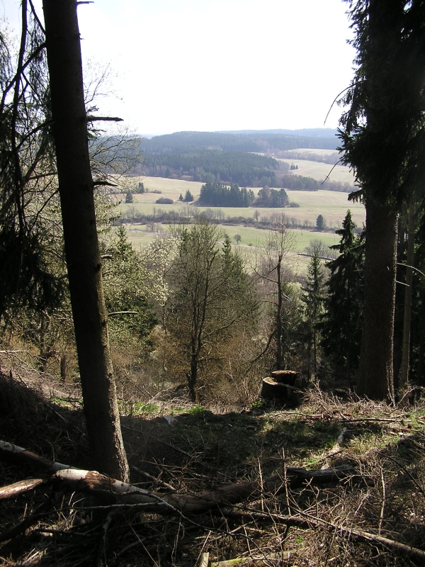
Pripojte k logu fotografii nekterého ze skalních útvaru na
hrebeni nebo jiného místa, které se vám líbilo. Add to your log
some photo of the rock on the top or of some other place you
liked.
Informace prevzaty z:
http://atlas.horniny.sci.muni.cz/magmaticke/magmatity_system_vulkanic.html