CJS - Conowingo Dam #1 Traditional Geocache
-
Difficulty:
-

-
Terrain:
-

Size:  (regular)
Related Web Page
Please note Use of geocaching.com services is subject to the terms and conditions
in our disclaimer.


Come on a journey to remember and commemorate the history and travels of Captain John Smith! Over four hundred years ago, Englishman John Smith and a small crew set out in an open boat to explore the Chesapeake Bay. Between 1607 and 1609 Smith mapped and documented nearly 3,000 miles of the Bay and its rivers. Along the way he visited many thriving American Indians communities and gathered information about this “fruitful and delightsome land.” In December 2006 the U.S. Congress designated the routes of Smith’s explorations of the Chesapeake as a national historic trail—the first national water trail.
Are you ready to follow in the wake of Captain John Smith? Visit sites along the National Historic Trail and learn about the native cultures and the natural environment of the 17th-century Chesapeake through the Captain John Smith Chesapeake Geotrail. The Trail provides opportunities for you to experience the Bay through the routes and places associated with Smith’s explorations. Caches will be located in museums, refuges, parks, and towns in Virginia, Maryland and Delaware along the rivers and creeks that Smith and his crew explored four centuries ago.
The Captain John Smith (CJS) Geotrail launched June 4, 2011 with over 40 caches within Maryland, Virginia and Delaware. A trackable geo coin will be awarded to the first 400 geocachers, while supplies last, for locating at least 15 CJS caches. To be eligible for the coin, geocachers must download a passport from either the CJS Geotrail or Maryland Geocaching Society website. Geocachers must find and log at least 15 finds, record the code word from each cache on their passport and post a picture of themselve at each cache location. After discovering the 15 required caches, geocachers may have thier passports validated in person or via mail at the National Park Service, Chesapeake Bay Office located at 410 Severn Ave, Suite 314, Annapolis, MD 21403. Please refer to the passport for complete validation instructions.
Participating in the CJS geotrail is fun and we hope that many people join in. However, it is not a requirement for logging your find on this cache once you find the container.
You are seeking a traditional hide. A Lock & Lock stocked with a variety of items. To find the correct trail, walk down the roadway, turn right, up and into the woods before the gate in the road. Please do not enter from the swimming pool side, this will expose the hide to lots of muggles. This cache is only available sunrise to sunset. Please no night caching! If you intend to do the CJS Conowingo #2 puzzle cache, begin with #2 and then seek this hide.
Captain John Smith discovered that the Susquehanna River was only navigable for a few miles before the fall line was reached, he naming this area of rapids after himself “Smith’s Falls”. With his explorations of the four rivers at the head of the Bay – the Susquehanna, Northeast, Elk, and Sassafras rivers – all of the major Chesapeake tributaries had been mapped except the Patuxent and the Rappahannock which they would explore on their way back to Jamestown. Having gotten this far by August, 1608, at least Captain Smith was able to show that there was no hoped-for Northwest Passage to the lucrative trade with the Far East. His employer, the Virginia Company of London, had established two main goals for the expedition: one, determine whether there was a water route across this unknown land (unknown to Europeans), thereby giving the English quicker access to the very profitable trade with the East, and two, find resources, particularly precious metals, that could be exported for profit. After reaching the head of the Bay, Smith knew the first goal was unattainable.
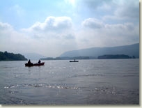
The Susquehanna River extends more than 400 miles and carries a tremendous amount of water into the Bay – a billion gallons a day! This amount of water, passing over the fall line, is a great opportunity for humans to harness the power of the water to create electricity. Operated by Exelon Power Corporation, the Conowingo Dam is one of the largest non-federal hydroelectric dams in the country. The dam is named for the town of Conowingo, Maryland. The original town site is now under the waters of the reservoir. Known locally as Conowingo Lake, the reservoir extends 14 miles and supplies drinking water for Baltimore and the Chester (PA) Water Authority.
The area below the dam is excellent for birdwatching and the area is especially well known for spotting bald eagles. According to the Harford Bird Club of Harford County, Maryland, “Conowingo is considered one of the best places east of the Mississippi River to view Bald Eagles because the birds are nearly always present in good numbers and viewing conditions are excellent.” A large number of bald eagles can be observed here, as many as 20 in a single scan, particularly in the winter months.

Thanks to Corfmania for helping with this hide and to the Maryland Geocaching Society for assisting with this project!
Additional Hints
(No hints available.)