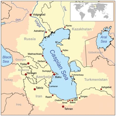
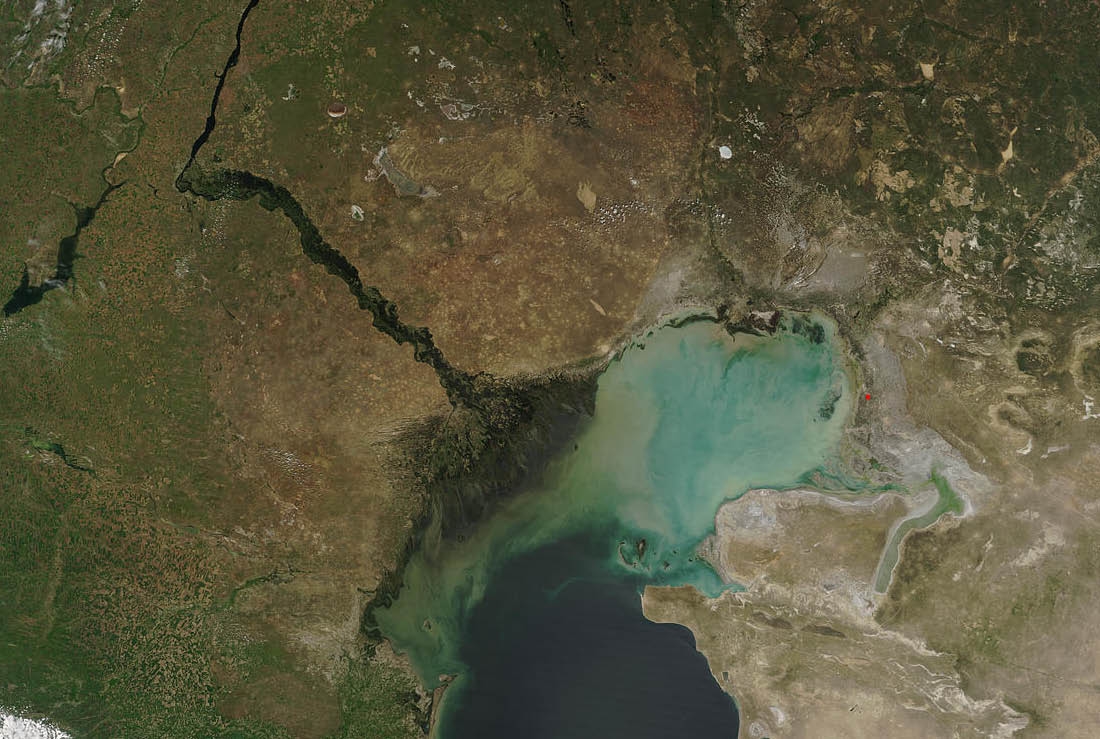
The Caspian Depression is part of the wider Aral-Caspian Depression
around the Aral and Caspian seas. Much of the Caspian Depression is
below sea-level; the lowest point of the depression is 28m or 92
feet below sea level. The depression lies at the southern end of
the Ryn Desert, and is in both Kazakhstan and Russia consisting of
large areas of marshlands in the eastern region. It is one of the
largest flat lowland areas in Central Asia, covering approximately
200,000 kilometres² (77,220 miles²). The area is very rich in
underground oil and gas reserves, and oil and natural gas pipelines
cross the depression from north to south and east to west. The two
largest cities in the depression are Astrakhan in Russia, and
Atyrau in Kazakhstan.
How this Depression was formed
Many geologists believe the Caspian Sea and the depression were
formed by tectonic forces. Some of them also believe that the North
Caspian depression became separated from the open ocean in ancient
times to form an enormous salt lake
During the Tertiary, the Pontic-Caspian basin included the modern
Caspian and Black Seas, and was connected to the Mediterranean.
Fluctuations of the proto-Caspian Sea in the Neocene determined the
modern geology of this ecoregion. In the Middle Pliocene, the sea
receded, and only two small lakes remained as relicts of the
ancient Pontic Sea. In the Upper Pliocene, the so-called
Akchagylian Sea expanded over Turkmenistan, then receding back by
the end of Pliocene. Aridization and erosion continued in the
Quaternary, combined with continuing sea level fluctuations and
aeolic relief formation. As the new land emerged, littoral flora
gave rise to number of different types of xerophytes. Large ancient
rivers, the Amu Darya and Uzboi, flowed to the Caspian Sea in the
Quaternary period; later, the Uzboi disappeared, and the Amudarya
changed its course to flow into the Aral Sea.
The Cache Location:
Shanyrak Village is where the many expatriates working in the
Tengiz and Korolev oil fields are accommodated and is also near the
small town of Tengiz.
To have reached this point you would have traveled from Atyrau a
distance of approximately 300km through the Caspian depression and
seen the main “empty” river beds that make up the
area.
TheCache:
Due to the difficulty of movement I have chosen coordinates that
are easy to reach on foot. When reaching the coordinates, you will
be standing in an area that once covered by the Caspian Sea. To
find out why the area is called the Caspian Depression I have put
together the following questions.
1. Describe the feeling of walking on the sand at GZ –
describe this and try explaining why the soil may react this way
(think of particle size and the materials that made the soil).
2. Describe all evidence that you saw at this site to justify
your answer.
3. What would you best describe this soil type to be? (Sandy/
Silty / Clay/ Loamy/ Peaty/ Chalky)
4. What is the height above sea level at this point? (GPS or
Google Earth) and how does this relate to the cache?
5. Describe any other feature of geological / Earth science
interest that you noticed in this region of Kazakhstan that you may
not see in your home region.
Please E-mail the answers to the questions along with the
following: Facing the Shanyrak Village, take a photo of your GPS
with the closest Dorm block number clearly showing [OPTIONAL]. Or
alternately note the Dome & Block number that can be seen from
the cache site. Also let me know why you were in Kazakhstan.

Free counters