Os Algares dos Vales (PT)
Descrição
A Freguesia de Atouguia pertence ao concelho de Ourém, situada em pleno maciço calcário, a cerca de 210 metros acima do nível do mar. O seu clima é caracterizado por alta pluviosidade (cerca de 1.400 mm de média anual), verões quentes e secos.
As formações das serras conferem-lhe uma paisagem árida, um solo rochoso e calcário onde só a azinheira, o carvalho português, o medronheiro, o sanguinho ou zanguinho, a figueira e a oliveira, conseguem resistir às condições adversas que o clima e território apresentam.
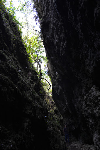
A sua estrutura tipicamente cársica determina a existência de algares, grutas com estalactites e estalagmites, bem assim como campos de lapiaz.
Algares
Os algares têm origem na erosão química e mecânica provocada pela circulação das águas subterrâneas. Pode formar-se a partir da superfície, principalmente quando nos terrenos calcários se encontram grandes quantidades de juntas e fracturas.
A erosão química é devida à dissolução do calcário pelas águas com grande concentração de ácido carbónico. A erosão mecânica é consequência do material sólido transportado pelas águas subterrâneas.
Algumas vezes formam-se a partir do abatimento de grutas subterrâneas.
“Os Algares dos Vales”
Situado num monte nas proximidades de Atouguia, a cerca de 230 metros de altitude. Pouco se sabe sobre esses algares e grutas nunca exploradas. Os aldeões que já se aventuraram nessas grutas contam que existem imensos morcegos, salamandras, centopeias e uma variedade de outros insectos.
Acessos
Para quem vem de longe pode usar a A1, sair em Fátima e ir em direcção Ourém (por Alvega).
Os caminhos das zonas envolventes aos algares são todos em terra batida/gravilha. Ainda assim podem usar facilmente carro, mota, bicicleta para chegarem a zona onde poderá estacionar.
Conselhos:
- Não se aventurar fora dos trilhos pois existe perigo eminente de cair em algares;
- Não ir em tempos chuvosos;
- Mesmo sem chuva o solo junto aos algares fica escorregadio. Usem calçado apropriado.
- Não é recomendado o uso de chinelos e de calções;
- Usar os waypoints de caminho para encontrar o trilho certo para os algares;
Cache
Por questões de sinal GPS, a cache não está em grutas, nem em fendas ou algares.
The Limestone Ravines of the Valley (EN)
Description
The parish of Atouguia belongs to Ourem's Municipality, situated in a limestone massif, about 210 meters above sea level. Its climate is characterized by high rainfall (about 1,400 mm annual average) and an hot and dry summers.
The formations of the hills give it a barren landscape, a rocky soil and limestone where only the oak, Portuguese oak, the arbutus, the buckthorn or zanguinho, fig and olive trees, able to withstand the adverse conditions of that present climate and territory.
The structure typically karstic determines the existence of karst ravines, caves with stalactites and stalagmites, as well as fields of Lapiaz.
Limestone Ravines
The limestone ravines come from the chemical and mechanical erosion caused by circulation of groundwater. Can be formed from the surface, especially when in the limestone soils are large numbers of joints and fractures.
The chemical erosion is due to the dissolution of limestone by water with high concentrations of carbonic acid. The mechanical erosion is the result of the solid material transported by the groundwater.
Sometimes formed from the reduction of underground caverns.
“The Limestone Ravines of the Valley”
Situated on a hill near Atouguia, with about 230 meters of altitude. Little is known about these caves and ravines never explored. Villagers who have ventured in these caves tell that there are huge bats, salamanders, centipedes and a variety of other insects.
Accessibility
For those coming from afar can use the A1, exit at Fatima and go towards Ourém (passing through Alvega).
The paths sorrounding the ravines are all on dirt / gravel. Still can easily use the car, motorcycle, bicycle to reach the area where you can park.
Advices:
- Do not venture off the rails because there is imminent danger of falling into ravines;
- Do not go in rainy season;
- Even without rain, the ground is slippery near the ravines. Use appropriate footwear.
- Not recommended for use in slippers and shorts;
- Use the track waypoints to find the right path to the ravines;
Cache
For reasons of GPS signal, the cache is not in caves, crevices or ravines.
Fotos / Photos
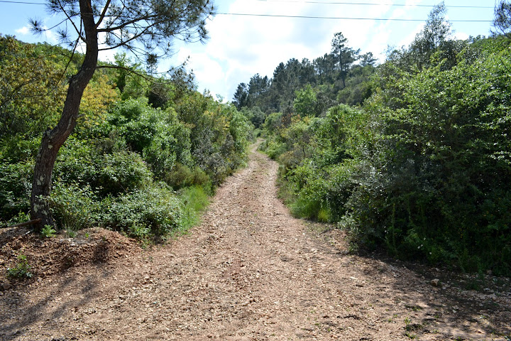
Waypoint Caminho 1 / Track Waypoint 1 |
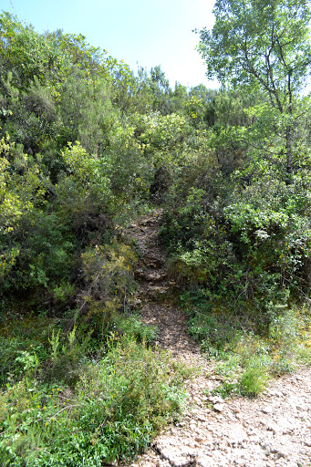
Waypoint Caminho 2 / Track Waypoint 2 |
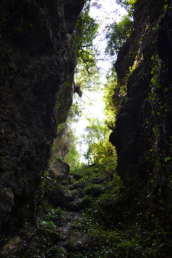
Algar / Limestone Ravine |
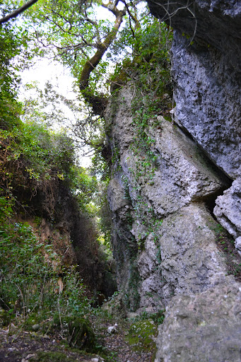
Fenda na rocha / Crack in rock |
Algar / Limestone Ravine |
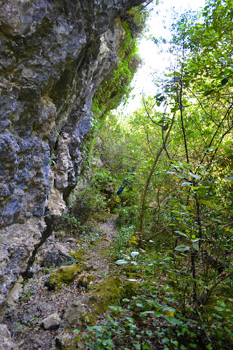
Rocha calcária e vegetação / Limestone rock and vegetation |