Deze cache is oorspronkelijk van Team MenM, maar zij hadden geen
zin meer om deze te blijven beheren toen de logvoorwaarde om een
foto bij te moeten voegen geschrapt werd. Naar aanleiding hiervan
stuurde ik ze een berichtje met de vraag of ik de earthcache over
mocht nemen. Dit mocht van hen, daarom lijkt het me passend om de
voorbeeldfoto van Team MenM te behouden op deze pagina.
Het retentiebekken Bergenven is gelegen in het natuurgebied De
Wildertse Duintjes. In de winter wordt het water hier opgestuwd tot
zijn maximumpeil. Zo kan het moerasbos aan de overzijde
“vernatten”. Het overtollige water kan over het wad
vrij wegstromen. In de zomer ontstaat er een waterreservoir dat de
uitdroging van de bodem tegengaat.
Het gemeentebestuur wil de waterkwaliteit en de vegetatie rondom
dit ven van nabij volgen. De plantengroei moet daarom ook
gerespecteerd worden en het terrein mag zo weinig mogelijk worden
betreden. Zo kunnen we samen dit stuk natuur beschermen.
Op het gegeven coördinaat vindt u een informatiebord van dit
retentiebekken.
Om deze earthcache als een “found it” te mogen loggen
vraag ik u de volgende vragen te beantwoorden:
1) Wat was de grootte en lengte van het ven rond 1850?
2) Wanneer werd het diepste gedeelte weer uitgegraven?
3) Wat is de hoogte van het maximumpeil?
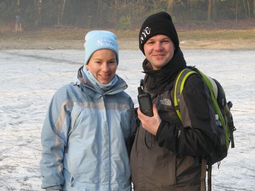
Foto's zijn niet verplicht, maar worden altijd gewaardeerd. Ik
kan u daarom dus niets verplichten, maar ik zou het leuk vinden als
u bij uw log een foto plaatst met daarop uzelf, uw GPS en op de
achtergrond het retentiebekken. Zorg dat het informatiebord niet op
de foto zichtbaar is. De foto onderaan de cachebeschrijving zou als
voorbeeld kunnen dienen.
Indien ik geen bericht krijg met het antwoord op de vragen,
wordt uw “found it” logje direct verwijderd.

This cache originally belonged to Team MenM, but they wouldn't
continue to maintain this earthcache when the condition to add a
picture to the log was removed from the earthcache rules. After
they archived the cache, I sent them a message in which I asked if
I could adopt their earthcache. This they didn't mind, so to remind
who the original owners are, I kept the original example picture of
Team MenM on this page.
The retention basin Bergenven is situated in the nature reserve
De Wildertse Duintjes. In winter the water in the basin will be
pushed till its maximum level. The swamp forest at the other side
then becomes wet. The surplus of water will flow away over the
shallows. In summer a water reservoir arises which will stop the
soil of drying out.
The local authorities wants to inspect the quality of the water
and the vegetation around the retention basin. The vegetation has
to be respected therefore and the area has to be entered as few as
possible. If we all act like this we can protect this piece of
nature together.
At the given coordinates you will find an information sign (in
Dutch language only) on which you can read about the retention
basin.
In order to log this earthcache as a “found it” I ask
you to answer the questions below:
1) What were the size and length of the basin around 1850?
2) When has the deepest part been dug out again?
3) What is the maximum height of the waterlevel?
It isn't required to add a picture to your log, but they are
always appreciated. At this picture I would like to see the
retention basin at the background and you holding your GPS. Please
do not take a picture with the info sign at the background. The
picture shown below could be an example.
If you fail to send me a message with the answers, your
“found it” log will be deleted at once.
voorbeeldfoto/example picture
Stats from 21-03-2011 onwards.