Este cache muestra un ejemplo de las formaciones rocosas tipo flisch existentes en el Valle de Tena.
Para realizar el log del cache hay que responde a las preguntas solicitadas y podeis incluir una fotografía de esta formación geológica en la que aparezca igualmente el GPS


Los flyschs son formaciones rocosas formadas al mismo tiempo que las montañas que alternan capas de rocas duras (caliza, pizarra o areniscas) intercaladas con otras más blandas (margas y arcillas) y que estas capas estén en posición inclinada o vertical (por plegamientos montañosos).Esta disposición favorece el retroceso, ya que la erosión sobre las capas blandas deja aisladas y debilitadas las capas duras, que así son erosionadas más fácilmente, pero a la vez la existencia de las rocas duras protege a las blandas.
El termino proviene del alemán y es relativamente viejo, creado antes del estudio en detalle del fenómeno que describe. Hace referencia a la sedimentación clásica dentro del fondo marino. Quiere decir fluir, deslizarse o "terreno que resbala".
Este tipo de sedimentación alternativa ha sido objeto de muchas investigaciones que causaron bastante polémica. Ha habido dos hipótesis de trabajo sobre su formación. Hasta los años 50 del siglo XX se defendía la hipótesis de las playas fósiles, después se impuso la hipótesis de las corrientes de turbidez en las zonas profundas del océano.
- Playas fósiles. Esta hipótesis defiende que la formación de los flysch se ha realizado a partir de la sedimentación costera, en un fenómeno parecido a la formación de las playas. Se basaba en el aspecto de la superficie de las capas areniscas en las que aparecen señales que recuerdan a las figuras dejadas por el oleaje en las arenas de las playas. De esta observación se pasó a la conjetura de que debían de ser fósiles de aquellas playas.
- Mediante turbiditas. La hipótesis más aceptada es la de la formación de sedimentos en la zonas profundas de los océanos. Estos sedimentos serían los procedentes de las corrientes oceánicas de gran turbidez que discurren por la pendiente del fondo dejando sedimentos llamados turbiditas.
Atendiendo a la hipótesis de las turbiditas se puede estimar que el flysch se forma de la siguiente forma:
- una corriente con carga de sedimentos se desliza por un talud sobre el fondo abisal del océano excavando una estructura sobre la superficie original del océano o la que ha dejado un episodio anterior de este mismo tipo;
- al disminuir la velocidad comienza la sedimentación del material que arrastra la corriente en diferentes capas ordenadas por las densidades de los mismos. Estas sedimentaciones son de forma laminar;
- cuando la corriente se calma se sedimentan los materiales más ligeros dando forma a las partes blandas del conglomerado.
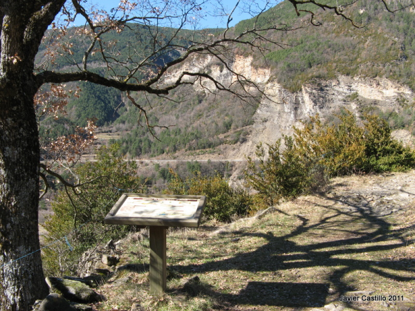
Para apuntaros como encontrado este earthcache, debéis hacer lo siguiente: en primer lugar, podeis de forma voluntaria tomaros una foto con vuestro GPS y el flysch al fondo en las coordenadas del caché y subid esa foto a vuestro log. Por otra parte, desde Biescas, tomar el GR15 en el waypoint incluido, dirección a la ermita de Santa Elena y a mitad de camino encontrareis un panel explicativo, en las coordenadas del segundo waypoint. Enviadnos un mail con las respuestas a las preguntas ¿Hace cuantos millones de años se formó este fýsch? ¿Que tipo de formación geologica está pegada a este flysch en Santa Orosia? ----------------------------------------------------------------------------------
This cache shows an example of the flysch rocks that you can find in Tena Valley (Huesca, Spain)
When you log the cache you can add an optional photo with the flysch and your GPS
Flysch is a sequence of sedimentary rocks that is deposited in a deep marine facies in the foreland basin of a developing orogen. Flysch is typically deposited during an early stage of the orogenesis. When the orogen evolves the foreland basin becomes shallower and molasse is deposited on top of the flysch. It is therefore called a syn-orogenic sediment (deposited contemporaneously with mountain building).
Flysch consists of repeated sedimentary cycles with upwards fining of the sediments. At the bottom of each cycle are sometimes coarse conglomerates or breccias, which gradually evolve upwards into sandstone and shale/claystone. Flysch typically consists of a sequence of shales rhythmically interbedded with thin, hard, graywacke-like sandstones. Typically the shales do not contain many fossils, the coarser sandstones often have fractions of micas and glauconite.
Flysch is formed under deep marine circumstances, in a quiet and low-energetic depositional environment. The coarser layers (which require higher energy) are disruptions in these circumstances, caused by pulsewise flows of mass transport from the forming orogenic wedge. In many cases the mass transports are represented in the record by turbidites.
Flysch deposits form at convergent plate boundaries at the stage of continental collision, often in remnant ocean basins that are present along the same boundary. The sedimental material in the flysch is derived from the forming mountains and deposited along the axis of the new mountain chain into remnant ocean basin. The same ocean basin is in the process of subducting under the orogenic wedge. As subduction continues, the flysch sediments are scraped off the down-going oceanic plate and are accreted onto the orogenic wedge. As a result, flysch deposits are often highly deformed by thrust faulting and folding.
The name flysch was introduced in geologic literature by the Swiss geologist Bernhard Studer in 1827. Studer used the term for the typical alternations of sandstone and shale in the foreland of the Alps. The name comes from the German word fliessen, which means to flow, because Studer thought flysch was deposited by rivers. The insight that flysch is actually a deep marine sediment typical for a particular plate tectonic setting came only much later.
The name flysch is currently used in many mountain chains belonging to the Alpine belt. Well-known flysch deposits are found in the forelands of the Pyrenees and Carpathians and in tectonically similar regions in Italy, the Balkans and on Cyprus. In the northern Alps, the Flysch is also a lithostratigraphic unit.
To log this earthcache, you must do the following: first, take a photo with your GPS and the flysch to the bottom in the coordinates and raise this photo to your Log, not obligatory. On the other hand, from Biescas, take the GR15 track in the included waipoint direction to the hermitage of Holy Elena and in the waipoint you will find an explanatory panel. Send us an e-mail with the responses to the 2 questions: How many million years this fýsch was formed? and That type of geological formation is join to this flysch in Santa Orosia?