The eye that cries out Cetina EarthCache
The eye that cries out Cetina
-
Difficulty:
-

-
Terrain:
-

Size:  (other)
Please note Use of geocaching.com services is subject to the terms and conditions
in our disclaimer.
This earthcache will bring you to Vrelo Cetina, the spring of the Cetina river.
Ovaj earthcache ce vas dovesti do Vrela Cetine, izvora rijeke Cetine.
Dinara (1830m) is highest Croatian mountain and summit. Dinara part of the longest mountain chain on Balkans and gave it its name, The Dinaric Alps. The chain stretches from Slovenia, over Croatia, Bosnia & Herzegovina, Monte Negro and ends in Albania.
Dinara (1830m) je najviša hrvatska planina i ujedno i najviši vrh. To je najduži planinski lanac na Balkanu i nosi ime Dinaridi. Lanac se proteže od Slovenije, preko Hrvatske, Bosne i Hercegovina, Crne Gora i završava u Albaniji.
Dinara is formed of limestone and is really the kingdom of karst, below and above the surface. There is not a single water flow on the mountain as thirsty karst terrain swallows it all. Inside the mountain are huge water reservoirs. This water emerges on the surface at the foothills of the mountain in form of strong sources which eject whole rivers at once. One of these sources is the spring of the river Cetina.
Dinara je formirana od vapnenca i zaista je kraljevstvo krša, ispod i iznad površine. Ne postoji niti jedan protok vode na planini jer ga je žedan krški teren citavog progutao. Unutar planine su veliki rezervoari vode. Ova voda izbija na površinu u podnožju planine u obliku jakih izvora koji izbacuju cijelu rijeku odjednom. Jedan od tih izvora je izvor rijeke Cetine.
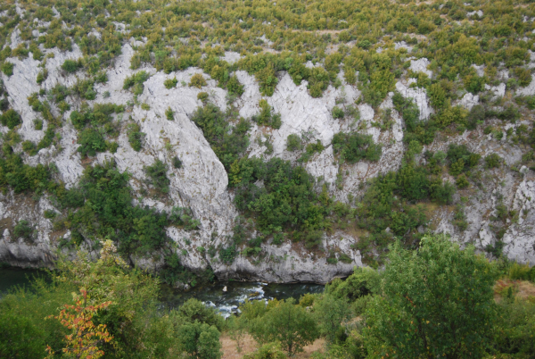
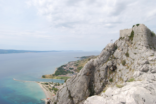
Cetina river emerges on the surface at the south east foot of Dinara group near Cetina village at the altitude of 395m. Cetina is one of 4 most beautiful Croatian rivers. It is 105km long, flows through deep canyons and ends into the Adriatic Sea at the city of Omis.
Rijeka Cetina izvire na površinu na jugoistocnom podnožju Dinare u blizini sela Cetine na nadmorskoj visini od 395m. Cetina je jedna od 4 najljepše hrvatske rijeke. Duga je 105 km, protjece kroz duboke kanjone, a ulijeva se u Jadransko more u gradu Omišu.


Vrela Cetina covers an area of almost 30 ha and was protected in 1971 as the hydrogeological monument of nature. The monument of nature and its vicinity, which is an integral part of the protected areas, are not permitted acts that threaten its features and value. The site contains a series of springs. At the given coordinates you will find one of the most beatifull springs of the Cetina river.
Vrela Cetine obuhvacaju podrucje od gotovo 30 ha, a zašticena su 1971. god. kao hidrogeološki spomenik prirode. U podrucju spomenika prirode i njegovoj okolici, koja je sastavni dio zašticenog podrucja, nisu dopuštene radnje koje ugrožavaju njegova izvorna obilježja i vrijednosti. Lokalitet sadrži niz izvora. Na danim koordinatama cete naci jedan od najatraktivnijih, prekrasni izvor rijeke Cetine.
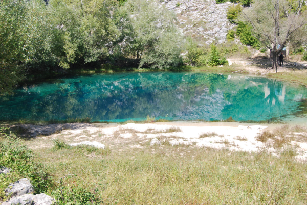
Its source is really amazing. It is easily described as huge 100m deep, perpendicular chasm filled with crystal clear water. Full strength of river is coming out of it.
Njegov izvor je stvarno nevjerojatan To je, jednostavno receno, veliki 100m dubok okomiti ponor ispunjen s kristalno cistom vodom. Rijeka u svojoj punoj snazi izvire iz njega.


To visit source of Cetina turn from main Knin-Split road at Civljane village, signs point ‘Cetina’.
Za posjet izvoru Cetine potrebno je skrenuti sa glavne ceste Knin-Split kod sela Civljane, gdje je znak za 'Cetinu'.
Please:
- Preserve nature
- Do not enter the water
- Do not throw stones into the water
Molimo vas da:
- Cuvate prirodu
- Ne ulazite u vodu
- Ne bacajte kamenje u vodu
To log this earthcache send me the answer of the following questions:
1) Divers investigated the cave. What depth did they reach?
2) What type of springs are located at Vrela Cetina.
3) How were these springs formed?
4) Which human made object can you see in the spring? (A real object, not the reflection of the church)
Logs without approval will be removed. No Internet logs.
Optional logging task: Add a picture of yourself at the spring.
Why this earthcache? I have seen several national parks in Croatia, one more beautiful as the other. A lot of advertising is done and busses full of tourists visit them. Not at this location. Not many tourists at the spring, but it is a place worthwhile to visit.
I personally was the most impressed by the beauty of the spring and the crystal clear water. I never have seen water more clear as at this location, not even in a bottle. A place I want to share with all of you.
Many thanks to “Public institution for management of protected areas in Sibenik - Knin County” for the approval of this earthcache and preserving this beautiful location.
Information source:
www.zasticenapodrucja.com/
Additional Hints
(No hints available.)