Groom Mining District EarthCache
-
Difficulty:
-

-
Terrain:
-
Size:  (other)
Please note Use of geocaching.com services is subject to the terms and conditions
in our disclaimer.
NOTE: This is an Earthcache with additional logging requirements (ALR's). Be careful not to copy/paste ET Found It logs to this cache or any Earthcache or your log will be deleted as a courteous reminder to fulfill the logging requirement. FAVORITE points appreciated!
Groom Mining District
(Pssst....Something's going on out here....)
Thanks to everyone who posts a
FAVORITE POINT!
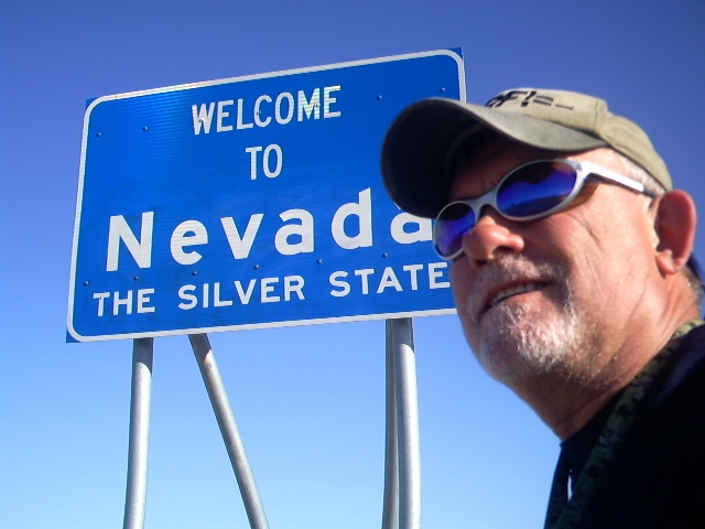 Silver State
Nevada is the Silver State! Silver mining in Nevada began in 1858 with the discovery of the Comstock Lode, the first major silver-mining district in the United States. Nevada is now the nation's second-largest producer of silver, after Alaska. The silver of Nevada came in gray, glossy, fabulously valuable crusts on the ground, and during the silver rush of the late 1800s it was swiftly turned into bullion and currency. Nowadays none of it is left in its natural form: horn silver.
 Horn Silver
Horn silver in Nevada formed strictly on the surface. Over millions of years of desert conditions, silver sulfide minerals weathered out of their volcanic host rocks and slowly turned, under the influence of rainwater, to silver chloride. The climate of Nevada concentrated this silver ore in supergene enrichments. These heavy gray crusts were often polished by dust and wind to the dull luster of a cow horn, or, horn silver. You could shovel it right off the ground, and you didn't need a Ph.D. to find it. And once it was gone, there was nothing left to hold the prospector's interest.
Groom Lake is a salt flat in Nevada. Lead and silver were discovered in the southern part of the Groom Range in 1864 and the English Groome Lead Mines Limited Company financed the mines in the 1870s, giving the Groom Lake Mining District its name. Mining continuing until 1918 and resumed after World War II until the early 1950s when it halted altogether. The Groom Mine and the Groom Mining District had become history.
The name, however, lived on. The mountain range where the mine was located was named the Groom Range, and at its southwestern edge, a dry lakebed was named the Groom Lake The lake and mountain range was withdrawn from public use during World War II for use as part of the Las Vegas Army Air Field gunnery and bombing range.
Area 51
Even more notable, with the rise of the Cold War, an area was needed for testing our ever bigger and more sophisticated atomic, hydrogen and thermonuclear bombs. The Nevada Test Site was a good location, and continued to be off limits. The area, which included the Groom Mountains and Groom Lake (Area 51), is still officially part of the Nellis gunnery range and is actively used as a test site today, though nuclear testing has long been discontinued.
This is a test range. You may hear sonic booms and encounter
LOW FLYING AIRCRAFT
___________________________________________
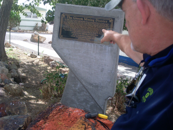
Where is The Groom Mining District? The coordinates will take you to the roadside marker shown in the image below left. It's located in the tiny remote desert community of Rachel Nevada along Highway 375, 148 miles NW of Las Vegas and 100 mile SE of Tonopah. There is no gas in Rachel! Last gas at Alamo or Tonopah!

___________________________________________
To Log Groom Mining District
You may post an optional photo of yourself or your GPSr at the posted coordinates with the Groom Mining District marker (see my photo above, left) in the background.
Please NOTE: This is the MOST-FAVORED EARTHCACHE in NEVADA!
Please help keep it going with your
FAVORITE POINT
And, to demonstrate the educational value of the Earthcache, please email responses to the following questions to ARF! at the link below:
1. What did the Nevada's weather concentrate the silver chloride into (two words)?
2. What were the gray, glossy, crusts on the ground called?
3. What geological feature is the Groom Lake?
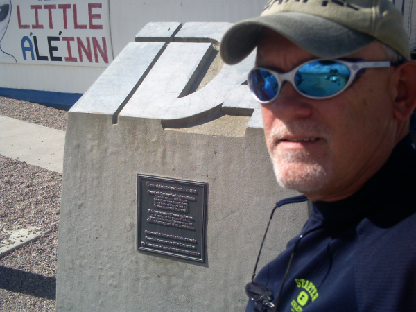
4. What does the nearby ID marker (above right) commemorate?
5. Complete this sentence from the marker, 'but high grade ore _ _ _' (three words).
Please email answers to:
ARF!
_____________________________
Alamo to Tonopah Earthcaches:
Groom Mining District Rachel, NV (GC2GHE8)
Alamo Breccia Alamo, NV (GC37ZKW)
Playa Goblin Knobs, NV (GC2GP44)
Walker Lane Tonopah, NV (GC36DRD)
Golden Arrow Mine Golden Arrow, NV (GC4QX9J)
______________________________
Please do not wait on a reply from me. Simply email the answers and log the Earthcache. Enjoy your visit!
_______________________________
Additional Hints
(Decrypt)
Ernq guvf grkg naq gur znexre.