Luc - skalni mesto/Luc - rock town Multi-cache
Luc - skalni mesto/Luc - rock town
-
Difficulty:
-

-
Terrain:
-

Size:  (small)
Please note Use of geocaching.com services is subject to the terms and conditions
in our disclaimer.
LUC - SKALNI MESTO
|
 |
|
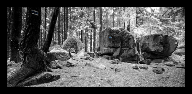
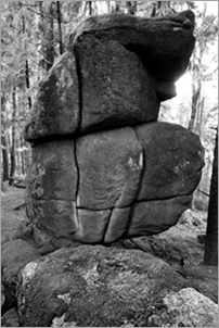
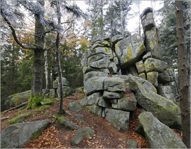
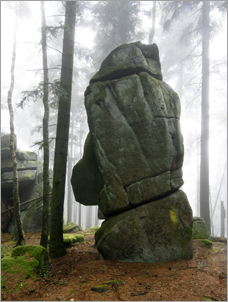
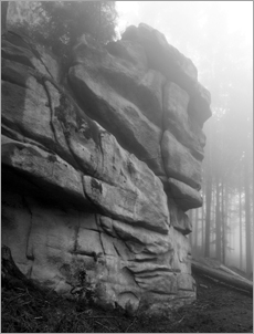
Tato kes vas zavede k
vrcholu hory Luc (933m) a predevsim pak na její severni hreben, po
kterem se tahne rozsahle skalni mesto s vice jak tuctem velkych a
jeste vetsim mnozstvim mensich skalnich utvaru. Vzhledem k tomu, ze
NPR Certova stena - Luc, kterou prochazime pri prístupu po
jihozapadnim hrebenu od obce Loucovice, konci na vrcholu, lze se na
severnim hrebenu jiz pohybovat bez omezeni. Cele sklani mesto,
ktere se tahne zhruba do vzdálenosti 800m od vrcholu si tak muzete
bez obav projit.
|
  |
|
STAGE1 - Vrchol hory Luc:
Na souradnicich N 48°
37,950 E014° 15,805 najdete rozcestnik. Horni
cedulka (oznaceni mista) ma v levem spodnim rohu letopocet.
Ciferace letopoctu je cislo A. V pravem spodnim rohu stejne cedulky
najdete oznaceni ve tvaru CKBCDm.
Cilove ulozeni kese je na
souradnicich:
N 48°
38,1E E014°
15,6F
Kde:
E =
4*A+5*B+6*C-2*D-1
F = 7*A-6*B+2*C-5*D
Obsah kese:
- Predmety na vymenu
- FTF privesek
- CG Traveling Bear Geocoin (viz. link)
Napoveda k umisteni kese: Foto hint
Odlov této kese
doporucujeme spojit i s navstevou dalsich kesi v okoli, predevsim
pak kese GC11DG3. Zde mate moznost, si na jeden ze skalnich
utvaru jihozapadniho hrebene vylezt (i bez potreb k lezeni). V
takovem pripade vam doporucujeme vyuzit druheho parkoviste a
postupovat v lovu smerem od Loucovic.
|
  |
English short
LUC - ROCK TOWN
This cache will show you
the top of the hill Luc (933m) and mainly the rock town on the
north part of this hill with more than dozen nature rock
sculptures. This part of the Luc hill is outside the nature reserve
"Devils Cliff - Luc", thus you may step out of the marked path.
View the formations of the rock town, which bear cca 800m northward
from the top.
STAGE1 - top of Luc:
On coordinates N 48°
37,950 E014° 15,805 you can find guidepost. On the
upper sign (description of place) in the left bottom corner is
number (era). Crossfoot of this era is number A. In the right bottom corner of same sign is
mark in format CKBCDm.
Final cache location is on
coordinates:
N 48°
38,1E E014°
15,6F
Where:
E
=4*A+5*B+6*C-2*D-1
F = 7*A-6*B+2*C-5*D
Help for finding cache: Foto hint
|
Additional Hints
(Decrypt)
[CZ] MN XNZRARZ CBQ FXNYXBH PPN 10Z CBQ PRFGBH H FXNYL KVK - IVM UVAG.
[EN] ORUVAQ FGBAR ORYBJ YVGGYR EBPX PPN 10Z HAQRE CNGU ARNE PYVSS KVK - FRR UVAG.